Wolseley Bridge Farm, Wolseley Bridge, Stafford, ST17 0XP
About Wolseley Bridge Farm
Wolseley Bridge Farm is a detached house in Wolseley Bridge, Stafford, Stafford (ST17 0XP). It has a recorded floor area of 394 m² (around 4241 sq ft), construction records dating it to before 1900 and council tax band E. The latest certificate (March 2015) shows a D (score 58), a step below the typical UK home. The recommended improvements would push it to C (score 77). The latest certificate is from March 2015, so improvements made since then won't be reflected.
Across 1999–2019, sale prices on this property compounded at 6.9% per year. Today's modelled estimate of £651,000 is 34.2% above the 2019 sale price. Sold March 2019 for £485,000. One historical planning record sits against the property in 2020.
Everything you need to know about Wolseley Bridge Farm
The true value, the hidden risks and the full sale history, in one report.
Pick your report · from £14.99
One time fee only - money back guarantee

The data behind every report





Energy performance
Wolseley Bridge Farm's carbon output runs well above what efficient homes in the postcode produce.
EPC Expired
This certificate is over 10 years old and is no longer valid.Expired 16 Mar 2025
EPC Rating
Certificate validity
Expired on 16 March 2025

Get a survey for this property
Level 3 Building Survey
Because the property was built before 1919, is a large detached home over 300m², and has solid (non-cavity) walls, we believe a Level 3 building survey should be considered.
From £1,155 · Includes VAT
Planning history
1 application on record at Wolseley Bridge Farm, Wolseley Bridge, Stafford, ST17 0XP
- May 2020RenovationFullOutcome in report
To remove the over-mature Leylandii hedge and the metal railings and proposed 2M wall of existing plinth along highway boundary
- Documents
- 24 docs on file
- Reference
- 20/31929/HOU
Unlock Wolseley Bridge Farm, Wolseley Bridge, Stafford, ST17 0XP's full planning history
You're seeing the shape of it. The report has the substance.
- Every decision — granted, refused or withdrawn (1 on record)
- All 1 application on this property in full, plus 1 notable nearby
- The 24 documents, officer reports & conditions
- What the pattern means for extending or converting here
One time fee only - money back guarantee
Sales history & valuation
Sale price has grown by over 3x since 1999.
£651,000
Modelled from EPC, postcode comparables and a sale-price growth of 6.9% per year over 20 years.
£485,000
Growth on file: 6.9% per year over 20 years.
Sales timeline
18 March 2019Most recent
£485,000
+267.4%over 19 years1 August 1999
£132,000
Median price across the last 5 sales in ST17 0XP: £372,000 (2025–2002).
Everything you need to know about Wolseley Bridge Farm
The true value, the hidden risks and the full sale history, in one report.
Pick your report · from £14.99
One time fee only - money back guarantee
The data behind every report
Similar properties nearby
1 Broc Hill Way, Brocton
ST17 0UB
1 Baswich Lane
ST17 0BH
1 Alsop Crest, Acton Trussell
ST17 0SJ
1 Barons Court, Wolseley Bridge
ST17 0XJ
1 Acton Hill Road, Acton Trussell
ST17 0RY
1 Anson Drive
ST17 0LT
1 Bank Top Cottage, Top Road, Acton Trussell
ST17 0RQ
1 Briar Close
ST17 0NG
The neighbourhood at a glance
Crime
201/mo
Steady year-on-year across the wider district.
Nearest stop
0.0 km
Bishton Lane — bus stop.
Closest school
1.0 km
Colwich CofE Primary School. 7 schools nearby.
Go deeper on the local area
A Local Area report breaks down crime, transport links, schools and air quality in depth.
Road noise across the postcode
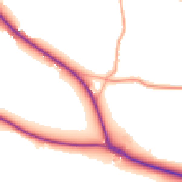
Daytime· 07:00 – 23:00
51.7dB

Night-time· 23:00 – 07:00
44.7dB