9 Croft Close, Leigh On Sea, SS9 4NX
About 9 Croft Close
9 Croft Close is a three-bedroom mid-terrace house in Leigh On Sea (SS9 4NX). It has a recorded floor area of 79 m² (around 850 sq ft), construction records dating it to 1930-1949 and council tax band B. The latest certificate (May 2023) shows a C (score 69), just inside the C band. The recommended improvements would push it to B (score 89).
At 79 m² the property is well over the postcode median (59 m² across 19 EPCs), placing it in the larger end of the local stock. Today's modelled estimate of £351,000 is 13.6% above the 2023 sale price. On a £-per-square-foot basis, the last sale (£363/sq ft) was about 126.7% above the typical sold price in the postcode. Most recent transfer: December 2023 at £309,000.
Know exactly what you're buying at 9 Croft Close
Before you offer, see what the listing won't tell you, the true value, the red flags and the full history.
Valuation
against the asking price
Risks
planning & flood
Sold prices
similar homes nearby
Trends
the local market
What this property has
Inside
- Bedrooms3
- Bathrooms1
Outside
- Private gardenRear
Energy performance
EPC Rating
Planning history
9 Croft Close has no planning applications on record.
The full report still covers planning activity across the surrounding area.
Sales history & valuation
9 Croft Close valuation sits well clear of the typical sold price in this postcode.
£351,000
Modelled from EPC, postcode comparables.
£309,000
Recorded with HM Land Registry.
Sales timeline
14 December 2023Most recent
£309,000
Median price across the last 5 sales in SS9 4NX: £250,000 (2022–2004).
Everything we know about 9 Croft Close, in one report
What it's really worth, what could be wrong, and the planning, sales and area data in full.
- Am I paying too much?
- Is something wrong with it?
- Is the agent's story true?
- Will it hold its value?

Versus other Croft Close homes
9 Croft Close is notably below the street on years held.
Price per m²
£3,911
Street avg £2,867
Floor Area
79 m²
Street avg 65 m²
Habitable Rooms
5 rooms
Street avg 4 rooms
CO₂ Emissions
3.0 t/year
Street avg 2.6 t/year
Similar properties nearby
The neighbourhood at a glance
Crime
3/mo
Steady year-on-year across the wider district.
Nearest stop
0.1 km
Danescroft Drive — bus stop.
Closest school
0.5 km
Blenheim Primary School. 23 schools nearby.
Go deeper on the local area
The full report breaks down crime, transport links, schools and air quality in depth.
Road noise across the postcode
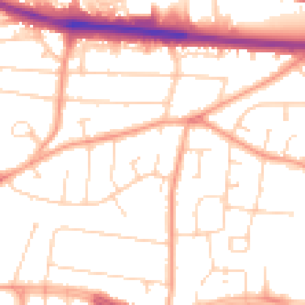
Daytime· 07:00 – 23:00
51.8dB

Night-time· 23:00 – 07:00
41.8dB