33 Syddal Road, Bramhall, Stockport, SK7 1AB
About 33 Syddal Road
33 Syddal Road is a detached house in Bramhall, Stockport, Stockport (SK7 1AB). It has a recorded floor area of 219 m² (around 2357 sq ft). The latest certificate (April 2014) returns a B (score 84), comfortably above the UK average. The latest certificate is from April 2014, so improvements made since then won't be reflected.
At 219 m² the property is well over the postcode median (153 m² across 5 EPCs), placing it in the larger end of the local stock. On energy efficiency it sits in the top 10% of properties in this postcode. Across 1996–2012, sale prices on this property compounded at 9.1% per year. Today's modelled estimate of £780,000 sits 130.8% above the 2012 sale of £338,000. On a £-per-square-foot basis, the last sale (£143/sq ft) was about 49.8% below the postcode norm. 6 planning records sit against the property, 3 approved, 2 refused. The record references conservation-area consent, which constrain future alterations. On the market in July 2012 and unlisted since — roughly 14 years. Across the public record there are 4 sales, relatively high churn for a single property.
Everything you need to know about 33 Syddal Road
The true value, the hidden risks and the full sale history, in one report.
Pick your report · from £14.99
One time fee only - money back guarantee

The data behind every report


Energy performance
33 Syddal Road ranks among the most efficient homes in the postcode for energy use.
EPC Expired
This certificate is over 10 years old and is no longer valid.Expired 08 Apr 2024
EPC Rating
Certificate validity
Expired on 8 April 2024

Get a survey for this property
Level 2 HomeBuyer Report
We've checked 10 risk factors against the available data for this property and believe a Level 2 HomeBuyer Report could be a suitable option for you.
From £995 · Includes VAT
Planning history
33 Syddal Road sits within a conservation area — exterior works face additional planning controls.
6 applications on record at 33 Syddal Road, Bramhall, Stockport, SK7 1AB
- Apr 2005FullOutcome in report
Demolition of existing single storey nursery school & erection of two semi-detached houses
- Reference
- DC/018628
- More recent applications — locked
- ConditionsMar 2015Decision
- FullSept 2012Decision
+ 3 more applications in the report
Unlock 33 Syddal Road, Bramhall, Stockport, SK7 1AB's full planning history
You're seeing the shape of it. The report has the substance.
- Every decision — granted, refused or withdrawn (6 on record)
- All 6 applications on this property in full
- The 52 documents, officer reports & conditions
- What the pattern means for extending or converting here
One time fee only - money back guarantee
Sales history & valuation
33 Syddal Road has more than quadrupled in price since its earliest registered sale in 1996.
£780,000
Modelled from EPC, postcode comparables and a sale-price growth of 9.1% per year over 16 years.
£338,000
Growth on file: 9.1% per year over 16 years.
Sales timeline
26 July 2012Most recent
£338,000
17 May 2007
£338,000
+25.2%over 1 year9 December 2005
£270,000
+221.4%over 9 years29 August 1996
£84,000
Median price across the last 5 sales in SK7 1AB: £575,000 (2016–2011).
Nearby sales in SK7 1AB
19 Syddal Road, Bramhall, Stockport, SK7 1AB
Sold Oct 2016
£608,00025 Syddal Road, Bramhall, Stockport, SK7 1AB
Sold Jul 2016
£632,50017 Syddal Road, Bramhall, Stockport, SK7 1AB
Sold Dec 2012
£575,00035 Syddal Road, Bramhall, Stockport, SK7 1AB
Sold Sept 2012
£495,00031 Syddal Road, Bramhall, Stockport, SK7 1AB
Sold Jul 2005
£393,950
Versus other Syddal Road homes
On price per m², 33 Syddal Road runs well behind the street norm.
Price per m²
£1,543
Street avg £3,464
Floor Area
219 m²
Street avg 161 m²
CO₂ Emissions
3.4 t/year
Street avg 7.4 t/year
Years Held
14 years
Street avg 12 years
Everything you need to know about 33 Syddal Road
The true value, the hidden risks and the full sale history, in one report.
Pick your report · from £14.99
One time fee only - money back guarantee
The data behind every report
Similar properties nearby
1 Chadwick Avenue, Woodford
SK7 1SJ
1 Courtyard Mews, 185 Moss Lane, Bramhall
SK7 1BA
1 Beamont Crescent, Woodford
SK7 1NX
1 Athol Road, Bramhall
SK7 1BR
1 Bowen Close, Bramhall
SK7 1NJ
1 Avro Crescent, Woodford
SK7 1SB
1 Atcherley Lane, Woodford
SK7 1NU
1 Carlton Avenue, Bramhall
SK7 1BW
The neighbourhood at a glance
Rail-style transport is unusually close for this postcode.
Crime
2/mo
Steady year-on-year across the wider district.
Nearest stop
0.2 km
Ack Lane East — bus stop.
Closest school
0.6 km
Moss Hey Primary School. 18 schools nearby.
Go deeper on the local area
A Local Area report breaks down crime, transport links, schools and air quality in depth.
Road noise across the postcode
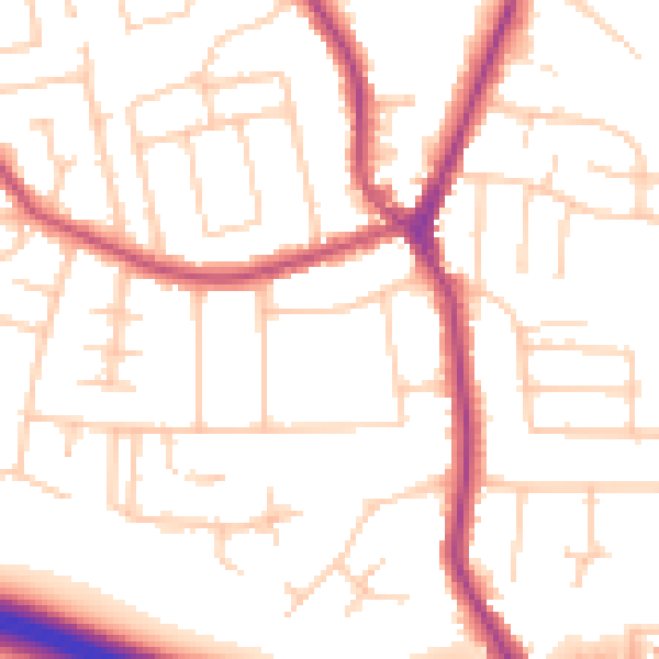
Daytime· 07:00 – 23:00
52.1dB

Night-time· 23:00 – 07:00
42.7dB