Flat, 119 Buxton Road, High Lane, Stockport, SK6 8DX
About Flat
Flat is a mid-terrace house in High Lane, Stockport, Stockport (SK6 8DX). It has a recorded floor area of 60 m² (around 646 sq ft), construction records dating it to 1900-1929 and council tax band A. At 60 m² this is the 3rd smallest of 7 units on EPC record in the building, where floor areas span 45–118 m². The building's EPC ratings span F to C across 7 units on file. The latest certificate (November 2016) shows a D (score 61), on the cusp of jumping into the C band.
Untraded for 15 years, with the last transfer in March 2011. Across the public record there are 5 sales, relatively high churn for a single property. Across 2002–2011, sale prices on this property compounded at 9.6% per year. Today's modelled estimate of £215,000 is 30.3% above the 2011 sale price. One historical planning record sits against the property in 2011.
Everything you need to know about Flat
The true value, the hidden risks and the full sale history, in one report.
Pick your report · every report is £14.99
One time fee only - money back guarantee

The data behind every report


Energy performance
EPC Rating
Get a survey for this property
Level 3 Building Survey
Because the property was built before 1919, we believe a Level 3 building survey should be considered.
From £885 · Includes VAT
Planning history
1 application on record at Flat, 119 Buxton Road, High Lane, Stockport, SK6 8DX
- Apr 2011Change Of UseFullOutcome in report
Change of use from bridal suite retail to bakery & shop retail.
- Documents
- 6 docs on file
- Reference
- DC/046593
Unlock Flat, 119 Buxton Road, High Lane, Stockport, SK6 8DX's full planning history
You're seeing the shape of it. The report has the substance.
- Every decision — granted, refused or withdrawn (1 on record)
- All 1 application on this property in full
- The 6 documents, officer reports & conditions
- What the pattern means for extending or converting here
One time fee only - money back guarantee
Sales history & valuation
Sale price has at least doubled since 2002.
£215,000
Modelled from EPC, postcode comparables and a sale-price growth of 9.6% per year over 9 years.
£165,000
Growth on file: 9.6% per year over 9 years.
Sales timeline
18 March 2011Most recent
£165,000
+26.9%23 November 2010
£130,000
-21.2%over 2 years4 September 2008
£165,000
+4.1%over 3 years5 November 2004
£158,500
+111.3%over 2 years12 August 2002
£75,000
Median price across the last 5 sales in SK6 8DX: £215,000 (2023–2007).
Nearby sales in SK6 8DX
81 Buxton Road, High Lane, Stockport, SK6 8DX
Sold Jan 2023
£380,000127 Buxton Road, High Lane, Stockport, SK6 8DX
Sold Sept 2018
£215,000123a, Buxton Road, High Lane, Stockport, SK6 8DX
Sold Jun 2010
£170,00079 Buxton Road, High Lane, Stockport, SK6 8DX
Sold Oct 2007
£279,000125 Buxton Road, High Lane, Stockport, SK6 8DX
Sold Mar 2007
£188,000
Everything you need to know about Flat
The true value, the hidden risks and the full sale history, in one report.
Pick your report · every report is £14.99
One time fee only - money back guarantee
The data behind every report
Similar properties nearby
The Copse, Flat 2, Balmoral Drive, High Lane
SK6 8BN
The Copse, Flat 1, Balmoral Drive, High Lane
SK6 8BN
The Copse, Flat 3, Balmoral Drive, High Lane
SK6 8BN
The Copse, Flat 6, Balmoral Drive, High Lane
SK6 8BN
Flat 3, 2 Carr Brow, High Lane
SK6 8EX
The Copse, Flat 4, Balmoral Drive, High Lane
SK6 8BN
Apartment B, 126 Buxton Road, High Lane
SK6 8ED
Flat 5, 2 Carr Brow, High Lane
SK6 8EX
The neighbourhood at a glance
Daytime road noise here sits well below conversation level — a quiet pocket of the postcode.
Crime
1/mo
Steady year-on-year across the wider district.
Nearest stop
0.1 km
Brookside Lane — bus stop.
Closest school
0.3 km
High Lane Primary School. 5 schools nearby.
Go deeper on the local area
A Local Area report breaks down crime, transport links, schools and air quality in depth.
Road noise across the postcode
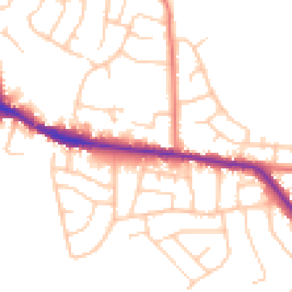
Daytime· 07:00 – 23:00
49.4dB

Night-time· 23:00 – 07:00
40.9dB