21 Ladysmith Road, Greenwich, London, SE9 5BN
About 21 Ladysmith Road
21 Ladysmith Road is a property in Greenwich, London, London (SE9 5BN). It has council tax band E.
Held since July 1995 — that's 31 years off the open market, well above the local norm. Only one transfer is on record with HM Land Registry, suggesting it has stayed in the same hands for a long time.
Everything you need to know about 21 Ladysmith Road
The true value, the hidden risks and the full sale history, in one report.
30-day money-back guarantee

The data behind every report


Energy performance
No EPC on record
This property doesn't have an Energy Performance Certificate yet. An EPC is required to sell or let — and unlocks our automated valuation.
Planning history
21 Ladysmith Road has no planning applications on record.
Notable planning nearby
10applications of note in the surrounding area
We flagged 1 thing worth checking at 21 Ladysmith Road
Independent checks surfaced things a buyer would want to understand before offering. The report explains each one in full, with the underlying data and what to ask.
- Signs of HMO activity in the area
30-day money-back guarantee
Sales history & valuation
21 Ladysmith Road has been held in the same hands since before 2000.
£73,200
Recorded with HM Land Registry.
Sales timeline
13 July 1995Most recent
£73,200
Median price across the last 5 sales in SE9 5BN: £689,950 (2023–2022).
Nearby sales in SE9 5BN
6 Ladysmith Road, Greenwich, London, SE9 5BN
Sold Dec 2023
£640,00023 Ladysmith Road, Greenwich, London, SE9 5BN
Sold Aug 2022
£730,00020 Ladysmith Road, Greenwich, London, SE9 5BN
Sold Jul 2022
£825,00014 Ladysmith Road, Greenwich, London, SE9 5BN
Sold Feb 2022
£689,9503 Ladysmith Road, Greenwich, London, SE9 5BN
Sold Jan 2022
£660,000
Everything you need to know about 21 Ladysmith Road
The true value, the hidden risks and the full sale history, in one report.
30-day money-back guarantee
The data behind every report
Similar properties nearby
1 2, Newmarket Green, Greenwich
SE9 5ER
1 Almshouses, Philipot Path
SE9 5DJ
1 Beech Court, Kingsground, Greenwich
SE9 5HB
1 Blann Close, Greenwich
SE9 5JJ
1 Campfield Road, Greenwich
SE9 5JF
1 Cedar Court, Kingsground, Greenwich
SE9 5HA
1 Cedarhurst Drive, Greenwich
SE9 5LP
1 Chaundrye Close, Greenwich
SE9 5QB
The neighbourhood at a glance
Reported crime in the wider district is trending notably upward year-on-year.
Crime
6/mo
Rising year-on-year across the wider district.
Nearest stop
0.1 km
Footscray Road / Southend Crescent — bus stop.
Closest school
0.1 km
St Thomas More Catholic Comprehensive School. 36 schools nearby.
Go deeper on the local area
The full report breaks down crime, transport links, schools and air quality in depth.
Road noise across the postcode
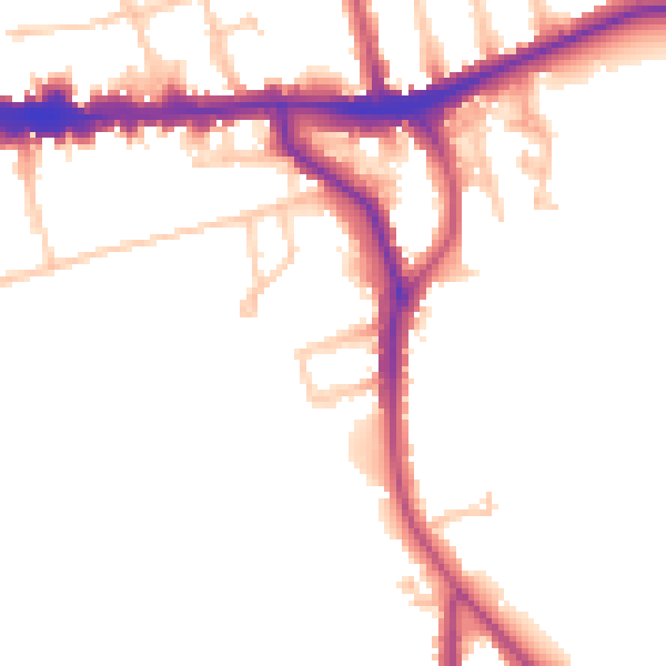
Daytime· 07:00 – 23:00
49.5dB
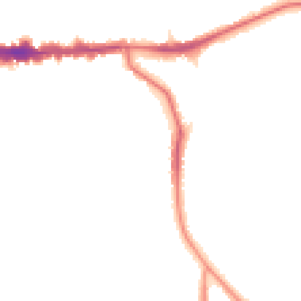
Night-time· 23:00 – 07:00
41.8dB