19 Mcleod Road, Greenwich, London, SE2 0BP
About 19 Mcleod Road
19 Mcleod Road is an end-of-terrace house in Greenwich, London, London (SE2 0BP). It has a recorded floor area of 117 m² (around 1259 sq ft), construction records dating it to 1900-1929 and council tax band D. The latest certificate (January 2015) shows a D (score 57), a step below the typical UK home. The recommended improvements would push it to C (score 78). The latest certificate is from January 2015, so improvements made since then won't be reflected.
Held since October 2009 — that's 17 years off the open market, well above the local norm. Across the public record there are 5 sales, relatively high churn for a single property. That sale fell during the post-crash dip, which often skews comparisons against later neighbouring sales. Across 1997–2009, sale prices on this property compounded at 13.6% per year. Today's modelled estimate of £472,000 sits 88.8% above the 2009 sale of £250,000. At 117 m² it's 28.6% larger than the typical home in the postcode (91 m² median across 19 EPCs). One historical planning record sits against the property in 2023.
Everything you need to know about 19 Mcleod Road
The true value, the hidden risks and the full sale history, in one report.
Pick your report · from £14.99
One time fee only - money back guarantee

The data behind every report







Energy performance
19 Mcleod Road's EPC is over a decade old — improvements since won't be reflected.
EPC Expired
This certificate is over 10 years old and is no longer valid.Expired 24 Jan 2025
EPC Rating
Certificate validity
Expired on 24 January 2025

Get a survey for this property
Level 3 Building Survey
Because the property was built before 1919 and has solid (non-cavity) walls, we believe a Level 3 building survey should be considered.
From £1,020 · Includes VAT
Planning history
A recent planning application at 19 Mcleod Road was refused — worth checking the council file.
1 application on record at 19 Mcleod Road, Greenwich, London, SE2 0BP
- May 2023FullOutcome in report
Retrospective permission for the conversion of an existing garage with a residential use (Use Class C3) to office (Use Class E(g)) and associated external alterations
Retrospective- Documents
- 10 docs on file
- Reference
- 21/4019/F
Unlock 19 Mcleod Road, Greenwich, London, SE2 0BP's full planning history
You're seeing the shape of it. The report has the substance.
- Every decision — granted, refused or withdrawn (1 on record)
- All 1 application on this property in full, plus 43 notable nearby
- The 10 documents, officer reports & conditions
- What the pattern means for extending or converting here
One time fee only - money back guarantee
Sales history & valuation
19 Mcleod Road has more than quadrupled in price since its earliest registered sale in 1997.
£472,000
Modelled from EPC, postcode comparables and a sale-price growth of 13.6% per year over 12 years.
£250,000
Growth on file: 13.6% per year over 12 years.
Sales timeline
18 October 2009Most recent
£250,000
+66.7%over 5 years26 August 2004
£150,000
+76.5%over 6 years21 July 1998
£85,000
+1.8%21 May 1998
£83,500
+51.8%28 November 1997
£55,000
Median price across the last 5 sales in SE2 0BP: £450,000 (2024–2020).
Nearby sales in SE2 0BP
10 Mcleod Road, Greenwich, London, SE2 0BP
Sold Jun 2024
£520,00033 Mcleod Road, Greenwich, London, SE2 0BP
Sold Mar 2022
£400,00029 Mcleod Road, Greenwich, London, SE2 0BP
Sold Mar 2022
£450,00020 Mcleod Road, Greenwich, London, SE2 0BP
Sold Apr 2021
£493,52037 Mcleod Road, Greenwich, London, SE2 0BP
Sold Nov 2020
£260,000
Versus other Mcleod Road homes
Floor Area for 19 Mcleod Road runs comfortably ahead of the street norm.
Price per m²
£2,137
Street avg £2,750
Floor Area
117 m²
Street avg 96 m²
Habitable Rooms
5 rooms
Street avg 5 rooms
CO₂ Emissions
5.7 t/year
Street avg 4.4 t/year
Everything you need to know about 19 Mcleod Road
The true value, the hidden risks and the full sale history, in one report.
Pick your report · from £14.99
One time fee only - money back guarantee
The data behind every report
Similar properties nearby
1 Friars Walk, Bexley
SE2 0PR
1 Glenview, Bexley
SE2 0SD
1 Bostall Lane, Greenwich
SE2 0NH
1 Federation Road, Greenwich
SE2 0JT
1 Glendown Road, Greenwich
SE2 0RJ
1 Carnation Street, Greenwich
SE2 0UZ
1 Crumpsall Street, Greenwich
SE2 0LP
1 Camrose Street, Greenwich
SE2 0HZ
The neighbourhood at a glance
Crime
196/mo
Falling year-on-year across the wider district.
Nearest stop
0.1 km
Cassilda Road — bus stop.
Closest school
0.4 km
Alexander McLeod Primary School. 49 schools nearby.
Go deeper on the local area
A Local Area report breaks down crime, transport links, schools and air quality in depth.
Road noise across the postcode
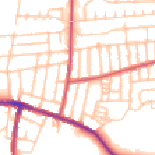
Daytime· 07:00 – 23:00
52.5dB

Night-time· 23:00 – 07:00
42.3dB