8 Burbage Close, Southwark, London, SE1 4ES
About 8 Burbage Close
8 Burbage Close is a three-bedroom mid-terrace house in Southwark, London, London (SE1 4ES). It has a recorded floor area of 83 m² (around 893 sq ft), construction records dating it to 1967-1975 and council tax band C. The latest certificate (October 2016) shows a D (score 67), on the cusp of jumping into the C band. The recommended improvements would lift it to B (score 85), a 2-band jump.
On a £-per-square-foot basis, the last sale (£851/sq ft) was about 228.1% above the typical sold price in the postcode. Last changed hands 9 years ago, in March 2017.
What this property has
Inside
- Bedrooms3
- Bathrooms1
- Dining roomYes
Outside
- Private gardenFront and rear
Building
- Central heatingYes
Everything you need to know about 8 Burbage Close
The true value, the hidden risks and the full sale history, in one report.
Pick your report · every report is £14.99
One time fee only - money back guarantee

The data behind every report


Energy performance
Recommended upgrades on file would lift this property by multiple EPC bands.
EPC Rating
Get a survey for this property
Level 2 HomeBuyer Report
We've checked 10 risk factors against the available data for this property and believe a Level 2 HomeBuyer Report could be a suitable option for you.
From £1,095 · Includes VAT
Planning history
8 Burbage Close has no planning applications on record.
But the area is active
7 notable applications nearby — larger schemes and conversions that could reshape the street. The report maps them all.
Sales history & valuation
8 Burbage Close valuation sits well clear of the typical sold price in this postcode.
£812,000
Modelled from EPC, postcode comparables.
£760,000
Recorded with HM Land Registry.
Sales timeline
17 March 2017Most recent
£760,000
Median price across the last 5 sales in SE1 4ES: £270,000 (2021–2001).
Versus other Burbage Close homes
Price per m² for 8 Burbage Close runs comfortably ahead of the street norm.
Price per m²
£9,157
Street avg £5,341
Floor Area
83 m²
Street avg 88 m²
Habitable Rooms
5 rooms
Street avg 5 rooms
CO₂ Emissions
3.0 t/year
Street avg 3.5 t/year
Everything you need to know about 8 Burbage Close
The true value, the hidden risks and the full sale history, in one report.
Pick your report · every report is £14.99
One time fee only - money back guarantee
The data behind every report
Similar properties nearby
1 Burbage Close, Southwark
SE1 4ES
1 Graduate Place, Southwark
SE1 4QH
1 Empire Square East, Empire Square, Southwark
SE1 4NB
1 Empire Square West, Empire Square, Southwark
SE1 4NH
1 Alice Street, Southwark
SE1 4QZ
1 Horsemongers Mews, Southwark
SE1 4GG
1 Meakin Estate, Rothsay Street, Southwark
SE1 4QN
1 Joseph Lancaster Terrace, Burbage Close, Southwark
SE1 4GX
The neighbourhood at a glance
Rail-style transport is unusually close for this postcode.
Crime
44/mo
Rising year-on-year across the wider district.
Nearest stop
0.1 km
Blackhorse Court — bus stop.
Closest school
0.1 km
Ark Globe Academy. 103 schools nearby.
Go deeper on the local area
A Local Area report breaks down crime, transport links, schools and air quality in depth.
Road noise across the postcode
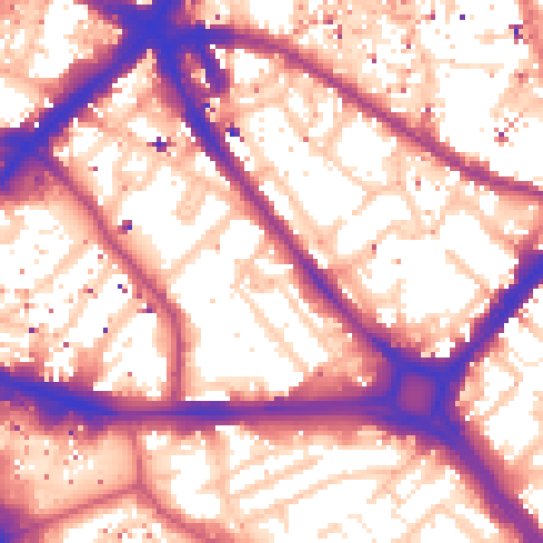
Daytime· 07:00 – 23:00
59.1dB
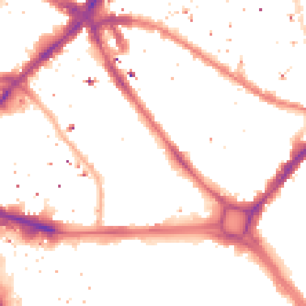
Night-time· 23:00 – 07:00
50.0dB