Are you a property professional?Get qualified leads from motivated homeowners.
Get started18 Blundell Avenue, Horley, RH6 8AU
About 18 Blundell Avenue
A plain-English summary derived from public records, EPC certificates, sold prices and local data.
18 Blundell Avenue is a two-bedroom semi-detached house in Horley (RH6 8AU). It has a recorded floor area of 67 m² (around 716 sq ft) and council tax band D. The latest certificate (October 2009) shows a D (score 65), on the cusp of jumping into the C band. The recommended improvements would push it to C (score 70). The latest certificate is from October 2009, so improvements made since then won't be reflected. Other recorded features include a conservatory.
Untraded for 19 years, with the last transfer in June 2007. That sale landed at the peak of the pre-credit-crunch market, which is a useful reference point when interpreting the price. Sale prices here have outpaced England HPI: 12.7% per year against 0% for the wider region. Today's modelled estimate of £419,000 sits 62.1% above the 2007 sale of £258,500.
What this property has
Pulled from EPC certificates, claim submissions and our property model. Empty categories are hidden — we only show what's known.
Inside
- Bedrooms2
- ConservatoryYes
Outside
- Private gardenrear
- Garage
Energy performance
Every EPC certificate filed against this property — current rating, recorded improvements, and where there's headroom to reach a higher band.
18 Blundell Avenue's EPC is over a decade old — improvements since won't be reflected.
EPC Expired
This certificate is over 10 years old and is no longer valid.Expired 19 Oct 2019
Sales history & valuation
Recorded transactions, our model's current estimate, and a quick read on what neighbouring properties have sold for.
Sale price has at least doubled since 2001.
Current estimate
See how we calculated this£419,000
Modelled from EPC, postcode comparables and a sale-price growth of 12.7% per year over 6 years.
Last sold (2007)
£258,500
Growth on file: 12.7% per year over 6 years.
Sales timeline
Launch offer · 33% off
Buying 18 Blundell Avenue, Horley, RH6 8AU? Know what you're getting into
Everything a buyer needs to know about this property, compiled into one in-depth report so there are no surprises after you offer.
Spot red flags before you buy
An AI-written breakdown of everything that matters
Versus other Blundell Avenue homes
Four headline reads against 20 similar houses on this street, drawn from the latest EPC and Land Registry data.
Years Held for 18 Blundell Avenue runs comfortably ahead of the street norm.
Price per m²
£3,887
Street avg £4,302
Floor Area
67 m²
Street avg 75 m²
Habitable Rooms
3 rooms
Similar properties nearby
A handful of close matches in the same postcode area, ranked by likeness on bedrooms, type and floor area.
The neighbourhood at a glance
A condensed read of the local area. Each tile links through to the full breakdown on the Horley district page.
Crime
26/mo
Steady year-on-year across the wider district.
Nearest stop
0.2 km
Lee Street — bus stop.
Road noise across the postcode
Modelled day and night-time noise levels around RH6 8AU from Defra's strategic mapping. The pin marks this postcode's centroid.
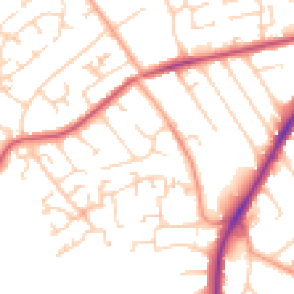
Daytime· 07:00 – 23:00
51.5dB

Everything within walking distance
Schools, transport stops and scenic spots near this property — 39 points of interest in total.
Common questions
The questions buyers, sellers and homeowners most often ask about 18 Blundell Avenue, Horley, RH6 8AU. Each answer is also embedded as structured data for search engines.
