Appenzell, Babylon Lane, Heath Charnock, Chorley, PR6 9EU
About Appenzell
Appenzell is a seven-bedroom property in Heath Charnock, Chorley, Chorley (PR6 9EU). There is a swimming pool on the plot, uncommon for the area. Other recorded features include notable views, a conservatory and attached land beyond the plot.
11 planning records sit against the property, 5 approved, 5 refused. Past consents include an extension, partial demolition and a conservatory, meaningful when judging how the property has evolved. 7 bedrooms is on the larger side for this postcode, where 4 is the typical count. Most recent transfer: August 2020 at £1,900,000.
What this property has
Inside
- Bedrooms7
- Bathrooms5
- ConservatoryYes
Outside
- Private gardenYes
- LandYes
- Notable viewsYes
- Swimming poolYes
Everything you need to know about Appenzell
The true value, the hidden risks and the full sale history, in one report.
Pick your report · every report is £14.99
One time fee only - money back guarantee

The data behind every report


Energy performance
No EPC on record
This property doesn't have an Energy Performance Certificate yet. An EPC is required to sell or let — and unlocks our automated valuation.
Get a survey for this property
Level 2 HomeBuyer Report
We've checked 10 risk factors against the available data for this property and believe a Level 2 HomeBuyer Report could be a suitable option for you.
Planning history
Planning history includes recorded demolition works, indicating a major rebuild phase at this address.
11 applications on record at Appenzell, Babylon Lane, Heath Charnock, Chorley, PR6 9EU
- Jun 2004ExtensionFullOutcome in report
Extension: Part single, part two storey · Side of property
Part two-storey, part single-storey extension on higher level to side,
- Documents
- 1 doc on file
- Reference
- 04/00404/FUL
- More recent applications — locked
- DemolitionMar 2022Decision
- AnnexNov 2016Decision
+ 8 more applications in the report
Unlock Appenzell, Babylon Lane, Heath Charnock, Chorley, PR6 9EU's full planning history
You're seeing the shape of it. The report has the substance.
- Every decision — granted, refused or withdrawn (11 on record)
- All 11 applications on this property in full, plus 4 notable nearby
- The 117 documents, officer reports & conditions
- What the pattern means for extending or converting here
One time fee only - money back guarantee
Sales history & valuation
Latest sale on Appenzell was the highest on Land Registry record across the postcode.
£1,900,000
Recorded with HM Land Registry.
Sales timeline
27 August 2020Most recent
£1,900,000
Median price across the last 5 sales in PR6 9EU: £155,000 (2019–2013).
Nearby sales in PR6 9EU
1 Springfield Cottages, Babylon Lane, Heath Charnock, Chorley, PR6 9EU
Sold Nov 2019
£155,000Meadowcroft, Babylon Lane, Heath Charnock, Chorley, PR6 9EU
Sold Oct 2016
£317,000Springfield House, Babylon Lane, Heath Charnock, Chorley, PR6 9EU
Sold Dec 2014
£320,0003 Springfield Cottages, Babylon Lane, Heath Charnock, Chorley, PR6 9EU
Sold Dec 2013
£105,0001 Newlands, Babylon Lane, Heath Charnock, Chorley, PR6 9EU
Sold Sept 1996
£170,000
Everything you need to know about Appenzell
The true value, the hidden risks and the full sale history, in one report.
Pick your report · every report is £14.99
One time fee only - money back guarantee
The data behind every report
Similar properties nearby
1 Crosse Hall Fold
PR6 9AD
1 Belvedere Road, Anderton
PR6 9NT
1 Brierfield Close, Adlington
PR6 9FU
1 Coniston Avenue, Adlington
PR6 9QH
1 Barn View, Adlington
PR6 9SJ
1 Bank Terrace, Coppice Lane, Heapey
PR6 9DA
1 Brentwood Road, Anderton
PR6 9PL
1 Barrow Nook Grove, Adlington
PR6 9FR
The neighbourhood at a glance
Crime
2/mo
Steady year-on-year across the wider district.
Nearest stop
0.1 km
Millbrook Row — bus stop.
Closest school
0.6 km
St Joseph's Catholic Primary School, Anderton. 6 schools nearby.
Go deeper on the local area
A Local Area report breaks down crime, transport links, schools and air quality in depth.
Road noise across the postcode
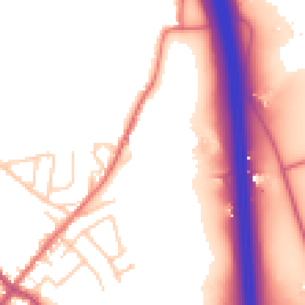
Daytime· 07:00 – 23:00
54.2dB

Night-time· 23:00 – 07:00
45.9dB