4 The Shires, Lea, Preston, PR4 0DN
About 4 The Shires
4 The Shires is a five-bedroom detached house in Lea, Preston, Preston (PR4 0DN). It has a recorded floor area of 274 m² (around 2949 sq ft) and council tax band G. The property has solar panels and underfloor heating on record, all of which lower running costs and tend to lift resale appeal. The latest certificate (January 2013) shows a C (score 78), near the top of the C band. Main heating runs on electricity: electricity, unspecified tariff. The latest certificate is from January 2013, so improvements made since then won't be reflected.
2 planning records sit against the property, 2 approved, 0 refused. Past consents include tree works, meaningful when judging how the property has evolved. On the market in June 2013 and unlisted since — roughly 13 years. Today's modelled estimate of £764,000 is 32.9% above the 2013 sale price.
What this property has
Inside
- Bedrooms5
- Open-plan layoutYes
- EnsuiteYes
Building
- Underfloor heatingYes
- Solar panelsYes
- RefurbishedYes
Everything you need to know about 4 The Shires
The true value, the hidden risks and the full sale history, in one report.
Pick your report · from £14.99
One time fee only - money back guarantee

The data behind every report







Energy performance
4 The Shires's EPC is over a decade old — improvements since won't be reflected.
EPC Expired
This certificate is over 10 years old and is no longer valid.Expired 16 Jan 2023
EPC Rating
Certificate validity
Expired on 16 January 2023

Get a survey for this property
Level 2 HomeBuyer Report
We've checked 10 risk factors against the available data for this property and believe a Level 2 HomeBuyer Report could be a suitable option for you.
From £995 · Includes VAT
Planning history
Planning history at 4 The Shires is exclusively tree-management applications — typical for a property with mature trees on or near the plot.
2 applications on record at 4 The Shires, Lea, Preston, PR4 0DN
- Mar 2016Tree WorksTreesOutcome in report
Reduce 1no branch from Horse Chestnut tree away from the property and using pruning cuts of no greater than 250mm, and to crown raise 1no group of Sycamore trees to 4m above ground level, thin the canopies by no more than 10% and then carry out a lateral reduction to provide clearance from the property
- Documents
- 5 docs on file
- Reference
- 06/2016/0015
- More recent applications — locked
- Tree WorksNov 2025Decision
Unlock 4 The Shires, Lea, Preston, PR4 0DN's full planning history
You're seeing the shape of it. The report has the substance.
- Every decision — granted, refused or withdrawn (2 on record)
- All 2 applications on this property in full, plus 9 notable nearby
- The 19 documents, officer reports & conditions
- What the pattern means for extending or converting here
One time fee only - money back guarantee
Sales history & valuation
£764,000
Modelled from EPC, postcode comparables.
£575,000
Recorded with HM Land Registry.
Sales timeline
13 June 2013Most recent
£575,000
Median price across the last 5 sales in PR4 0DN: £685,000 (2026–2014).
Versus other The Shires homes
On years held, 4 The Shires stands well clear of the street.
Price per m²
£2,099
Street avg £2,267
Floor Area
274 m²
Street avg 303 m²
CO₂ Emissions
4.7 t/year
Street avg 5.3 t/year
Years Held
13 years
Street avg 6 years
Everything you need to know about 4 The Shires
The true value, the hidden risks and the full sale history, in one report.
Pick your report · from £14.99
One time fee only - money back guarantee
The data behind every report
Similar properties nearby
1 Armaside Road, Cottam
PR4 0WH
1 Bampton Drive, Cottam
PR4 0WL
1 Barnstaple Way, Cottam
PR4 0LY
1 Almond Brook Drive, Woodplumpton
PR4 0YX
1 Barnview Court, Lower Bartle
PR4 0FX
1 Bartle Hall Cottage, Lea Lane, Bartle
PR4 0HA
1 Blythe Road, Lightfoot Green
PR4 0FE
1 Ashdene Court, Cottam
PR4 0GX
The neighbourhood at a glance
Daytime road noise here sits well below conversation level — a quiet pocket of the postcode.
Crime
259/mo
Falling year-on-year across the wider district.
Nearest stop
0.2 km
Westleigh — bus stop.
Closest school
0.7 km
Lea Neeld's Endowed Church of England Primary School. 15 schools nearby.
Go deeper on the local area
A Local Area report breaks down crime, transport links, schools and air quality in depth.
Road noise across the postcode
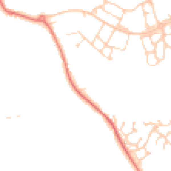
Daytime· 07:00 – 23:00
46.3dB

Night-time· 23:00 – 07:00
36.9dB