3 Cheshire Way, Emsworth, PO10 8PU
About 3 Cheshire Way
3 Cheshire Way is a three-bedroom semi-detached house in Emsworth (PO10 8PU). It has a recorded floor area of 89 m² (around 958 sq ft), construction records dating it to 1967-1975 and council tax band D. The latest certificate (April 2023) shows a C (score 73). The recommended improvements would push it to B (score 86). Records show the property has been extended at some point in its history.
At 89 m² it's 15.2% smaller than the typical home in the postcode (105 m² median across 6 EPCs). On energy efficiency it sits in the top 10% of properties in this postcode. One planning record on file: an extension approved in 2004. Past consents include an extension, meaningful when judging how the property has evolved. On a £-per-square-foot basis, the last sale (£377/sq ft) was about 65.8% above the typical sold price in the postcode. Sold April 2024 for £361,500.
Know exactly what you're buying at 3 Cheshire Way
Before you offer, see what the listing won't tell you, the true value, the red flags and the full history.
Already flagged here
Launch offer · save £5
Valuation
against the asking price
Risks
planning & flood
Sold prices
similar homes nearby
Trends
the local market
What this property has
Inside
- Bedrooms3
- Bathrooms1
- Open-plan layoutYes
- Dining roomYes
- CloakroomYes
- EnsuiteYes
Outside
- Private gardenfront_and_rear
- Garageintegral
Building
- Previously extendedYes
Energy performance
3 Cheshire Way ranks among the most efficient homes in the postcode for energy use.
EPC Rating
Planning history
3 Cheshire Way has an approved single-storey rear extension on the planning record.
- Oct 2004ExtensionFullIn report
Extension: Single storey · Rear of property
Single storey rear extension.
- Documents
- 8 docs on file
- Reference
- 04/03321/DOM
We flagged 1 thing worth checking at 3 Cheshire Way
Independent checks surfaced things a buyer would want to understand before offering. The report explains each one in full, with the underlying data and what to ask.
- Larger development activity nearby
30-day money-back guarantee
Sales history & valuation
3 Cheshire Way valuation sits well clear of the typical sold price in this postcode.
£396,000
Modelled from EPC, postcode comparables.
£361,500
Recorded with HM Land Registry.
Sales timeline
10 April 2024Most recent
£361,500
Median price across the last 5 sales in PO10 8PU: £397,500 (2024–2014).
Nearby sales in PO10 8PU
Everything we know about 3 Cheshire Way, in one report
What it's really worth, what could be wrong, and the planning, sales and area data in full.
What we flagged
- Larger development activity nearby

Versus other Cheshire Way homes
3 Cheshire Way outperforms the street on epc rating by a wide margin.
Price per m²
£4,062
Street avg £3,629
Floor Area
89 m²
Street avg 102 m²
Habitable Rooms
6 rooms
Street avg 6 rooms
CO₂ Emissions
2.6 t/year
Street avg 4.2 t/year
Similar properties nearby
1 Byerley Close, Westbourne
PO10 8TS
1 Church Road, Southbourne
PO10 8JT
1 Cheshire Way
PO10 8PU
1 Barnfield Close
PO10 8NH
1 Alfrey Close
PO10 8ET
1 Breach Avenue
PO10 8NB
1 Avocet Quay
PO10 8BY
1 Beckenham Terrace, North Street, Westbourne
PO10 8SW
The neighbourhood at a glance
Rail-style transport is unusually close for this postcode.
Crime
2/mo
Steady year-on-year across the wider district.
Nearest stop
0.2 km
Breach Avenue — bus stop.
Closest school
0.6 km
Bourne Community College. 7 schools nearby.
Go deeper on the local area
The full report breaks down crime, transport links, schools and air quality in depth.
Road noise across the postcode
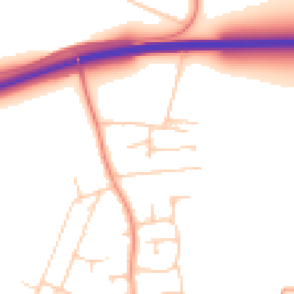
Daytime· 07:00 – 23:00
51.2dB

Night-time· 23:00 – 07:00
43.3dB