The Cottage, Prinsted Lane, Prinsted, Emsworth, PO10 8HR
About The Cottage
The Cottage is a property in Prinsted, Emsworth, Emsworth (PO10 8HR). It has council tax band F.
Energy performance
No EPC on record
This property doesn't have an Energy Performance Certificate yet. An EPC is required to sell or let — and unlocks our automated valuation.
Planning history
No planning applications are recorded against The Cottage, Prinsted Lane, Prinsted, Emsworth, PO10 8HR. The full report also covers planning activity across the surrounding area.
Sales history & valuation
No sales recorded with HM Land Registry
That can mean the property has never traded since the registry began publishing in 1995, was a new build that hasn't been registered yet, or is held in the same hands long-term.
Median price across the last 5 sales in PO10 8HR: £575,000 (2024–2019).
Nearby sales in PO10 8HR
Manor Barn, Prinsted Lane, Prinsted, Emsworth, PO10 8HR
Sold Sept 2024
£910,0001 Fairview Cottages, Prinsted Lane, Prinsted, Emsworth, PO10 8HR
Sold Jan 2022
£575,000Spinmill, Prinsted Lane, Prinsted, Emsworth, PO10 8HR
Sold Nov 2020
£800,000Highfield, Prinsted Lane, Prinsted, Emsworth, PO10 8HR
Sold Nov 2019
£528,580The Manor House, Prinsted Lane, Prinsted, Emsworth, PO10 8HR
Sold Jul 2019
£1,400,000
Similar properties nearby
1 3, Slipper Road
PO10 8BS
1 Akela Way
PO10 8FF
1 Aldsworth Manor Barns, Aldsworth
PO10 8QT
1 Alfrey Close
PO10 8ET
1 Avocet Quay
PO10 8BY
1 Barn Cottages, Prinsted Lane, Prinsted
PO10 8HT
1 Barnfield Close
PO10 8NH
1 Beckenham Terrace, North Street, Westbourne
PO10 8SW
The neighbourhood at a glance
Rail-style transport is unusually close for this postcode.
Crime
2/mo
Steady year-on-year across the wider district.
Nearest stop
0.2 km
Prinsted Lane — bus stop.
Closest school
0.6 km
Southbourne Infant School. 8 schools nearby.
Road noise across the postcode
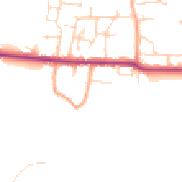
Daytime· 07:00 – 23:00
45.9dB

Night-time· 23:00 – 07:00
38.4dB