Highfield, Prinsted Lane, Prinsted, Emsworth, PO10 8HR
About Highfield
Highfield is a detached house in Prinsted, Emsworth, Emsworth (PO10 8HR). It has a recorded floor area of 71 m² (around 764 sq ft), construction records dating it to 1950-1966 and council tax band E. The latest certificate (September 2019) shows an E (score 54), well below the UK norm with real room to improve. The recommended improvements would lift it to C (score 80), a 2-band jump.
At 71 m² it sits well below the postcode median (155 m² across 11 EPCs), making it one of the more compact homes locally. 2 planning records sit against the property, 1 approved, 0 refused. Past consents include an extension, meaningful when judging how the property has evolved. Today's modelled estimate of £586,000 is 10.9% above the 2019 sale price. On a £-per-square-foot basis, the last sale (£692/sq ft) was about 102.9% above the typical sold price in the postcode. Last sale on file: £528,580 in November 2019.
Know exactly what you're buying at Highfield
Before you offer, see what the listing won't tell you, the true value, the red flags and the full history.
Already flagged here
Launch offer · save £5
Valuation
against the asking price
Risks
planning & flood
Sold prices
similar homes nearby
Trends
the local market
Energy performance
Recommended upgrades on file would lift this property by multiple EPC bands.
EPC Rating
Planning history
Highfield has 2 separate extension applications on the council record.
- Mar 2020ExtensionFullIn report
Extension: Single storey
Single storey extension to bungalow.
- Documents
- 12 docs on file
- Reference
- 20/00078/DOM
- Aug 2019ExtensionOutlineIn report
Extension: Single storey · Side of property
Single storey side extension to bungalow to create additional living space.
- Reference
- 19/02005/PASUR
We flagged 1 thing worth checking at Highfield
Independent checks surfaced things a buyer would want to understand before offering. The report explains each one in full, with the underlying data and what to ask.
- Larger development activity nearby
30-day money-back guarantee
Sales history & valuation
Highfield valuation sits well clear of the typical sold price in this postcode.
£586,000
Modelled from EPC, postcode comparables.
£528,580
Recorded with HM Land Registry.
Sales timeline
6 November 2019Most recent
£528,580
Median price across the last 5 sales in PO10 8HR: £800,000 (2024–2019).
Nearby sales in PO10 8HR
Manor Barn, Prinsted Lane, Prinsted, Emsworth, PO10 8HR
Sold Sept 2024
£910,0001 Fairview Cottages, Prinsted Lane, Prinsted, Emsworth, PO10 8HR
Sold Jan 2022
£575,000Spinmill, Prinsted Lane, Prinsted, Emsworth, PO10 8HR
Sold Nov 2020
£800,000The Manor House, Prinsted Lane, Prinsted, Emsworth, PO10 8HR
Sold Jul 2019
£1,400,000Harbour Cottage, Prinsted Lane, Prinsted, Emsworth, PO10 8HR
Sold Dec 2014
£610,000
Everything we know about Highfield, in one report
What it's really worth, what could be wrong, and the planning, sales and area data in full.
What we flagged
- Larger development activity nearby

Versus other Prinsted Lane homes
Highfield outperforms the street on price per m² by a wide margin.
Price per m²
£7,445
Street avg £3,973
Floor Area
71 m²
Street avg 169 m²
Habitable Rooms
4 rooms
Street avg 6 rooms
CO₂ Emissions
4.1 t/year
Street avg 6.9 t/year
Similar properties nearby
1 Cockbush Cottages, Woodberry Lane
PO10 8QN
1 Barn Cottages, Prinsted Lane, Prinsted
PO10 8HT
1 Benjamin Drive
PO10 8NT
1 Chantry Hall, Westbourne
PO10 8FG
1 Alfrey Close
PO10 8ET
1 Breach Avenue
PO10 8NB
1 Collett Crescent
PO10 8GD
1 Cedar Villas, Commonside
PO10 8TD
The neighbourhood at a glance
Rail-style transport is unusually close for this postcode.
Crime
2/mo
Steady year-on-year across the wider district.
Nearest stop
0.2 km
Prinsted Lane — bus stop.
Closest school
0.6 km
Southbourne Infant School. 8 schools nearby.
Go deeper on the local area
The full report breaks down crime, transport links, schools and air quality in depth.
Road noise across the postcode
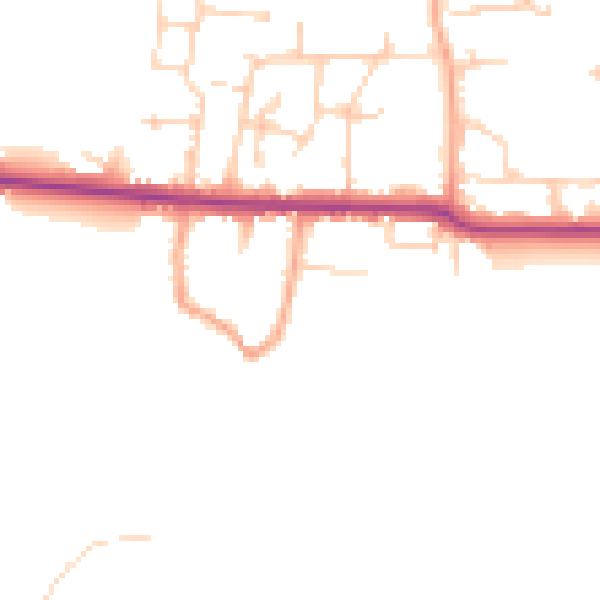
Daytime· 07:00 – 23:00
45.9dB

Night-time· 23:00 – 07:00
38.4dB