31 Albert Street, Royton, Oldham, OL2 5UF
About 31 Albert Street
31 Albert Street is a mid-terrace house in Royton, Oldham, Oldham (OL2 5UF). It has a recorded floor area of 69 m² (around 743 sq ft), construction records dating it to 1967-1975 and council tax band A. The latest certificate (June 2014) shows a C (score 69), just inside the C band. The latest certificate is from June 2014, so improvements made since then won't be reflected.
Everything you need to know about 31 Albert Street
The true value, the hidden risks and the full sale history, in one report.
Pick your report · every report is £14.99
One time fee only - money back guarantee

The data behind every report


Energy performance
31 Albert Street's EPC is over a decade old — improvements since won't be reflected.
EPC Expired
This certificate is over 10 years old and is no longer valid.Expired 22 Jun 2024
EPC Rating
Get a survey for this property
Level 2 HomeBuyer Report
We've checked 10 risk factors against the available data for this property and believe a Level 2 HomeBuyer Report could be a suitable option for you.
From £495 · Includes VAT
Planning history
31 Albert Street has no planning applications on record.
But the area is active
3 notable applications nearby — larger schemes and conversions that could reshape the street. The report maps them all.
Sales history & valuation
31 Albert Street has no Land Registry sales on file, suggesting it has stayed in the same hands since registration began.
£131,000
Modelled from EPC, postcode comparables.
No sales recorded with HM Land Registry
That can mean the property has never traded since the registry began publishing in 1995, was a new build that hasn't been registered yet, or is held in the same hands long-term.
Median price across the last 5 sales in OL2 5UF: £144,000 (2025–2022).
Nearby sales in OL2 5UF
84 Albert Street, Royton, Oldham, OL2 5UF
Sold May 2025
£145,00072 Albert Street, Royton, Oldham, OL2 5UF
Sold Jul 2024
£144,00078 Albert Street, Royton, Oldham, OL2 5UF
Sold Oct 2022
£144,00033 Albert Street, Royton, Oldham, OL2 5UF
Sold Sept 2022
£110,50021 Albert Street, Royton, Oldham, OL2 5UF
Sold Feb 2022
£78,000
Versus other Albert Street homes
EPC Rating for 31 Albert Street lags the street by a wide margin.
EPC Rating
69 (C)
Street avg 74 (C)
Floor Area
69 m²
Street avg 63 m²
CO₂ Emissions
2.6 t/year
Street avg 2.1 t/year
Habitable Rooms
3 rooms
Street avg 3 rooms
Everything you need to know about 31 Albert Street
The true value, the hidden risks and the full sale history, in one report.
Pick your report · every report is £14.99
One time fee only - money back guarantee
The data behind every report
Similar properties nearby
1 Birchinlee Avenue, Royton
OL2 5EL
1 All Saints Close, Royton
OL2 5RD
1 Albert Street, Royton
OL2 5UF
1 Burnsall Grove, Royton
OL2 5RJ
1 Bromley Avenue, Royton
OL2 5YB
1 Cemetery Road, Royton
OL2 5SP
1 Briony Close, Royton
OL2 5AL
1 Chapel Lane, Royton
OL2 5QG
The neighbourhood at a glance
Crime
1/mo
Steady year-on-year across the wider district.
Nearest stop
0.1 km
Albert Street — bus stop.
Closest school
0.3 km
Thorp Primary School. 37 schools nearby.
Go deeper on the local area
A Local Area report breaks down crime, transport links, schools and air quality in depth.
Road noise across the postcode
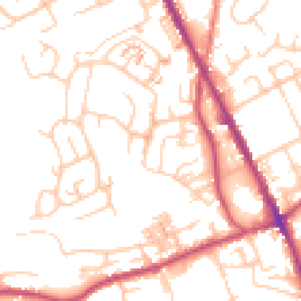
Daytime· 07:00 – 23:00
51.7dB
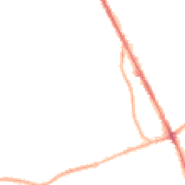
Night-time· 23:00 – 07:00
41.5dB