19 Hawtrey Road, Camden, London, NW3 3SS
About 19 Hawtrey Road
19 Hawtrey Road is a three-bedroom end-of-terrace house in Camden, London, London (NW3 3SS). It has a recorded floor area of 125 m² (around 1345 sq ft), construction records dating it to 1967-1975 and council tax band G. Tenure is freehold. The latest certificate (March 2016) shows an E (score 41), well below the UK norm with real room to improve. The rating has held steady at E across 2 certificates since January 2014. The recommended improvements would lift it to C (score 78), a 2-band jump. The latest certificate is from March 2016, so improvements made since then won't be reflected.
6 planning records sit against the property, 4 approved, 1 refused, 1 pending. Past consents include new windows and an extension, meaningful when judging how the property has evolved. An application is currently awaiting a decision. At 125 m² it's 22.1% smaller than the typical home in the postcode (161 m² median across 24 EPCs). It lags the bulk of the postcode on energy efficiency (less efficient than 79% of similar EPCs). Today's modelled estimate of £2,067,000 is 25.3% above the 2021 sale price. On a £-per-square-foot basis, the last sale (£1,226/sq ft) was about 52.2% above the typical sold price in the postcode. Sold December 2021 for £1,650,000. That sale was during the post-pandemic price surge, when transactions cleared materially above pre-2020 trend.
Know exactly what you're buying at 19 Hawtrey Road
Before you offer, see what the listing won't tell you, the true value, the red flags and the full history.
Valuation
against the asking price
Risks
planning & flood
Sold prices
similar homes nearby
Trends
the local market
What this property has
Inside
- Bedrooms3
- Bathrooms2
- Dining roomYes
- CloakroomYes
Building
- TenureFreehold
Energy performance
19 Hawtrey Road's carbon output runs well above what efficient homes in the postcode produce.
EPC Expired
This certificate is over 10 years old and is no longer valid.Expired 30 Mar 2026
EPC Rating
Planning history
A new windows application was refused at 19 Hawtrey Road in 2023.
- May 2024FullIn report
Installation of air conditioning units
- Documents
- 17 docs on file
- Reference
- 2024/2136/P
- Sept 2023RenovationFullIn report
Installation of ground floor side window
New Windows- Documents
- 7 docs on file
- Reference
- 2023/3048/P
What's in 19 Hawtrey Road, Camden, London, NW3 3SS's planning history?
4 more on this property, plus refusals, disputes and full decisions nearby, in the report.
Sales history & valuation
The latest sale landed in the post-pandemic price surge — useful context when reading the figure.
£2,067,000
Modelled from EPC, postcode comparables.
£1,650,000
Recorded with HM Land Registry.
Sales timeline
23 December 2021Most recent
£1,650,000
Median price across the last 5 sales in NW3 3SS: £1,700,000 (2025–2020).
Nearby sales in NW3 3SS
9 Hawtrey Road, Camden, London, NW3 3SS
Sold Jan 2025
£2,185,00058 Hawtrey Road, Camden, London, NW3 3SS
Sold Jul 2024
£1,625,000108 Hawtrey Road, Camden, London, NW3 3SS
Sold Jun 2022
£1,700,00052 Hawtrey Road, Camden, London, NW3 3SS
Sold Jun 2021
£1,535,00096 Hawtrey Road, Camden, London, NW3 3SS
Sold Apr 2020
£1,700,000
Everything we know about 19 Hawtrey Road, in one report
What it's really worth, what could be wrong, and the planning, sales and area data in full.
- Am I paying too much?
- Is something wrong with it?
- Is the agent's story true?
- Will it hold its value?

Versus other Hawtrey Road homes
19 Hawtrey Road is notably below the street on floor area.
Price per m²
£13,200
Street avg £9,974
Floor Area
125 m²
Street avg 166 m²
Habitable Rooms
5 rooms
Street avg 6 rooms
CO₂ Emissions
8.1 t/year
Street avg 6.1 t/year
Similar properties nearby
1 Erskine Mews, Camden
NW3 3AP
10 Elsworthy Road, Camden
NW3 3DJ
1 Hawtrey Road, Camden
NW3 3SS
10 Briary Close, Camden
NW3 3JZ
1 Brocas Close, Camden
NW3 3LD
1 King Henrys Road, Camden
NW3 3QP
1 Elliott Square, Camden
NW3 3SU
1 Tobin Close, Camden
NW3 3DY
The neighbourhood at a glance
Rail-style transport is unusually close for this postcode.
Crime
6/mo
Rising year-on-year across the wider district.
Nearest stop
0.0 km
Lower Merton Rise — bus stop.
Closest school
0.3 km
The UCL Academy. 80 schools nearby.
Go deeper on the local area
The full report breaks down crime, transport links, schools and air quality in depth.
Road noise across the postcode
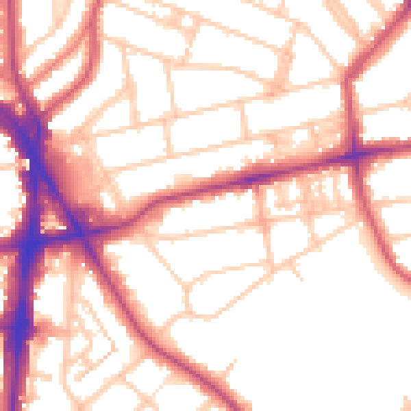
Daytime· 07:00 – 23:00
53.7dB

Night-time· 23:00 – 07:00
43.4dB