Are you a property professional?Get qualified leads from motivated homeowners.
Get started15 Caddington Road, Barnet, London, NW2 1RP
3 sales on record
About 15 Caddington Road
A plain-English summary derived from public records, EPC certificates, sold prices and local data.
15 Caddington Road is a four-bedroom semi-detached house in Barnet, London, London (NW2 1RP). It has a recorded floor area of 149 m² (around 1604 sq ft), construction records dating it to before 1900 and council tax band F. The latest certificate (August 2012) shows a D (score 56), a step below the typical UK home. The recommended improvements would push it to C (score 79). The latest certificate is from August 2012, so improvements made since then won't be reflected. Period features are noted in the property record.
Sale prices here have outpaced London HPI: 5.4% per year against 0% for the wider region. On a £-per-square-foot basis, the last sale (£586/sq ft) was about 43.8% above the typical sold price in the postcode. At 149 m² the property is well over the postcode median (76 m² across 26 EPCs), placing it in the larger end of the local stock. One planning record on file: an extension approved in 2004. Past consents include an extension and partial demolition, meaningful when judging how the property has evolved. Sold August 2021 for £940,000. That sale was during the post-pandemic price surge, when transactions cleared materially above pre-2020 trend.
What this property has
Pulled from EPC certificates, claim submissions and our property model. Empty categories are hidden — we only show what's known.
Inside
- Bedrooms4
- Dining roomYes
- CloakroomYes
Outside
- Private garden
Energy performance
Every EPC certificate filed against this property — current rating, recorded improvements, and where there's headroom to reach a higher band.
15 Caddington Road's carbon output runs well above what efficient homes in the postcode produce.
EPC Expired
This certificate is over 10 years old and is no longer valid.Expired 17 Aug 2022
Planning history
Applications and permits filed against 15 Caddington Road, Barnet, London, NW2 1RP, sourced from the PlanIt planning register.
Planning history includes recorded demolition works, indicating a major rebuild phase at this address.
- Sept 2004DemolitionFullApprove subject to conditions
Sales history & valuation
Recorded transactions, our model's current estimate, and a quick read on what neighbouring properties have sold for.
Sale price has at least doubled since 2002.
Current estimate
See how we calculated this£985,000
Modelled from EPC, postcode comparables and a sale-price growth of 5.4% per year over 19 years.
Last sold (2021)
£940,000
Growth on file: 5.4% per year over 19 years.
Sales timeline
Versus other Caddington Road homes
Four headline reads against 11 similar houses on this street, drawn from the latest EPC and Land Registry data.
Floor Area for 15 Caddington Road runs comfortably ahead of the street norm.
Price per m²
£6,309
Street avg £5,795
Floor Area
149 m²
Street avg 127 m²
Habitable Rooms
6 rooms
Similar properties nearby
A handful of close matches in the same postcode area, ranked by likeness on bedrooms, type and floor area.
The neighbourhood at a glance
A condensed read of the local area. Each tile links through to the full breakdown on the London district page.
Rail-style transport is unusually close for this postcode.
Crime
14/mo
Rising year-on-year across the wider district.
Nearest stop
0.1 km
Dersingham Road — bus stop.
Road noise across the postcode
Modelled day and night-time noise levels around NW2 1RP from Defra's strategic mapping. The pin marks this postcode's centroid.
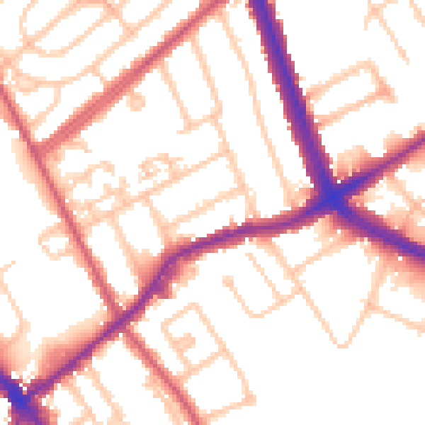
Daytime· 07:00 – 23:00
53.5dB

Everything within walking distance
Schools, transport stops and scenic spots near this property — 82 points of interest in total.
Beautiful places to visit nearby
Curated scenic spots within reach of this postcode, served by Beautifulplaces.ai. Photography and tagging come from their open dataset.
Common questions
The questions buyers, sellers and homeowners most often ask about 15 Caddington Road, Barnet, London, NW2 1RP. Each answer is also embedded as structured data for search engines.