15 Brougham Avenue, Mansfield, NG19 7LA
About 15 Brougham Avenue
15 Brougham Avenue is a two-bedroom detached house in Mansfield (NG19 7LA). It has a recorded floor area of 68 m² (around 732 sq ft), construction records dating it to 1930-1949 and council tax band A. The latest certificate (November 2012) shows a D (score 63), on the cusp of jumping into the C band. The rating has held steady at D across 2 certificates since November 2012. The recommended improvements would push it to C (score 80). The latest certificate is from November 2012, so improvements made since then won't be reflected. Other recorded features include a conservatory.
Across 2013–2017, sale prices on this property compounded at 8.3% per year. Today's modelled estimate of £143,000 sits 57.1% above the 2017 sale of £91,000. On a £-per-square-foot basis, the last sale (£124/sq ft) was about 27.6% above the typical sold price in the postcode. One planning record on file: partial demolition approved in 2021. Past consents include partial demolition, meaningful when judging how the property has evolved. Last sold in November 2017, so it's been off the market for around 9 years. At 68 m² it's 17.6% smaller than the typical home in the postcode (83 m² median across 14 EPCs).
What this property has
Inside
- Bedrooms2
- Bathrooms1
- CloakroomYes
- ConservatoryYes
Outside
- GarageYes
Everything you need to know about 15 Brougham Avenue
The true value, the hidden risks and the full sale history, in one report.
Pick your report · every report is £14.99
One time fee only - money back guarantee

The data behind every report


Energy performance
15 Brougham Avenue's EPC is over a decade old — improvements since won't be reflected.
EPC Expired
This certificate is over 10 years old and is no longer valid.Expired 15 Nov 2022
EPC Rating
Get a survey for this property
Level 2 HomeBuyer Report
We've checked 10 risk factors against the available data for this property and believe a Level 2 HomeBuyer Report could be a suitable option for you.
From £495 · Includes VAT
Planning history
Planning history includes recorded demolition works, indicating a major rebuild phase at this address.
1 application on record at 15 Brougham Avenue, Mansfield, NG19 7LA
- Jul 2021DemolitionFullOutcome in report
DEMOLITION OF EXISTING SINGLE GARAGE AND REPLACE WITH NEW GARAGE
- Documents
- 10 docs on file
- Reference
- 2021/0485/HHA
Unlock 15 Brougham Avenue, Mansfield, NG19 7LA's full planning history
You're seeing the shape of it. The report has the substance.
- Every decision — granted, refused or withdrawn (1 on record)
- All 1 application on this property in full, plus 3 notable nearby
- The 10 documents, officer reports & conditions
- What the pattern means for extending or converting here
One time fee only - money back guarantee
Sales history & valuation
15 Brougham Avenue valuation sits well clear of the typical sold price in this postcode.
£143,000
Modelled from EPC, postcode comparables and a sale-price growth of 8.3% per year over 5 years.
£91,000
Growth on file: 8.3% per year over 5 years.
Sales timeline
15 November 2017Most recent
£91,000
+43.3%over 4 years9 May 2013
£63,500
Median price across the last 5 sales in NG19 7LA: £127,000 (2024–2019).
Nearby sales in NG19 7LA
Versus other Brougham Avenue homes
On floor area, 15 Brougham Avenue runs well behind the street norm.
Price per m²
£1,338
Street avg £1,145
Floor Area
68 m²
Street avg 83 m²
Habitable Rooms
3 rooms
Street avg 5 rooms
CO₂ Emissions
3.1 t/year
Street avg 4.9 t/year
Everything you need to know about 15 Brougham Avenue
The true value, the hidden risks and the full sale history, in one report.
Pick your report · every report is £14.99
One time fee only - money back guarantee
The data behind every report
Similar properties nearby
1 Brougham Avenue
NG19 7LA
1 Carpenter Avenue
NG19 7LD
1 Cranmer Grove
NG19 7JR
1 Burlington Drive
NG19 7HU
1 Deansgate, Pleasley
NG19 7QW
1 Clumber Drive
NG19 7HJ
1 Crompton Road, Pleasley
NG19 7RG
1 Cator Road, Pleasley
NG19 7RH
The neighbourhood at a glance
Daytime road noise here sits well below conversation level — a quiet pocket of the postcode.
Crime
3/mo
Steady year-on-year across the wider district.
Nearest stop
0.1 km
Bright Square — bus stop.
Closest school
0.1 km
Crescent Primary School. 18 schools nearby.
Go deeper on the local area
A Local Area report breaks down crime, transport links, schools and air quality in depth.
Road noise across the postcode
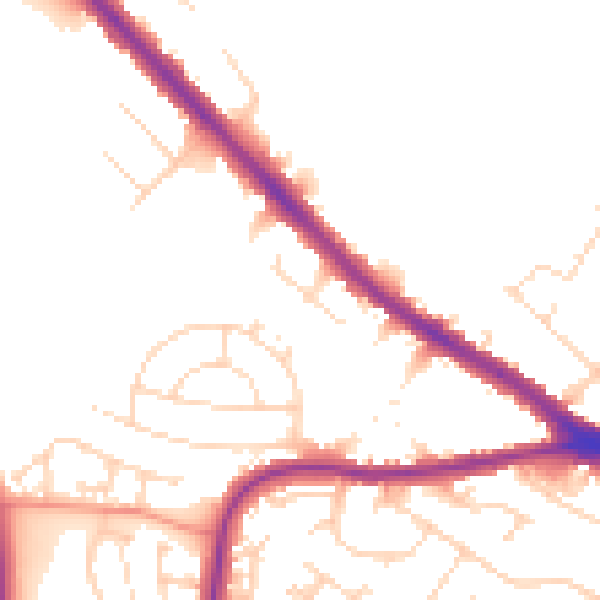
Daytime· 07:00 – 23:00
49.9dB

Night-time· 23:00 – 07:00
41.8dB