17 Forest Grove, Nottingham, NG1 4HS
About 17 Forest Grove
17 Forest Grove is a one-bedroom detached house in Nottingham (NG1 4HS). It has a recorded floor area of 68 m² (around 732 sq ft), construction records dating it to 1900-1929 and council tax band B. The latest certificate (June 2020) shows an E (score 53), well below the UK norm with real room to improve. The recommended improvements would lift it to B (score 85), a 3-band jump. Our model identifies extension potential, subject to local planning policy. The home occupies a cul-de-sac position.
One planning application is currently pending a decision in 2014. The record references conservation-area consent, which constrain future alterations. Across 2001–2020, sale prices on this property compounded at 3.1% per year. Today's modelled estimate of £209,000 is 16.1% above the 2020 sale price. On a £-per-square-foot basis, the last sale (£246/sq ft) was about 91.4% above the typical sold price in the postcode. At 68 m² it's 29.2% smaller than the typical home in the postcode (96 m² median across 13 EPCs). 1 bedrooms is on the smaller side for this postcode, where 3 is the typical count. Sold November 2020 for £180,000.
What this property has
Inside
- Bedrooms1
- Bathrooms1
Outside
- Private gardenYes
- ParkingOff street
- Cul-de-sacYes
Building
- Heating systemGas
- Extension potentialPossible
Everything you need to know about 17 Forest Grove
The true value, the hidden risks and the full sale history, in one report.
Pick your report · every report is £14.99
One time fee only - money back guarantee

The data behind every report


Energy performance
Recommended upgrades on file would lift this property by multiple EPC bands.
EPC Rating
Get a survey for this property
Level 3 Building Survey
Because the property was built before 1919 and has solid (non-cavity) walls, we believe a Level 3 building survey should be considered.
From £885 · Includes VAT
Planning history
17 Forest Grove sits within a conservation area — exterior works face additional planning controls.
1 application on record at 17 Forest Grove, Nottingham, NG1 4HS
- Jul 2014Tree WorksTreesOutcome in report
Works to trees within a conservation area as per submitted details.
Conservation Area- Documents
- 1 doc on file
- Reference
- 14/01823/PWC
Unlock 17 Forest Grove, Nottingham, NG1 4HS's full planning history
You're seeing the shape of it. The report has the substance.
- Every decision — granted, refused or withdrawn
- All 1 application on this property in full, plus 16 notable nearby
- The 1 documents, officer reports & conditions
- What the pattern means for extending or converting here
One time fee only - money back guarantee
Sales history & valuation
The latest sale landed in the post-pandemic price surge — useful context when reading the figure.
£209,000
Modelled from EPC, postcode comparables and a sale-price growth of 3.1% per year over 19 years.
£180,000
Growth on file: 3.1% per year over 19 years.
Sales timeline
13 November 2020Most recent
£180,000
+80.0%over 18 years30 November 2001
£100,000
Median price across the last 5 sales in NG1 4HS: £217,500 (2022–2016).
Nearby sales in NG1 4HS
Versus other Forest Grove homes
Floor Area for 17 Forest Grove lags the street by a wide margin.
Price per m²
£2,647
Street avg £40,934
Floor Area
68 m²
Street avg 103 m²
Habitable Rooms
2 rooms
Street avg 5 rooms
CO₂ Emissions
4.5 t/year
Street avg 5.3 t/year
Everything you need to know about 17 Forest Grove
The true value, the hidden risks and the full sale history, in one report.
Pick your report · every report is £14.99
One time fee only - money back guarantee
The data behind every report
Similar properties nearby
The neighbourhood at a glance
Rail-style transport is unusually close for this postcode.
Crime
39/mo
Rising year-on-year across the wider district.
Nearest stop
0.2 km
Forest Road — bus stop.
Closest school
0.6 km
Bluecoat Trent Academy. 43 schools nearby.
Go deeper on the local area
A Local Area report breaks down crime, transport links, schools and air quality in depth.
Road noise across the postcode
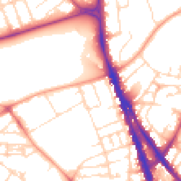
Daytime· 07:00 – 23:00
53.8dB
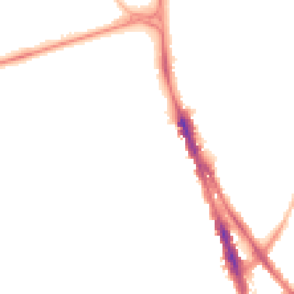
Night-time· 23:00 – 07:00
43.5dB