33 Blandford Square, Newcastle Upon Tyne, NE1 4HZ
About 33 Blandford Square
33 Blandford Square is an end-of-terrace house in Newcastle Upon Tyne (NE1 4HZ). It has a recorded floor area of 50 m² (around 538 sq ft), construction records dating it to 1900-1929 and council tax band A. At 50 m² this is the smallest unit on EPC record across the building (50–116 m²). The building's EPC ratings span F to C across 9 units on file. The latest certificate (July 2018) shows a D (score 62), on the cusp of jumping into the C band. Main heating runs on electricity.
Today's modelled estimate of £124,000 is 29.1% below the 2013 sale of £175,000, below the original sale price, which typically signals condition or completion-status changes worth verifying. On a £-per-square-foot basis, the last sale (£325/sq ft) was about 70% above the typical sold price in the postcode. At 50 m² it sits well below the postcode median (86 m² across 8 EPCs), making it one of the more compact homes locally. Last sold in October 2013, so it's been off the market for around 13 years.
Everything you need to know about 33 Blandford Square
The true value, the hidden risks and the full sale history, in one report.
30-day money-back guarantee

The data behind every report


Energy performance
EPC Rating
Planning history
33 Blandford Square has no planning applications on record.
The full report still covers planning activity across the surrounding area.
Sales history & valuation
£124,000
Modelled from EPC, postcode comparables.
£175,000
Recorded with HM Land Registry.
Sales timeline
21 October 2013Most recent
£175,000
Median price across the last 5 sales in NE1 4HZ: £215,000 (2019–2016).
Nearby sales in NE1 4HZ
1 Brewery Stables, Blandford Square, Newcastle Upon Tyne, NE1 4HZ
Sold Nov 2019
£249,9502 Brewery Stables, Blandford Square, Newcastle Upon Tyne, NE1 4HZ
Sold Mar 2019
£220,0004 Brewery Stables, Blandford Square, Newcastle Upon Tyne, NE1 4HZ
Sold Feb 2017
£172,50023 Blandford Square, Newcastle Upon Tyne, NE1 4HZ
Sold Mar 2016
£160,0007 Brewery Stables, Blandford Square, Newcastle Upon Tyne, NE1 4HZ
Sold Mar 2013
£156,000
Versus other Blandford Square homes
On price per m², 33 Blandford Square stands well clear of the street.
Price per m²
£3,500
Street avg £2,210
Floor Area
50 m²
Street avg 81 m²
Habitable Rooms
2 rooms
Street avg 3 rooms
CO₂ Emissions
4.2 t/year
Street avg 4.1 t/year
Everything you need to know about 33 Blandford Square
The true value, the hidden risks and the full sale history, in one report.
30-day money-back guarantee
The data behind every report
Similar properties nearby
10 Citygate, Bath Lane
NE1 4DL
10 Forth Place
NE1 4EU
1 Thornton Court, Forth Place
NE1 4ES
10 St James View, St James Street
NE1 4NH
10 Charlotte Mews
NE1 4XH
10 Peel House, Temple Street
NE1 4BP
1 Charlotte Mews
NE1 4XH
1 The Open
NE1 4DB
The neighbourhood at a glance
Rail-style transport is unusually close for this postcode.
Crime
14/mo
Rising year-on-year across the wider district.
Nearest stop
0.1 km
Westgate Road-Westgate Hill — bus stop.
Closest school
0.2 km
Our Lady and St Anne's Catholic Primary School. 34 schools nearby.
Go deeper on the local area
The full report breaks down crime, transport links, schools and air quality in depth.
Road noise across the postcode
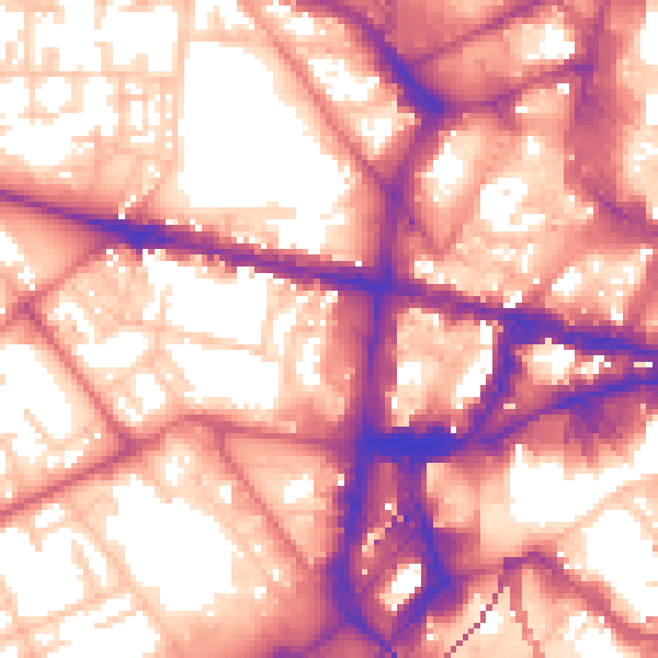
Daytime· 07:00 – 23:00
60.1dB
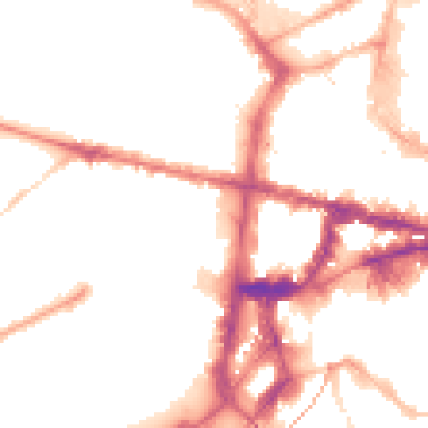
Night-time· 23:00 – 07:00
50.6dB