Flat A, 9 Alroy Road, London, N4 1EF
About Flat A
Flat A is a one-bedroom mid-terrace house in London (N4 1EF). It has a recorded floor area of 72 m² (around 775 sq ft) and construction records dating it to 1900-1929. The latest certificate (October 2023) shows a C (score 69), just inside the C band. When first surveyed in February 2011 the rating was D, the property has climbed 1 band since. Between certificates, window efficiency went from Poor to Average, hot-water efficiency went from Average to Good and main heating went from Average to Good. Other recorded features include a basement. Period features are noted in the property record.
Last sale on file: £440,000 in March 2020. Across the public record there are 5 sales, relatively high churn for a single property. At 72 m² it's 16.1% larger than the typical home in the postcode (62 m² median across 20 EPCs). Its energy rating outperforms most of the postcode (better than 85% of similar EPCs). Across 1997–2020, sale prices on this property compounded at 9.1% per year. Today's modelled estimate of £516,000 is 17.3% above the 2020 sale price. On a £-per-square-foot basis, the last sale (£568/sq ft) was about 139.2% above the typical sold price in the postcode.
Know exactly what you're buying at Flat A
Before you offer, see what the listing won't tell you, the true value, the red flags and the full history.
Already flagged here
Valuation
against the asking price
Risks
planning & flood
Sold prices
similar homes nearby
Trends
the local market
What this property has
Inside
- Bedrooms1
- Bathrooms1
- Dining roomYes
- StudyYes
- BasementYes
Outside
- Private gardenYes
Building
- Period featuresYes
Energy performance
EPC Rating
Property Improvements
Changes detected from historical EPC data
Heating controls changed
Hot water efficiency improved
Low energy lighting percentage decreased
Hot water efficiency decreased
Low energy lighting percentage decreased
Heating controls upgraded for better temperature management
Windows upgraded, improving insulation
Loft insulation upgraded to recommended levels
More low energy lighting installed
Planning history
Flat A has no planning applications on record.
Notable planning nearby
31applications of note in the surrounding area
We flagged 2 things worth checking at Flat A
Independent checks surfaced things a buyer would want to understand before offering. The report explains each one in full, with the underlying data and what to ask.
- Signs of HMO activity in the area
- Larger development activity nearby
30-day money-back guarantee
Sales history & valuation
Latest sale on Flat A was the highest on Land Registry record across the postcode.
£516,000
Modelled from EPC, postcode comparables and a sale-price growth of 9.1% per year over 22 years.
£440,000
Growth on file: 9.1% per year over 22 years.
Sales timeline
12 March 2020Most recent
£440,000
+1.1%over 3 years24 March 2016
£435,000
+74.0%over 4 years14 June 2011
£249,950
+33.0%over 6 years26 November 2004
£188,000
+203.2%over 7 years9 October 1997
£62,000
Median price across the last 5 sales in N4 1EF: £300,000 (2007–2003).
Nearby sales in N4 1EF
Everything we know about Flat A, in one report
What it's really worth, what could be wrong, and the planning, sales and area data in full.
What we flagged
- Signs of HMO activity in the area
- Larger development activity nearby

Versus other Alroy Road homes
Flat A is notably below the street on years held.
Price per m²
£6,111
Street avg £5,449
Floor Area
72 m²
Street avg 48 m²
Habitable Rooms
4 rooms
Street avg 3 rooms
CO₂ Emissions
2.6 t/year
Street avg 2.8 t/year
Similar properties nearby
232 234, Ground Floor Flat, Hermitage Road
N4 1NN
22a, Flat 1, Endymion Road
N4 1EE
22a, Flat 2, Endymion Road
N4 1EE
16a, Flat 3, Grand Parade, Green Lanes, Haringey
N4 1LA
12a, Ground Floor Flat, Endymion Road
N4 1EE
22a, Flat 4, Endymion Road
N4 1EE
2a, Flat 2, Kimberley Gardens
N4 1LF
12a, Basement Flat, Endymion Road
N4 1EE
The neighbourhood at a glance
Rail-style transport is unusually close for this postcode.
Crime
15/mo
Rising year-on-year across the wider district.
Nearest stop
0.1 km
Endymion Road — bus stop.
Closest school
0.4 km
St Aidan's Voluntary Controlled Primary School. 84 schools nearby.
Go deeper on the local area
The full report breaks down crime, transport links, schools and air quality in depth.
Road noise across the postcode
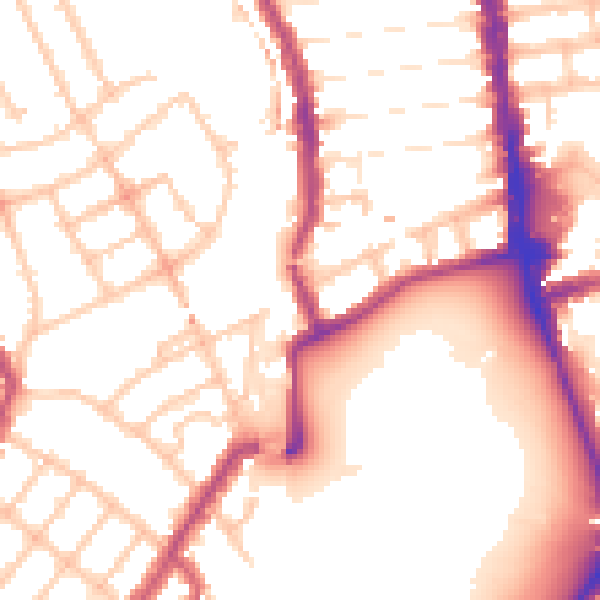
Daytime· 07:00 – 23:00
53.8dB

Night-time· 23:00 – 07:00
44.6dB