9 Baxendale, Barnet, London, N20 0EG
About 9 Baxendale
9 Baxendale is a mid-terrace house in Barnet, London, London (N20 0EG). It has a recorded floor area of 149 m² (around 1604 sq ft), construction records dating it to 1967-1975 and council tax band G. The latest certificate (September 2025) shows a D (score 60), on the cusp of jumping into the C band. The recommended improvements would push it to C (score 70).
Held since October 2005 — that's 21 years off the open market, well above the local norm. Across 2001–2005, sale prices on this property compounded at 9.5% per year. Today's modelled estimate of £1,019,000 sits 103.8% above the 2005 sale of £499,950. On a £-per-square-foot basis, the last sale (£312/sq ft) was about 31% below the postcode norm.
Everything you need to know about 9 Baxendale
The true value, the hidden risks and the full sale history, in one report.
30-day money-back guarantee

The data behind every report


Energy performance
9 Baxendale's carbon output runs well above what efficient homes in the postcode produce.
EPC Rating
Get a survey for this property
Level 3 Building Survey
Because the property has been extended more than once, we believe a Level 3 building survey should be considered.
From £1,645 · Includes VAT
Planning history
9 Baxendale has no planning applications on record.
Notable planning nearby
10applications of note in the surrounding area
We flagged 2 things worth checking at 9 Baxendale
Independent checks surfaced things a buyer would want to understand before offering. The report explains each one in full, with the underlying data and what to ask.
- Signs of HMO activity in the area
- Larger development activity nearby
30-day money-back guarantee
Sales history & valuation
9 Baxendale's estimated value is more than triple its earliest registered sale price (2001).
£1,019,000
Modelled from EPC, postcode comparables and a sale-price growth of 9.5% per year over 5 years.
£499,950
Growth on file: 9.5% per year over 5 years.
Sales timeline
13 October 2005Most recent
£499,950
+53.8%over 4 years19 January 2001
£325,000
Median price across the last 5 sales in N20 0EG: £850,000 (2024–2023).
Nearby sales in N20 0EG
Versus other Baxendale homes
9 Baxendale is notably below the street on price per m².
Price per m²
£3,355
Street avg £5,491
Floor Area
149 m²
Street avg 145 m²
Habitable Rooms
8 rooms
Street avg 6 rooms
CO₂ Emissions
6.3 t/year
Street avg 5.5 t/year
Everything you need to know about 9 Baxendale
The true value, the hidden risks and the full sale history, in one report.
30-day money-back guarantee
The data behind every report
Similar properties nearby
1 Baxendale, Barnet
N20 0EG
1 Church Way, Barnet
N20 0JN
1 Church Close, Barnet
N20 0JU
1 Ainsworth Close, Barnet
N20 0FA
1 Dannatt Close, Barnet
N20 0FR
1 Birley Road, Barnet
N20 0HB
1 Derwent Crescent, Barnet
N20 0QN
1 Bawtry Road, Barnet
N20 0SR
The neighbourhood at a glance
Rail-style transport is unusually close for this postcode.
Crime
4/mo
Rising year-on-year across the wider district.
Nearest stop
0.2 km
Whetstone High Road / Friern Barnet Lane — bus stop.
Closest school
0.2 km
St John's CofE Primary and Nursery School. 42 schools nearby.
Go deeper on the local area
The full report breaks down crime, transport links, schools and air quality in depth.
Road noise across the postcode
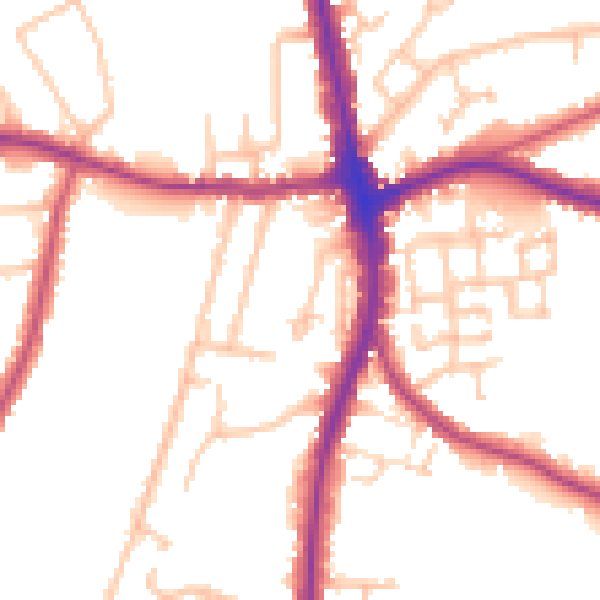
Daytime· 07:00 – 23:00
51.2dB

Night-time· 23:00 – 07:00
42.3dB