8 Baxendale, Barnet, London, N20 0EG
About 8 Baxendale
8 Baxendale is a four-bedroom end-of-terrace house in Barnet, London, London (N20 0EG). It has a recorded floor area of 111 m² (around 1195 sq ft), construction records dating it to 1976-1982 and council tax band G. The latest certificate (June 2023) shows a D (score 56), a step below the typical UK home. The recommended improvements would push it to C (score 76). Our model identifies extension potential, subject to local planning policy.
Today's modelled estimate of £852,000 is 20% above the 2024 sale price. On a £-per-square-foot basis, the last sale (£594/sq ft) was about 40.9% above the typical sold price in the postcode. At 111 m² it's 25% smaller than the typical home in the postcode (148 m² median across 21 EPCs). Last sale on file: £710,000 in June 2024.
What this property has
Inside
- Bedrooms4
- Bathrooms2
- EnsuiteYes
Outside
- Private gardenYes
- ParkingYes
Building
- Extension potentialPossible
Everything you need to know about 8 Baxendale
The true value, the hidden risks and the full sale history, in one report.
30-day money-back guarantee

The data behind every report


Energy performance
EPC Rating
Get a survey for this property
Level 2 HomeBuyer Report
We've checked 10 risk factors against the available data for this property and believe a Level 2 HomeBuyer Report could be a suitable option for you.
From £1,095 · Includes VAT
Planning history
8 Baxendale has no planning applications on record.
Notable planning nearby
10applications of note in the surrounding area
We flagged 2 things worth checking at 8 Baxendale
Independent checks surfaced things a buyer would want to understand before offering. The report explains each one in full, with the underlying data and what to ask.
- Signs of HMO activity in the area
- Larger development activity nearby
30-day money-back guarantee
Sales history & valuation
8 Baxendale valuation sits well clear of the typical sold price in this postcode.
£852,000
Modelled from EPC, postcode comparables.
£710,000
Recorded with HM Land Registry.
Sales timeline
6 June 2024Most recent
£710,000
Median price across the last 5 sales in N20 0EG: £850,000 (2024–2023).
Nearby sales in N20 0EG
Versus other Baxendale homes
On floor area, 8 Baxendale runs well behind the street norm.
Price per m²
£6,396
Street avg £5,301
Floor Area
111 m²
Street avg 147 m²
Habitable Rooms
6 rooms
Street avg 6 rooms
CO₂ Emissions
5.3 t/year
Street avg 5.5 t/year
Everything you need to know about 8 Baxendale
The true value, the hidden risks and the full sale history, in one report.
30-day money-back guarantee
The data behind every report
Similar properties nearby
1 Dannatt Close, Barnet
N20 0FR
1 Derwent Crescent, Barnet
N20 0QN
1 Church Way, Barnet
N20 0JN
1 Bawtry Road, Barnet
N20 0SR
1 Baxendale, Barnet
N20 0EG
1 Darcy Close, Barnet
N20 0LF
1 Ainsworth Close, Barnet
N20 0FA
1 Barfield Avenue, Barnet
N20 0BX
The neighbourhood at a glance
Rail-style transport is unusually close for this postcode.
Crime
4/mo
Rising year-on-year across the wider district.
Nearest stop
0.2 km
Whetstone High Road / Friern Barnet Lane — bus stop.
Closest school
0.2 km
St John's CofE Primary and Nursery School. 42 schools nearby.
Go deeper on the local area
The full report breaks down crime, transport links, schools and air quality in depth.
Road noise across the postcode
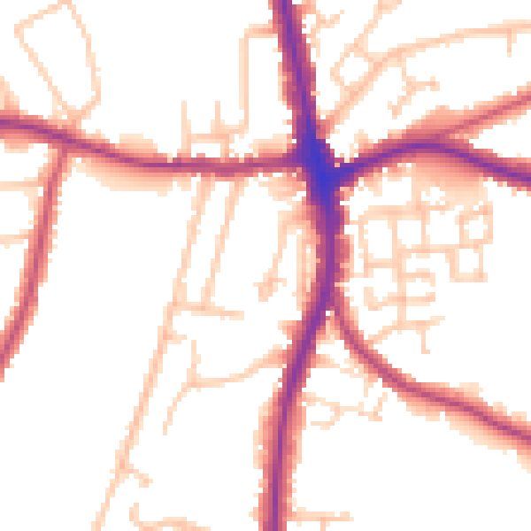
Daytime· 07:00 – 23:00
51.2dB

Night-time· 23:00 – 07:00
42.3dB