15 Passmore Gardens, Haringey, London, N11 2PE
About 15 Passmore Gardens
15 Passmore Gardens is a semi-detached house in Haringey, London, London (N11 2PE). It has a recorded floor area of 129 m² (around 1388 sq ft), construction records dating it to 1930-1949 and council tax band F. The latest certificate (February 2011) shows an E (score 40), well below the UK norm with real room to improve. The latest certificate is from February 2011, so improvements made since then won't be reflected.
Across 2006–2011, sale prices on this property compounded at 5.5% per year. Today's modelled estimate of £839,000 sits 50.6% above the 2011 sale of £557,000. It lags the bulk of the postcode on energy efficiency (less efficient than 78% of similar EPCs). Last sold in August 2011, so it's been off the market for around 15 years.
Everything you need to know about 15 Passmore Gardens
The true value, the hidden risks and the full sale history, in one report.
30-day money-back guarantee

The data behind every report


Energy performance
15 Passmore Gardens's carbon output runs well above what efficient homes in the postcode produce.
EPC Expired
This certificate is over 10 years old and is no longer valid.Expired 03 Feb 2021
EPC Rating
Planning history
15 Passmore Gardens has no planning applications on record.
Notable planning nearby
20applications of note in the surrounding area
We flagged 2 things worth checking at 15 Passmore Gardens
Independent checks surfaced things a buyer would want to understand before offering. The report explains each one in full, with the underlying data and what to ask.
- Signs of HMO activity in the area
- Larger development activity nearby
30-day money-back guarantee
Sales history & valuation
15 Passmore Gardens valuation sits well clear of the typical sold price in this postcode.
£839,000
Modelled from EPC, postcode comparables and a sale-price growth of 5.5% per year over 5 years.
£557,000
Growth on file: 5.5% per year over 5 years.
Sales timeline
9 August 2011Most recent
£557,000
+30.1%over 4 years24 August 2006
£428,000
Median price across the last 5 sales in N11 2PE: £710,000 (2024–2014).
Nearby sales in N11 2PE
23 Passmore Gardens, Haringey, London, N11 2PE
Sold Oct 2024
£1,080,0003 Passmore Gardens, Haringey, London, N11 2PE
Sold Mar 2023
£825,0001b, Passmore Gardens, Haringey, London, N11 2PE
Sold Nov 2015
£700,0001c, Passmore Gardens, Haringey, London, N11 2PE
Sold Sept 2015
£710,00011 Passmore Gardens, Haringey, London, N11 2PE
Sold Dec 2004
£400,000
Versus other Passmore Gardens homes
EPC Rating for 15 Passmore Gardens lags the street by a wide margin.
Price per m²
£4,321
Street avg £5,540
Floor Area
129 m²
Street avg 139 m²
Habitable Rooms
4 rooms
Street avg 6 rooms
CO₂ Emissions
9.5 t/year
Street avg 5.1 t/year
Everything you need to know about 15 Passmore Gardens
The true value, the hidden risks and the full sale history, in one report.
30-day money-back guarantee
The data behind every report
Similar properties nearby
1 Hastings Road, Enfield
N11 2RJ
1 Ollerton Road, Enfield
N11 2JY
1 Lancaster Road, Enfield
N11 2TB
1 Bosworth Road, Enfield
N11 2SY
1 Lower Maidstone Road, Enfield
N11 2RU
1 Passmore Gardens, Haringey
N11 2PE
1 Edith Road, Haringey
N11 2QW
1 Fletton Road, Haringey
N11 2QL
The neighbourhood at a glance
Rail-style transport is unusually close for this postcode.
Crime
5/mo
Rising year-on-year across the wider district.
Nearest stop
0.2 km
Warwick Road (N11) — bus stop.
Closest school
0.3 km
Bounds Green Junior School. 62 schools nearby.
Go deeper on the local area
The full report breaks down crime, transport links, schools and air quality in depth.
Road noise across the postcode
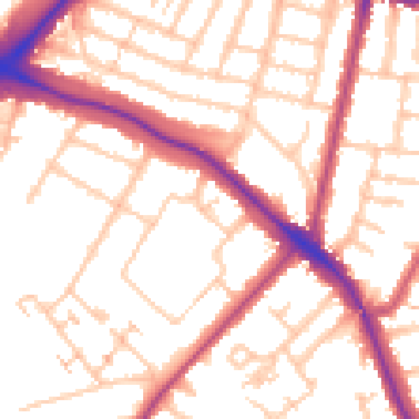
Daytime· 07:00 – 23:00
53.8dB

Night-time· 23:00 – 07:00
44.0dB