4 Sherbourne Drive, Strood, Rochester, ME2 3LX
About 4 Sherbourne Drive
4 Sherbourne Drive is a five-bedroom detached house in Strood, Rochester, Rochester (ME2 3LX). It has a recorded floor area of 172 m² (around 1851 sq ft), construction records dating it to 1983-1990 and council tax band F. The latest certificate (January 2016) shows a D (score 64), on the cusp of jumping into the C band. The recommended improvements would push it to C (score 75). The latest certificate is from January 2016, so improvements made since then won't be reflected.
5 planning records sit against the property, 3 approved, 1 refused. Past consents include an extension, meaningful when judging how the property has evolved. At 172 m² it's 28.4% larger than the typical home in the postcode (134 m² median across 3 EPCs). Across 1998–2017, sale prices on this property compounded at 11.9% per year. Today's modelled estimate of £679,000 is 19.1% above the 2017 sale price. On a £-per-square-foot basis, the last sale (£308/sq ft) was about 15.5% above the typical sold price in the postcode. Last sold in November 2017, so it's been off the market for around 9 years.
Know exactly what you're buying at 4 Sherbourne Drive
Before you offer, see what the listing won't tell you, the true value, the red flags and the full history.
Already flagged here
Valuation
against the asking price
Risks
planning & flood
Sold prices
similar homes nearby
Trends
the local market
What this property has
Inside
- Bedrooms5
Energy performance
4 Sherbourne Drive's carbon output runs well above what efficient homes in the postcode produce.
EPC Expired
This certificate is over 10 years old and is no longer valid.Expired 15 Jan 2026
EPC Rating
Planning history
4 Sherbourne Drive has been extended on multiple sides of the property across separate planning applications.
- Aug 2015ExtensionFullIn report
Extension: Single storey
Construction of a first floor side extension over existing garage with dormer windows to front and balcony to rear, first floor rear extension over existing and insertion of rooflight to rear
- Agent
- W.D.Evans Building Services
- Documents
- 12 docs on file
- Reference
- MC/15/1928
- Dec 2012ExtensionFullIn report
Extension: Single storey · Rear of property
Construction of a first floor extension including pitched roof and balcony to existing rear garage roof
- Agent
- W.D.Evans Building Services
- Documents
- 12 docs on file
- Reference
- MC/12/2328
We flagged 2 things worth checking at 4 Sherbourne Drive
Independent checks surfaced things a buyer would want to understand before offering. The report explains each one in full, with the underlying data and what to ask.
- Signs of HMO activity in the area
- Larger development activity nearby
30-day money-back guarantee
Sales history & valuation
Latest sale on 4 Sherbourne Drive was the highest on Land Registry record across the postcode.
£679,000
Modelled from EPC, postcode comparables and a sale-price growth of 11.9% per year over 19 years.
£570,000
Growth on file: 11.9% per year over 19 years.
Sales timeline
24 November 2017Most recent
£570,000
+776.9%over 19 years30 July 1998
£65,000
Median price across the last 5 sales in ME2 3LX: £510,000 (2021–2003).
Everything we know about 4 Sherbourne Drive, in one report
What it's really worth, what could be wrong, and the planning, sales and area data in full.
What we flagged
- Signs of HMO activity in the area
- Larger development activity nearby

Versus other Sherbourne Drive homes
Price per m² for 4 Sherbourne Drive lags the street by a wide margin.
Price per m²
£3,314
Street avg £3,834
Floor Area
172 m²
Street avg 138 m²
Habitable Rooms
9 rooms
Street avg 9 rooms
CO₂ Emissions
6.1 t/year
Street avg 4.3 t/year
Similar properties nearby
1 Brasted Court
ME2 3NE
1 Central Road
ME2 3HF
1 Bramley Rise
ME2 3SU
1 Dean Road, Strood
ME2 3QH
1 Allington Drive
ME2 3SR
1 Colewood Drive
ME2 3UE
1 Banning Street
ME2 3AG
1 Barnets Yard, West Street
ME2 3XG
The neighbourhood at a glance
Daytime road noise here sits well below conversation level — a quiet pocket of the postcode.
Crime
3/mo
Steady year-on-year across the wider district.
Nearest stop
0.2 km
Clarendon Drive — bus stop.
Closest school
0.4 km
Temple Mill Primary School. 18 schools nearby.
Go deeper on the local area
The full report breaks down crime, transport links, schools and air quality in depth.
Road noise across the postcode
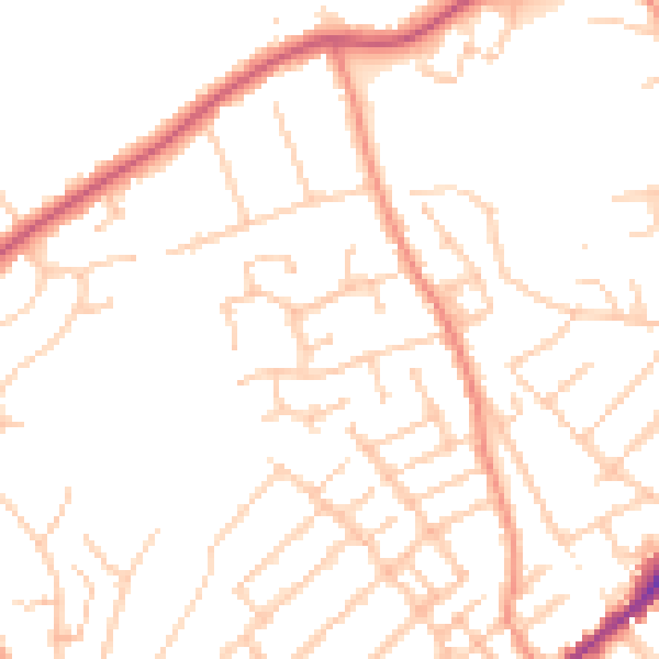
Daytime· 07:00 – 23:00
49.9dB

Night-time· 23:00 – 07:00
40.4dB