6 Chestnut Avenue, Worsley, Manchester, M28 7EE
About 6 Chestnut Avenue
6 Chestnut Avenue is a three-bedroom semi-detached house in Worsley, Manchester, Manchester (M28 7EE). It has a recorded floor area of 84 m² (around 904 sq ft), construction records dating it to 1930-1949 and council tax band A. The latest certificate (March 2021) shows a D (score 65), on the cusp of jumping into the C band. The recommended improvements would lift it to B (score 84), a 2-band jump. The home occupies a cul-de-sac position.
Today's modelled estimate of £221,000 sits 113.5% above the 2022 sale of £103,500. Most recent transfer: February 2022 at £103,500. That sale was during the post-pandemic price surge, when transactions cleared materially above pre-2020 trend. One historical planning record sits against the property in 2023.
What this property has
Inside
- Bedrooms3
- Bathrooms1
- CloakroomYes
Outside
- Private gardenYes
- DrivewayYes
- Cul-de-sacYes
Everything you need to know about 6 Chestnut Avenue
The true value, the hidden risks and the full sale history, in one report.
Pick your report · every report is £14.99
One time fee only - money back guarantee

The data behind every report


Energy performance
Recommended upgrades on file would lift this property by multiple EPC bands.
EPC Rating
Get a survey for this property
Level 2 HomeBuyer Report
We've checked 10 risk factors against the available data for this property and believe a Level 2 HomeBuyer Report could be a suitable option for you.
From £545 · Includes VAT
Planning history
1 application on record at 6 Chestnut Avenue, Worsley, Manchester, M28 7EE
- Jul 2023OutlineOutcome in report
Certificate of lawfulness for the proposed siting of a mobile home within the residential curtilage of a dwelling house, for purpose ancillary to the main use of the host dwellinghouse
- Documents
- 7 docs on file
- Reference
- 23/81661/CLUDP
Unlock 6 Chestnut Avenue, Worsley, Manchester, M28 7EE's full planning history
You're seeing the shape of it. The report has the substance.
- Every decision — granted, refused or withdrawn (1 on record)
- All 1 application on this property in full, plus 1 notable nearby
- The 7 documents, officer reports & conditions
- What the pattern means for extending or converting here
One time fee only - money back guarantee
Sales history & valuation
The latest sale landed in the post-pandemic price surge — useful context when reading the figure.
£221,000
Modelled from EPC, postcode comparables.
£103,500
Recorded with HM Land Registry.
Sales timeline
10 February 2022Most recent
£103,500
Median price across the last 5 sales in M28 7EE: £235,000 (2025–2021).
Nearby sales in M28 7EE
31 Chestnut Avenue, Worsley, Manchester, M28 7EE
Sold Nov 2025
£205,00035 Chestnut Avenue, Worsley, Manchester, M28 7EE
Sold Apr 2024
£252,00037 Chestnut Avenue, Worsley, Manchester, M28 7EE
Sold Aug 2023
£276,00027 Chestnut Avenue, Worsley, Manchester, M28 7EE
Sold Apr 2022
£235,00013 Chestnut Avenue, Worsley, Manchester, M28 7EE
Sold Aug 2021
£230,750
Versus other Chestnut Avenue homes
Floor Area for 6 Chestnut Avenue lags the street by a wide margin.
Price per m²
£1,232
Street avg £2,043
Floor Area
84 m²
Street avg 95 m²
Habitable Rooms
5 rooms
Street avg 5 rooms
CO₂ Emissions
3.8 t/year
Street avg 3.8 t/year
Everything you need to know about 6 Chestnut Avenue
The true value, the hidden risks and the full sale history, in one report.
Pick your report · every report is £14.99
One time fee only - money back guarantee
The data behind every report
Similar properties nearby
1 Claughton Avenue, Worsley
M28 7UB
1 Ash Grove, Worsley
M28 7EH
1 Beck Grove, Worsley
M28 7JH
1 Chiltern Close, Worsley
M28 7FS
1 Edge Green, Worsley
M28 7XP
1 Bedford Avenue, Worsley
M28 7GG
1 Bunting Mews, Worsley
M28 7XG
1 Carlton Close, Worsley
M28 7TX
The neighbourhood at a glance
Rail-style transport is unusually close for this postcode.
Nearest stop
0.1 km
Lime Grove — bus stop.
Closest school
0.4 km
Christ The King RC Primary School. 30 schools nearby.
Go deeper on the local area
A Local Area report breaks down crime, transport links, schools and air quality in depth.
Road noise across the postcode
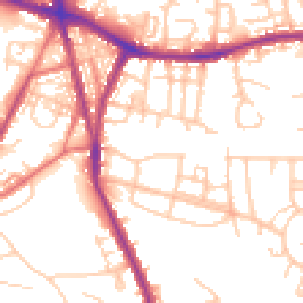
Daytime· 07:00 – 23:00
54.3dB

Night-time· 23:00 – 07:00
46.2dB