1 Chenille Close, Worsley, Manchester, M28 3ZL
About 1 Chenille Close
1 Chenille Close is a detached house in Worsley, Manchester, Manchester (M28 3ZL). It has a recorded floor area of 109 m² (around 1173 sq ft). The latest certificate (September 2019) returns a B (score 83), comfortably above the UK average. The recommended improvements would push it to A (score 93).
Today's modelled estimate of £381,000 is 31.4% above the 2019 sale price. Most recent transfer: September 2019 at £289,995.
Everything you need to know about 1 Chenille Close
The true value, the hidden risks and the full sale history, in one report.
Pick your report · every report is £14.99
One time fee only - money back guarantee

The data behind every report


Energy performance
EPC Rating
Get a survey for this property
Level 2 HomeBuyer Report
We've checked 10 risk factors against the available data for this property and believe a Level 2 HomeBuyer Report could be a suitable option for you.
From £595 · Includes VAT
Planning history
1 Chenille Close has no planning applications on record.
But the area is active
15 notable applications nearby — larger schemes and conversions that could reshape the street. The report maps them all.
Sales history & valuation
1 Chenille Close valuation sits well clear of the typical sold price in this postcode.
£381,000
Modelled from EPC, postcode comparables.
£289,995
Recorded with HM Land Registry.
Sales timeline
29 September 2019Most recent
£289,995
Median price across the last 5 sales in M28 3ZL: £298,000 (2025–2021).
Nearby sales in M28 3ZL
7 Chenille Close, Worsley, Manchester, M28 3ZL
Sold Jul 2025
£381,0008 Chenille Close, Worsley, Manchester, M28 3ZL
Sold May 2025
£270,0005 Chenille Close, Worsley, Manchester, M28 3ZL
Sold Aug 2023
£298,0006 Chenille Close, Worsley, Manchester, M28 3ZL
Sold May 2021
£256,00011 Chenille Close, Worsley, Manchester, M28 3ZL
Sold Mar 2021
£329,995
Versus other Chenille Close homes
EPC Rating for 1 Chenille Close lags the street by a wide margin.
Price per m²
£2,661
Street avg £2,874
Floor Area
109 m²
Street avg 96 m²
CO₂ Emissions
1.8 t/year
Street avg 1.5 t/year
Years Held
7 years
Street avg 5 years
Everything you need to know about 1 Chenille Close
The true value, the hidden risks and the full sale history, in one report.
Pick your report · every report is £14.99
One time fee only - money back guarantee
The data behind every report
Similar properties nearby
1 Church Road, Worsley
M28 3LW
1 Bullbridge View, Worsley
M28 3YB
1 Coral Road, Worsley
M28 3YH
1 Avoncliffe Road, Worsley
M28 3UJ
1 Bonnington Close, Worsley
M28 3UP
1 Bryony Close, Worsley
M28 3GR
1 Collyhurst Avenue, Worsley
M28 3DJ
1 Chirk Lane, Worsley
M28 3UN
The neighbourhood at a glance
Nearest stop
0.1 km
Norfolk Street — bus stop.
Closest school
0.4 km
North Walkden Primary School. 39 schools nearby.
Go deeper on the local area
A Local Area report breaks down crime, transport links, schools and air quality in depth.
Road noise across the postcode
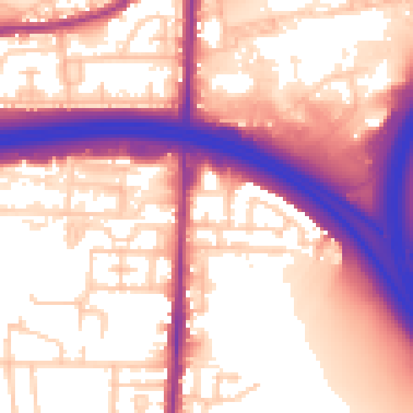
Daytime· 07:00 – 23:00
59.3dB
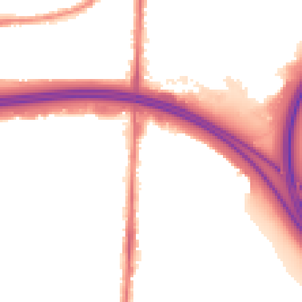
Night-time· 23:00 – 07:00
51.7dB