9 Burnbray Avenue, Manchester, M19 1DA
About 9 Burnbray Avenue
9 Burnbray Avenue is a semi-detached house in Manchester (M19 1DA). It has a recorded floor area of 90 m² (around 969 sq ft), construction records dating it to 1930-1949 and council tax band A. The latest certificate (August 2020) shows a C (score 69), just inside the C band. When first surveyed in October 2013 the rating was D, the property has climbed 1 band since. Between certificates, window efficiency went from Average to Good; while wall efficiency dropped from Good to Average and roof efficiency dropped from Good to Very Poor.
At 90 m² it's 19.2% larger than the typical home in the postcode (76 m² median across 6 EPCs). Today's modelled estimate of £276,000 is 22.7% above the 2021 sale price. Most recent transfer: May 2021 at £225,000. That sale was during the post-pandemic price surge, when transactions cleared materially above pre-2020 trend.
Know exactly what you're buying at 9 Burnbray Avenue
Before you offer, see what the listing won't tell you, the true value, the red flags and the full history.
Already flagged here
Valuation
against the asking price
Risks
planning & flood
Sold prices
similar homes nearby
Trends
the local market
Energy performance
EPC Rating
Property Improvements
Changes detected from historical EPC data
Window efficiency improved
Low energy lighting percentage decreased
Planning history
9 Burnbray Avenue has no planning applications on record.
Notable planning nearby
3applications of note in the surrounding area
We flagged 1 thing worth checking at 9 Burnbray Avenue
Independent checks surfaced things a buyer would want to understand before offering. The report explains each one in full, with the underlying data and what to ask.
- Larger development activity nearby
30-day money-back guarantee
Sales history & valuation
The latest sale landed in the post-pandemic price surge — useful context when reading the figure.
£276,000
Modelled from EPC, postcode comparables.
£225,000
Recorded with HM Land Registry.
Sales timeline
20 May 2021Most recent
£225,000
Median price across the last 1 sales in M19 1DA: £192,000 (2019–2019).
Nearby sales in M19 1DA
Everything we know about 9 Burnbray Avenue, in one report
What it's really worth, what could be wrong, and the planning, sales and area data in full.
What we flagged
- Larger development activity nearby

Versus other Burnbray Avenue homes
On co₂ emissions, 9 Burnbray Avenue runs well behind the street norm.
EPC Rating
69 (C)
Street avg 70 (C)
Floor Area
90 m²
Street avg 79 m²
CO₂ Emissions
3.8 t/year
Street avg 2.6 t/year
Habitable Rooms
5 rooms
Street avg 5 rooms
Similar properties nearby
The neighbourhood at a glance
Rail-style transport is unusually close for this postcode.
Nearest stop
0.1 km
Mauldeth Road Rail Station — railway station.
Closest school
0.3 km
Mauldeth Road Primary School. 51 schools nearby.
Go deeper on the local area
The full report breaks down crime, transport links, schools and air quality in depth.
Road noise across the postcode
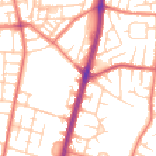
Daytime· 07:00 – 23:00
52.6dB

Night-time· 23:00 – 07:00
41.5dB