6 Drayton Street, Manchester, M15 5LL
About 6 Drayton Street
6 Drayton Street is a four-bedroom mid-terrace house in Manchester (M15 5LL). It has a recorded floor area of 102 m² (around 1098 sq ft), construction records dating it to 2003-2006 and council tax band C. The latest certificate (May 2024) shows a C (score 76), near the top of the C band. The rating has held steady at C across 3 certificates since February 2009. Between certificates, lighting went from Good to Very Good; while hot-water efficiency dropped from Very Good to Good and main heating dropped from Very Good to Good. The recommended improvements would push it to B (score 87).
Untraded for 21 years, with the last transfer in January 2005. Today's modelled estimate of £307,000 sits 71.6% above the 2005 sale of £178,950. On a £-per-square-foot basis, the last sale (£163/sq ft) was about 15.5% below the postcode norm. At 102 m² it's 27.5% larger than the typical home in the postcode (80 m² median across 60 EPCs).
What this property has
Inside
- Bedrooms4
- Bathrooms3
Outside
- Private gardenYes
- DrivewayYes
Building
- Heating systemGas
- RefurbishedYes
Everything you need to know about 6 Drayton Street
The true value, the hidden risks and the full sale history, in one report.
30-day money-back guarantee

The data behind every report


Energy performance
EPC Rating
Property Improvements
Changes detected from historical EPC data
Hot water efficiency decreased
More low energy lighting installed
Ventilation system changed
Planning history
6 Drayton Street has no planning applications on record.
The full report still covers planning activity across the surrounding area.
Sales history & valuation
6 Drayton Street valuation sits well clear of the typical sold price in this postcode.
£307,000
Modelled from EPC, postcode comparables.
£178,950
Recorded with HM Land Registry.
Sales timeline
28 January 2005Most recent
£178,950
Median price across the last 5 sales in M15 5LL: £185,000 (2025–2022).
Nearby sales in M15 5LL
Versus other Drayton Street homes
6 Drayton Street outperforms the street on years held by a wide margin.
Price per m²
£1,754
Street avg £2,189
Floor Area
102 m²
Street avg 98 m²
Habitable Rooms
4 rooms
Street avg 5 rooms
CO₂ Emissions
2.6 t/year
Street avg 2.7 t/year
Everything you need to know about 6 Drayton Street
The true value, the hidden risks and the full sale history, in one report.
30-day money-back guarantee
The data behind every report
Similar properties nearby
The neighbourhood at a glance
Crime
1/mo
Steady year-on-year across the wider district.
Nearest stop
0.1 km
Yew Street — bus stop.
Closest school
0.2 km
Loreto College. 45 schools nearby.
Go deeper on the local area
The full report breaks down crime, transport links, schools and air quality in depth.
Road noise across the postcode
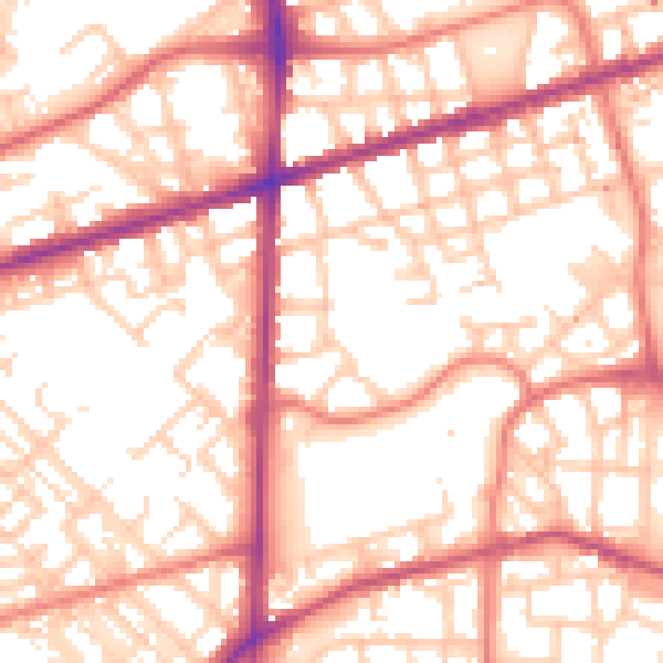
Daytime· 07:00 – 23:00
55.8dB

Night-time· 23:00 – 07:00
45.4dB