51 Drayton Street, Manchester, M15 5LL
About 51 Drayton Street
51 Drayton Street is a two-bedroom detached house in Manchester (M15 5LL). It has a recorded floor area of 61 m² (around 657 sq ft), construction records dating it to 2003-2006 and council tax band B. The latest certificate (April 2021) shows a C (score 78), near the top of the C band. Earlier certificates rated it B (September 2010); the latest reading is one band lower. Between certificates, hot-water efficiency dropped from Very Good to Good and main heating dropped from Very Good to Good. At 61 m² this is the 4th smallest of 61 units on EPC record in the building, where floor areas span 53–142 m². The building's EPC ratings span D to B across 61 units on file.
Today's modelled estimate of £173,000 is 16.9% above the 2024 sale price. On a £-per-square-foot basis, the last sale (£225/sq ft) was about 17.1% above the typical sold price in the postcode. At 61 m² it's 24.7% smaller than the typical home in the postcode (81 m² median across 60 EPCs). Sold November 2024 for £148,000.
What this property has
Inside
- Bedrooms2
- Bathrooms2
Everything you need to know about 51 Drayton Street
The true value, the hidden risks and the full sale history, in one report.
30-day money-back guarantee

The data behind every report


Energy performance
51 Drayton Street's carbon output is low for the local stock.
EPC Rating
Planning history
51 Drayton Street has no planning applications on record.
The full report still covers planning activity across the surrounding area.
Sales history & valuation
51 Drayton Street's sale-price growth has lagged the wider UK trajectory across its history on file.
£173,000
Modelled from EPC, postcode comparables and a sale-price growth of 0.3% per year over 19 years.
£148,000
Growth on file: 0.3% per year over 19 years.
Sales timeline
12 November 2024Most recent
£148,000
+6.5%over 18 years17 November 2005
£138,950
Median price across the last 5 sales in M15 5LL: £265,000 (2025–2022).
Nearby sales in M15 5LL
Versus other Drayton Street homes
51 Drayton Street is notably below the street on years held.
Price per m²
£2,426
Street avg £2,083
Floor Area
61 m²
Street avg 66 m²
Habitable Rooms
3 rooms
Street avg 3 rooms
CO₂ Emissions
1.5 t/year
Street avg 1.5 t/year
Everything you need to know about 51 Drayton Street
The true value, the hidden risks and the full sale history, in one report.
30-day money-back guarantee
The data behind every report
Similar properties nearby
The neighbourhood at a glance
Crime
1/mo
Steady year-on-year across the wider district.
Nearest stop
0.1 km
Yew Street — bus stop.
Closest school
0.2 km
Loreto College. 45 schools nearby.
Go deeper on the local area
The full report breaks down crime, transport links, schools and air quality in depth.
Road noise across the postcode
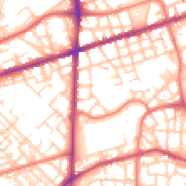
Daytime· 07:00 – 23:00
55.8dB

Night-time· 23:00 – 07:00
45.4dB