46 48, Flat 3, West Street, Dunstable, LU6 1TA
About 46 48
46 48 is a property in Dunstable (LU6 1TA). It has a recorded floor area of 58 m² (around 624 sq ft). At 58 m² this is the largest unit on EPC record across 46 48 (34–58 m²). The latest certificate (January 2015) shows a C (score 76), near the top of the C band. The latest certificate is from January 2015, so improvements made since then won't be reflected.
At 58 m² it's 19.6% larger than the typical home in the postcode (49 m² median across 20 EPCs). Its energy rating outperforms most of the postcode (better than 75% of similar EPCs). 2 planning records sit against the property, 2 approved, 0 refused.
Everything you need to know about 46 48
The true value, the hidden risks and the full sale history, in one report.
30-day money-back guarantee

The data behind every report


Energy performance
46 48's EPC is over a decade old — improvements since won't be reflected.
EPC Expired
This certificate is over 10 years old and is no longer valid.Expired 06 Jan 2025
EPC Rating
Planning history
- Mar 2014ConditionsIn report
Variation of Condition 5 To reflect minor amendments to scheme, off application 12/1386.
- Reference
- CB/14/00053/VOC
- Mar 2014
We flagged 2 things worth checking at 46 48
Independent checks surfaced things a buyer would want to understand before offering. The report explains each one in full, with the underlying data and what to ask.
- Signs of HMO activity in the area
- Larger development activity nearby
30-day money-back guarantee
Sales history & valuation
46 48 has no Land Registry sales on file, suggesting it has stayed in the same hands since registration began.
£197,000
Modelled from EPC, postcode comparables.
No sales recorded with HM Land Registry
That can mean the property has never traded since the registry began publishing in 1995, was a new build that hasn't been registered yet, or is held in the same hands long-term.
Median price across the last 5 sales in LU6 1TA: £340,000 (2024–2020).
Nearby sales in LU6 1TA
Versus other West Street homes
On epc rating, 46 48 stands well clear of the street.
EPC Rating
76 (C)
Street avg 60 (D)
Floor Area
58 m²
Street avg 49 m²
CO₂ Emissions
1.7 t/year
Street avg 2.7 t/year
Everything you need to know about 46 48
The true value, the hidden risks and the full sale history, in one report.
30-day money-back guarantee
The data behind every report
Similar properties nearby
3 5, Flat 4, High Street North
LU6 1HX
3 5, Flat 1, High Street North
LU6 1HX
3 5, Flat 2, High Street North
LU6 1HX
3 5, Flat 3, High Street North
LU6 1HX
169a, Flat, West Street
LU6 1PD
43 45, Flat 3, High Street North
LU6 1JE
116a, Flat, High Street North
LU6 1LN
62 68, Flat 3, West Street
LU6 1TA
The neighbourhood at a glance
Crime
3/mo
Steady year-on-year across the wider district.
Nearest stop
0.1 km
West Street — bus stop.
Closest school
0.2 km
Dunstable Icknield Lower School. 24 schools nearby.
Go deeper on the local area
The full report breaks down crime, transport links, schools and air quality in depth.
Road noise across the postcode
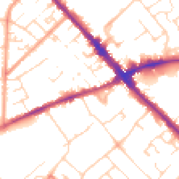
Daytime· 07:00 – 23:00
51.5dB

Night-time· 23:00 – 07:00
41.4dB