Are you a property professional?Get qualified leads from motivated homeowners.
Get started1 Kirby Lane, Kirby Muxloe, Leicester, LE9 2JG
1 planning record
About 1 Kirby Lane
A plain-English summary derived from public records, EPC certificates, sold prices and local data.
1 Kirby Lane is a four-bedroom detached house in Kirby Muxloe, Leicester, Leicester (LE9 2JG). It has a recorded floor area of 198 m² (around 2131 sq ft), construction records dating it to 1900-1929 and council tax band F. The latest certificate (October 2014) shows a D (score 57), a step below the typical UK home. The recommended improvements would push it to C (score 77). The latest certificate is from October 2014, so improvements made since then won't be reflected. Period features are noted in the property record. The home occupies a cul-de-sac position.
At 198 m² the property is well over the postcode median (118 m² across 31 EPCs), placing it in the larger end of the local stock. One planning record on file: tree works approved in 2017. Past consents include tree works, meaningful when judging how the property has evolved. Today's modelled estimate of £644,000 is 34.2% above the 2015 sale price. On a £-per-square-foot basis, the last sale (£225/sq ft) was about 18.3% above the typical sold price in the postcode. Last changed hands 11 years ago, in January 2015.
What this property has
Pulled from EPC certificates, claim submissions and our property model. Empty categories are hidden — we only show what's known.
Inside
- Bedrooms4
- Dining roomYes
- EnsuiteYes
Outside
- Private garden
Energy performance
Every EPC certificate filed against this property — current rating, recorded improvements, and where there's headroom to reach a higher band.
1 Kirby Lane's carbon output runs well above what efficient homes in the postcode produce.
EPC Expired
This certificate is over 10 years old and is no longer valid.Expired 08 Oct 2024
Planning history
Applications and permits filed against 1 Kirby Lane, Kirby Muxloe, Leicester, LE9 2JG, sourced from the PlanIt planning register.
- Jun 2017Tree WorksTreesGranted
to carry out works to a group of yew trees
Sales history & valuation
Recorded transactions, our model's current estimate, and a quick read on what neighbouring properties have sold for.
1 Kirby Lane valuation sits well clear of the typical sold price in this postcode.
Current estimate
See how we calculated this£644,000
Modelled from EPC, postcode comparables.
Last sold (2015)
£480,000
Recorded with HM Land Registry.
Sales timeline
Versus other Kirby Lane homes
Four headline reads against 24 similar houses on this street, drawn from the latest EPC and Land Registry data.
Floor Area for 1 Kirby Lane runs comfortably ahead of the street norm.
Price per m²
£2,424
Street avg £2,763
Floor Area
198 m²
Street avg 140 m²
Habitable Rooms
8 rooms
Similar properties nearby
A handful of close matches in the same postcode area, ranked by likeness on bedrooms, type and floor area.
The neighbourhood at a glance
A condensed read of the local area. Each tile links through to the full breakdown on the Leicester district page.
Crime
3/mo
Steady year-on-year across the wider district.
Nearest stop
0.1 km
Forest Drive — bus stop.
Road noise across the postcode
Modelled day and night-time noise levels around LE9 2JG from Defra's strategic mapping. The pin marks this postcode's centroid.
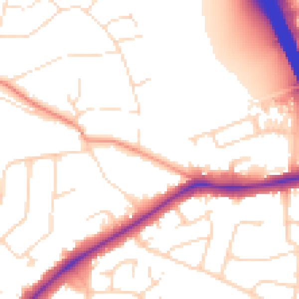
Daytime· 07:00 – 23:00
53.0dB

Everything within walking distance
Schools, transport stops and scenic spots near this property — 39 points of interest in total.
Beautiful places to visit nearby
Curated scenic spots within reach of this postcode, served by Beautifulplaces.ai. Photography and tagging come from their open dataset.
Common questions
The questions buyers, sellers and homeowners most often ask about 1 Kirby Lane, Kirby Muxloe, Leicester, LE9 2JG. Each answer is also embedded as structured data for search engines.