9 The Copse, Bushby, Leicester, LE7 9RW
About 9 The Copse
9 The Copse is a five-bedroom detached house in Bushby, Leicester, Leicester (LE7 9RW). It has a recorded floor area of 264 m² (around 2842 sq ft), construction records dating it to 2003-2006 and council tax band G. The latest certificate (February 2024) shows a C (score 78), near the top of the C band. The rating has held steady at C across 2 certificates since November 2013. Between certificates, lighting went from Average to Very Good. The recommended improvements would push it to B (score 82).
3 planning records sit against the property, 3 approved, 0 refused. Past consents include tree works and an extension, meaningful when judging how the property has evolved. At 264 m² it's 18.4% larger than the typical home in the postcode (223 m² median across 4 EPCs). 5 bedrooms is on the larger side for this postcode, where 3 is the typical count. Across 2003–2017, sale prices on this property compounded at 2.8% per year. On a £-per-square-foot basis, the last sale (£245/sq ft) was about 18.7% above the typical sold price in the postcode. Last changed hands 9 years ago, in September 2017.
Know exactly what you're buying at 9 The Copse
Before you offer, see what the listing won't tell you, the true value, the red flags and the full history.
Valuation
against the asking price
Risks
planning & flood
Sold prices
similar homes nearby
Trends
the local market
What this property has
Inside
- Bedrooms5
- Bathrooms3
- Dining roomYes
- Utility roomYes
- CloakroomYes
- EnsuiteYes
- StudyYes
Outside
- Private gardenYes
- GarageDouble
Building
- Heating systemGas
Energy performance
EPC Rating
Property Improvements
Changes detected from historical EPC data
More low energy lighting installed
Planning history
9 The Copse has an approved single-storey side extension on the planning record.
- Nov 2013Tree WorksTreesIn report
Works to one Holly (fell), one Lawson's Cypress (reshape), and four Large Leaved Lime trees (raise canopies) (HDC TPO No 142)
- Documents
- 6 docs on file
- Reference
- 13/01419/TPO
- Oct 2013Tree WorksTreesIn report
Five Day Notice - Removal of Silver Birch
- Documents
- 2 docs on file
- Reference
- 13/01495/DDD
What's in 9 The Copse, Bushby, Leicester, LE7 9RW's planning history?
1 more on this property, plus refusals, disputes and full decisions nearby, in the report.
Sales history & valuation
9 The Copse valuation sits well clear of the typical sold price in this postcode.
£760,000
Modelled from EPC, postcode comparables and a sale-price growth of 2.8% per year over 14 years.
£695,000
Growth on file: 2.8% per year over 14 years.
Sales timeline
7 September 2017Most recent
£695,000
+46.3%over 13 years18 December 2003
£475,000
Median price across the last 5 sales in LE7 9RW: £690,000 (2022–2010).
Nearby sales in LE7 9RW
6 The Copse, Bushby, Leicester, LE7 9RW
Sold May 2022
£870,0002 The Copse, Bushby, Leicester, LE7 9RW
Sold Apr 2021
£695,0008 The Copse, Bushby, Leicester, LE7 9RW
Sold Nov 2020
£690,0003 The Copse, Bushby, Leicester, LE7 9RW
Sold Oct 2011
£468,0004 The Copse, Bushby, Leicester, LE7 9RW
Sold May 2004
£537,500
Everything we know about 9 The Copse, in one report
What it's really worth, what could be wrong, and the planning, sales and area data in full.
- Am I paying too much?
- Is something wrong with it?
- Is the agent's story true?
- Will it hold its value?

Versus other The Copse homes
On floor area, 9 The Copse stands well clear of the street.
Price per m²
£2,633
Street avg £3,044
Floor Area
264 m²
Street avg 223 m²
Habitable Rooms
10 rooms
Street avg 9 rooms
CO₂ Emissions
5.9 t/year
Street avg 6.7 t/year
Similar properties nearby
1 Chapel Close, Houghton On The Hill
LE7 9HT
1 Back Lane, Gaulby
LE7 9LP
1 Bennion Road, Bushby
LE7 9QF
1 Chestnut Drive, Bushby
LE7 9RB
1 Cedar Cottages, Rolleston Road, Skeffington
LE7 9YD
1 Angus Close, Thurnby
LE7 9QG
1 Charnwood Drive, Thurnby
LE7 9PD
1 Bert Cole Lane, Scraptoft
LE7 9YL
The neighbourhood at a glance
Daytime road noise here sits well below conversation level — a quiet pocket of the postcode.
Crime
2/mo
Steady year-on-year across the wider district.
Nearest stop
0.2 km
Main Street — bus stop.
Closest school
0.7 km
Thurnby, St Luke's Church of England Primary School. 13 schools nearby.
Go deeper on the local area
The full report breaks down crime, transport links, schools and air quality in depth.
Road noise across the postcode
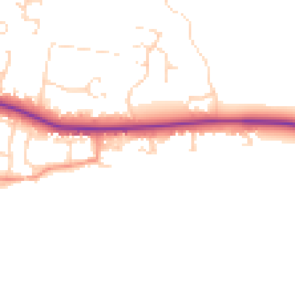
Daytime· 07:00 – 23:00
46.4dB

Night-time· 23:00 – 07:00
39.6dB