16 Church Lane, Anstey, Leicester, LE7 7AF
About 16 Church Lane
16 Church Lane is a three-bedroom mid-terrace house in Anstey, Leicester, Leicester (LE7 7AF). It has a recorded floor area of 96 m² (around 1033 sq ft), construction records dating it to 1976-1982 and council tax band B. Tenure is freehold. The latest certificate (June 2015) shows a D (score 55), a step below the typical UK home. When first surveyed in August 2011 the rating was E, the property has climbed 1 band since. Between certificates, lighting dropped from Poor to Very Poor. The recommended improvements would lift it to B (score 83), a 2-band jump. The latest certificate is from June 2015, so improvements made since then won't be reflected.
At 96 m² the property is well over the postcode median (57 m² across 37 EPCs), placing it in the larger end of the local stock. Across 2011–2018, sale prices on this property compounded at 2.9% per year. Today's modelled estimate of £247,000 is 34.2% above the 2018 sale price. On a £-per-square-foot basis, the last sale (£178/sq ft) was about 23.8% above the typical sold price in the postcode. On the market in May 2018 and unlisted since — roughly 8 years.
Know exactly what you're buying at 16 Church Lane
Before you offer, see what the listing won't tell you, the true value, the red flags and the full history.
Already flagged here
Valuation
against the asking price
Risks
planning & flood
Sold prices
similar homes nearby
Trends
the local market
What this property has
Inside
- Bedrooms3
- Bathrooms2
- Dining roomYes
Outside
- Private gardenYes
- ParkingOff road
Building
- TenureFreehold
Energy performance
Recommended upgrades on file would lift this property by multiple EPC bands.
EPC Expired
This certificate is over 10 years old and is no longer valid.Expired 29 Jun 2025
EPC Rating
Property Improvements
Changes detected from historical EPC data
Heating controls changed
Hot water system upgraded
Windows upgraded, improving insulation
Planning history
16 Church Lane has no planning applications on record.
Notable planning nearby
5applications of note in the surrounding area
We flagged 1 thing worth checking at 16 Church Lane
Independent checks surfaced things a buyer would want to understand before offering. The report explains each one in full, with the underlying data and what to ask.
- Larger development activity nearby
30-day money-back guarantee
Sales history & valuation
16 Church Lane saw 3 transfers in just over a decade — high turnover for the postcode.
£247,000
Modelled from EPC, postcode comparables and a sale-price growth of 2.9% per year over 7 years.
£184,000
Growth on file: 2.9% per year over 7 years.
Sales timeline
23 May 2018Most recent
£184,000
+13.9%over 2 years14 December 2015
£161,500
+5.6%over 4 years4 November 2011
£152,950
Median price across the last 5 sales in LE7 7AF: £185,000 (2022–2019).
Nearby sales in LE7 7AF
49 Church Lane, Anstey, Leicester, LE7 7AF
Sold Oct 2022
£205,50069 Church Lane, Anstey, Leicester, LE7 7AF
Sold Oct 2021
£185,00065 Church Lane, Anstey, Leicester, LE7 7AF
Sold Nov 2020
£185,00051 Church Lane, Anstey, Leicester, LE7 7AF
Sold Jun 2020
£162,50067 Church Lane, Anstey, Leicester, LE7 7AF
Sold Jul 2018
£140,000
Everything we know about 16 Church Lane, in one report
What it's really worth, what could be wrong, and the planning, sales and area data in full.
What we flagged
- Larger development activity nearby

Versus other Church Lane homes
CO₂ Emissions for 16 Church Lane lags the street by a wide margin.
Price per m²
£1,917
Street avg £2,019
Floor Area
96 m²
Street avg 81 m²
Habitable Rooms
5 rooms
Street avg 4 rooms
CO₂ Emissions
5.5 t/year
Street avg 4.2 t/year
Similar properties nearby
1 Bates Hollow, Rothley
LE7 7RT
1 Birkdale Road, Anstey
LE7 7DF
1 Burrow Drive, Rothley
LE7 7RZ
1 Badgers Bank, Rothley
LE7 7PH
1 Broughton Close, Anstey
LE7 7EU
1 Brownhill Crescent, Rothley
LE7 7LA
1 Alvis Dale, Rothley
LE7 7QH
1 Anstige Avenue, Anstey
LE7 7TP
The neighbourhood at a glance
Crime
2/mo
Steady year-on-year across the wider district.
Nearest stop
0.1 km
Paper Mill Close — bus stop.
Closest school
0.2 km
The Latimer Primary School. 15 schools nearby.
Go deeper on the local area
The full report breaks down crime, transport links, schools and air quality in depth.
Road noise across the postcode
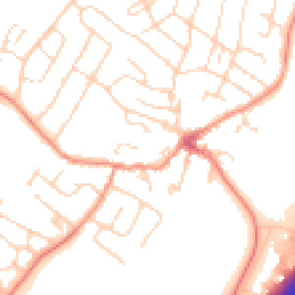
Daytime· 07:00 – 23:00
51.3dB

Night-time· 23:00 – 07:00
41.5dB