18 Heathbrook Drive, Ratby, Leicester, LE6 0XB
About 18 Heathbrook Drive
18 Heathbrook Drive is a semi-detached house in Ratby, Leicester, Leicester (LE6 0XB). It has a recorded floor area of 71 m² (around 764 sq ft), construction records dating it to 1983-1990 and council tax band B. The latest certificate (September 2013) shows a C (score 71). The recommended improvements would push it to B (score 89). The latest certificate is from September 2013, so improvements made since then won't be reflected.
Untraded for 23 years, with the last transfer in April 2003. Across 1999–2003, sale prices on this property compounded at 18.3% per year. Today's modelled estimate of £239,000 sits 143.9% above the 2003 sale of £98,000. On a £-per-square-foot basis, the last sale (£128/sq ft) was about 19.3% below the postcode norm. At 71 m² it's 23.7% smaller than the typical home in the postcode (93 m² median across 16 EPCs).
Everything you need to know about 18 Heathbrook Drive
The true value, the hidden risks and the full sale history, in one report.
30-day money-back guarantee

The data behind every report


Energy performance
18 Heathbrook Drive's EPC is over a decade old — improvements since won't be reflected.
EPC Expired
This certificate is over 10 years old and is no longer valid.Expired 04 Sept 2023
EPC Rating
Planning history
18 Heathbrook Drive has no planning applications on record.
The full report still covers planning activity across the surrounding area.
Sales history & valuation
Sale price has at least doubled since 1999.
£239,000
Modelled from EPC, postcode comparables and a sale-price growth of 18.3% per year over 4 years.
£98,000
Growth on file: 18.3% per year over 4 years.
Sales timeline
27 April 2003Most recent
£98,000
+63.5%over 2 years9 April 2001
£59,950
+22.3%over 2 years12 March 1999
£49,000
Median price across the last 5 sales in LE6 0XB: £290,000 (2023–2022).
Nearby sales in LE6 0XB
17 Heathbrook Drive, Ratby, Leicester, LE6 0XB
Sold Aug 2023
£267,00027 Heathbrook Drive, Ratby, Leicester, LE6 0XB
Sold Jun 2023
£287,50031 Heathbrook Drive, Ratby, Leicester, LE6 0XB
Sold Dec 2022
£385,0008 Heathbrook Drive, Ratby, Leicester, LE6 0XB
Sold Oct 2022
£290,00010 Heathbrook Drive, Ratby, Leicester, LE6 0XB
Sold Mar 2022
£445,000
Versus other Heathbrook Drive homes
18 Heathbrook Drive outperforms the street on co₂ emissions by a wide margin.
Price per m²
£1,380
Street avg £2,447
Floor Area
71 m²
Street avg 91 m²
Habitable Rooms
5 rooms
Street avg 5 rooms
CO₂ Emissions
2.4 t/year
Street avg 3.3 t/year
Everything you need to know about 18 Heathbrook Drive
The true value, the hidden risks and the full sale history, in one report.
30-day money-back guarantee
The data behind every report
Similar properties nearby
1 Bumblebee Close, Ratby
LE6 0PB
1 Ash Court, Groby
LE6 0EH
1 Brookvale Cottages, Ratby Road, Groby
LE6 0BS
1 Branting Hill, Groby
LE6 0DB
1 Carmen Grove, Groby
LE6 0BA
1 Bennion Close, Groby
LE6 0DU
1 Bancroft Way, Ratby
LE6 0BZ
1 Castle Rise, Groby
LE6 0YQ
The neighbourhood at a glance
Crime
2/mo
Steady year-on-year across the wider district.
Nearest stop
0.1 km
Heathbrook Drive — bus stop.
Closest school
0.7 km
Ratby Primary School. 9 schools nearby.
Go deeper on the local area
The full report breaks down crime, transport links, schools and air quality in depth.
Road noise across the postcode
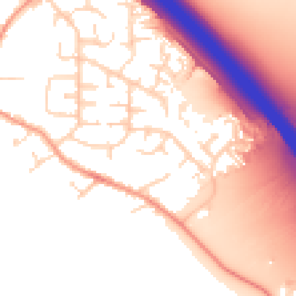
Daytime· 07:00 – 23:00
55.0dB

Night-time· 23:00 – 07:00
47.4dB