Flat 2, 16 Turner Street, Leicester, LE1 6WY
About Flat 2
Flat 2 is a mid-terrace house in Leicester (LE1 6WY). It has a recorded floor area of 59 m² (around 635 sq ft), construction records dating it to before 1900 and council tax band A. At 59 m² this is the 2nd smallest of 4 units on EPC record in the building, where floor areas span 50–78 m². The building's EPC ratings span E to D, with this unit at the bottom. On EPC score it ranks last in the building (44 versus a best of 66). The latest certificate (June 2016) shows an E (score 44), well below the UK norm with real room to improve. The recommended improvements would push it to D (score 67). The latest certificate is from June 2016, so improvements made since then won't be reflected.
Untraded for 20 years, with the last transfer in February 2006. At 59 m² it's 26.9% larger than the typical home in the postcode (47 m² median across 24 EPCs). Today's modelled estimate of £136,000 is 13.4% above the 2006 sale price. On a £-per-square-foot basis, the last sale (£189/sq ft) was about 31.9% above the typical sold price in the postcode.
Everything you need to know about Flat 2
The true value, the hidden risks and the full sale history, in one report.
Pick your report · every report is £14.99
One time fee only - money back guarantee

The data behind every report


Energy performance
EPC Expired
This certificate is over 10 years old and is no longer valid.Expired 06 Jun 2026
EPC Rating
Get a survey for this property
Level 3 Building Survey
Because the property was built before 1919 and has solid (non-cavity) walls, we believe a Level 3 building survey should be considered.
From £820 · Includes VAT
Planning history
Flat 2 has no planning applications on record.
But the area is active
4 notable applications nearby — larger schemes and conversions that could reshape the street. The report maps them all.
Sales history & valuation
Flat 2 valuation sits well clear of the typical sold price in this postcode.
£136,000
Modelled from EPC, postcode comparables.
£119,950
Recorded with HM Land Registry.
Sales timeline
24 February 2006Most recent
£119,950
Median price across the last 5 sales in LE1 6WY: £106,000 (2022–2016).
Nearby sales in LE1 6WY
Flat 4, 5 Turner Street, Leicester, LE1 6WY
Sold Nov 2022
£106,0007 Turner Street, Leicester, LE1 6WY
Sold Nov 2021
£350,000Flat 1, 16 Turner Street, Leicester, LE1 6WY
Sold Aug 2018
£130,000Flat 3, 12 Turner Street, Leicester, LE1 6WY
Sold Dec 2016
£40,000Flat 3, 16 Turner Street, Leicester, LE1 6WY
Sold May 2016
£95,000
Versus other Turner Street homes
CO₂ Emissions for Flat 2 lags the street by a wide margin.
Price per m²
£2,033
Street avg £2,509
Floor Area
59 m²
Street avg 44 m²
Habitable Rooms
3 rooms
Street avg 2 rooms
CO₂ Emissions
5.2 t/year
Street avg 3.1 t/year
Everything you need to know about Flat 2
The true value, the hidden risks and the full sale history, in one report.
Pick your report · every report is £14.99
One time fee only - money back guarantee
The data behind every report
Similar properties nearby
14a, Flat 1, Market Street
LE1 6DP
18a, Flat 1, Pocklingtons Walk
LE1 6BU
12 Eastgate Apartments, East Street
LE1 6NB
14 Eastgate Apartments, East Street
LE1 6NB
1 Eastgate Apartments, East Street
LE1 6NB
13 Eastgate Apartments, East Street
LE1 6NB
16 Eastgate Apartments, East Street
LE1 6NB
11 Eastgate Apartments, East Street
LE1 6NB
The neighbourhood at a glance
Rail-style transport is unusually close for this postcode.
Crime
13/mo
Rising year-on-year across the wider district.
Nearest stop
0.2 km
Tower Street — bus stop.
Closest school
0.3 km
Beauchamp City Sixth Form. 51 schools nearby.
Go deeper on the local area
A Local Area report breaks down crime, transport links, schools and air quality in depth.
Road noise across the postcode
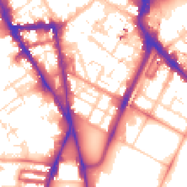
Daytime· 07:00 – 23:00
57.1dB

Night-time· 23:00 – 07:00
47.7dB