Flat 9, 3 Queen Street, Leicester, LE1 1RG
About Flat 9
Flat 9 is a detached house in Leicester (LE1 1RG). It has a recorded floor area of 93 m² (around 1001 sq ft) and council tax band B. At 93 m² this is the 10th smallest of 14 units on EPC record in the building, where floor areas span 64–107 m². The building's EPC ratings span C to B, with this unit at the bottom. The latest certificate (November 2017) shows a C (score 80), near the top of the C band.
At 93 m² the property is well over the postcode median (71 m² across 13 EPCs), placing it in the larger end of the local stock. Last sale on file: £230,000 in December 2022. That sale was during the post-pandemic price surge, when transactions cleared materially above pre-2020 trend.
Everything you need to know about Flat 9
The true value, the hidden risks and the full sale history, in one report.
Pick your report · every report is £14.99
One time fee only - money back guarantee

The data behind every report


Energy performance
EPC Rating
Get a survey for this property
Level 2 HomeBuyer Report
We've checked 10 risk factors against the available data for this property and believe a Level 2 HomeBuyer Report could be a suitable option for you.
From £545 · Includes VAT
Planning history
Flat 9 has no planning applications on record.
But the area is active
2 notable applications nearby — larger schemes and conversions that could reshape the street. The report maps them all.
Sales history & valuation
The latest sale landed in the post-pandemic price surge — useful context when reading the figure.
£226,000
Modelled from EPC, postcode comparables and a sale-price growth of 0.4% per year over 5 years.
£230,000
Growth on file: 0.4% per year over 5 years.
Sales timeline
8 December 2022Most recent
£230,000
+2.2%over 4 years15 December 2017
£225,000
Median price across the last 5 sales in LE1 1RG: £178,000 (2024–2020).
Nearby sales in LE1 1RG
Flat 5, 3 Queen Street, Leicester, LE1 1RG
Sold Nov 2024
£165,000Flat 12, 3 Queen Street, Leicester, LE1 1RG
Sold Dec 2022
£190,000Flat 2, 3 Queen Street, Leicester, LE1 1RG
Sold Aug 2022
£178,000Flat 6, 3 Queen Street, Leicester, LE1 1RG
Sold Jan 2021
£157,500Flat 14, 3 Queen Street, Leicester, LE1 1RG
Sold Aug 2020
£210,000
Versus other Queen Street homes
Flat 9 is notably below the street on years held.
Price per m²
£2,473
Street avg £2,477
Floor Area
93 m²
Street avg 80 m²
CO₂ Emissions
1.9 t/year
Street avg 1.8 t/year
Years Held
3 years
Street avg 6 years
Everything you need to know about Flat 9
The true value, the hidden risks and the full sale history, in one report.
Pick your report · every report is £14.99
One time fee only - money back guarantee
The data behind every report
Similar properties nearby
122a, Flat 2, Charles Street
LE1 1LB
142b, Flat 12, Charles Street
LE1 1LH
142b, Flat 10, Charles Street
LE1 1LH
122a, Flat 23, Charles Street
LE1 1LB
122a, Flat 14, Charles Street
LE1 1LB
122a, Flat 6, Charles Street
LE1 1LB
122a, Flat 7, Charles Street
LE1 1LB
142b, Flat 13, Charles Street
LE1 1LH
The neighbourhood at a glance
Rail-style transport is unusually close for this postcode.
Crime
13/mo
Rising year-on-year across the wider district.
Nearest stop
0.2 km
Charles Street — bus stop.
Closest school
0.5 km
Beauchamp City Sixth Form. 56 schools nearby.
Go deeper on the local area
A Local Area report breaks down crime, transport links, schools and air quality in depth.
Road noise across the postcode
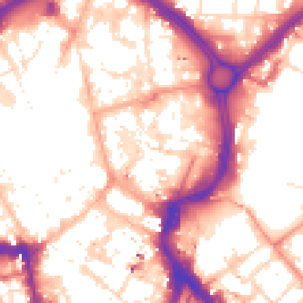
Daytime· 07:00 – 23:00
55.9dB

Night-time· 23:00 – 07:00
46.0dB