88 Greystone Road, Broadgreen, Liverpool, L14 6UH
About 88 Greystone Road
88 Greystone Road is a property in Broadgreen, Liverpool, Liverpool (L14 6UH). It has council tax band B.
It hasn't traded since August 2008, a hold of 18 years that's notably long for the area. That sale landed at the peak of the pre-credit-crunch market, which is a useful reference point when interpreting the price. Across 2000–2008, sale prices on this property compounded at 11.4% per year.
Everything you need to know about 88 Greystone Road
The true value, the hidden risks and the full sale history, in one report.
Pick your report · every report is £14.99
One time fee only - money back guarantee

The data behind every report


Energy performance
No EPC on record
This property doesn't have an Energy Performance Certificate yet. An EPC is required to sell or let — and unlocks our automated valuation.
Get a survey for this property
Level 2 HomeBuyer Report
We've checked 10 risk factors against the available data for this property and believe a Level 2 HomeBuyer Report could be a suitable option for you.
Planning history
88 Greystone Road has no planning applications on record.
A planning report still maps activity across the surrounding area and reads this property's extension & conversion potential.
Sales history & valuation
Sale price has at least doubled since 2000.
£128,000
Growth on file: 11.4% per year over 8 years.
Sales timeline
27 August 2008Most recent
£128,000
+151.0%over 8 years28 February 2000
£51,000
Median price across the last 5 sales in L14 6UH: £114,950 (2021–2004).
Nearby sales in L14 6UH
90 Greystone Road, Broadgreen, Liverpool, L14 6UH
Sold Dec 2021
£153,00098 Greystone Road, Broadgreen, Liverpool, L14 6UH
Sold Oct 2014
£121,50092 Greystone Road, Broadgreen, Liverpool, L14 6UH
Sold Apr 2011
£110,000108 Greystone Road, Broadgreen, Liverpool, L14 6UH
Sold Mar 2009
£70,000120 Greystone Road, Broadgreen, Liverpool, L14 6UH
Sold Sept 2004
£114,950
Everything you need to know about 88 Greystone Road
The true value, the hidden risks and the full sale history, in one report.
Pick your report · every report is £14.99
One time fee only - money back guarantee
The data behind every report
Similar properties nearby
The neighbourhood at a glance
Rail-style transport is unusually close for this postcode.
Crime
6/mo
Rising year-on-year across the wider district.
Nearest stop
0.3 km
Ashfield Way — bus stop.
Closest school
0.2 km
Malvern Primary School. 47 schools nearby.
Go deeper on the local area
A Local Area report breaks down crime, transport links, schools and air quality in depth.
Road noise across the postcode
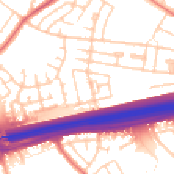
Daytime· 07:00 – 23:00
55.3dB

Night-time· 23:00 – 07:00
46.2dB