9 Chesfield Road, Kingston Upon Thames, KT2 5TH
About 9 Chesfield Road
9 Chesfield Road is a five-bedroom detached house in Kingston Upon Thames (KT2 5TH). It has a recorded floor area of 188 m² (around 2024 sq ft) and construction records dating it to before 1900. The latest certificate (September 2015) shows a D (score 62), on the cusp of jumping into the C band. The recommended improvements would lift it to B (score 82), a 2-band jump. The latest certificate is from September 2015, so improvements made since then won't be reflected.
At 188 m² the property is well over the postcode median (108 m² across 15 EPCs), placing it in the larger end of the local stock. 6 planning records sit against the property, 6 approved, 0 refused. Past consents include an extension, meaningful when judging how the property has evolved. The record references listed-building consent, which constrain future alterations. Last sold in June 2016, so it's been off the market for around 10 years. Across the public record there are 4 sales, relatively high churn for a single property. Across 1997–2016, sale prices on this property compounded at 16.7% per year. Today's modelled estimate of £1,469,000 is 22.4% above the 2016 sale price. On a £-per-square-foot basis, the last sale (£593/sq ft) was about 48.5% above the typical sold price in the postcode.
What this property has
Inside
- Bedrooms5
- Open-plan layoutYes
- Dining roomYes
- CloakroomYes
- EnsuiteYes
Outside
- Private gardenFront and rear
Everything you need to know about 9 Chesfield Road
The true value, the hidden risks and the full sale history, in one report.
30-day money-back guarantee

The data behind every report


Energy performance
9 Chesfield Road's carbon output runs well above what efficient homes in the postcode produce.
EPC Expired
This certificate is over 10 years old and is no longer valid.Expired 29 Sept 2025
EPC Rating
Planning history
9 Chesfield Road has 2 separate extension applications on the council record.
- Oct 2015ExtensionOutlineIn report
Extension: Single storey · Rear of property
Alteration to roof on single storey rear extension to form dual pitched gable-ended roof.
- Documents
- 11 docs on file
- Reference
- 15/12155/LDP
- Oct 2015ExtensionOutlineIn report
Extension: Single storey · Rear of property
Alteration to roof on single storey rear extension to form dual pitched gable-ended roof.
- Council
- Kingston Town
- Documents
- 11 docs on file
- Reference
- 15/12155
What's in 9 Chesfield Road, Kingston Upon Thames, KT2 5TH's planning history?
4 more on this property, plus refusals, disputes and full decisions nearby, in the report.
Sales history & valuation
Latest sale on 9 Chesfield Road was the highest on Land Registry record across the postcode.
£1,469,000
Modelled from EPC, postcode comparables and a sale-price growth of 16.7% per year over 19 years.
£1,200,000
Growth on file: 16.7% per year over 19 years.
Sales timeline
12 June 2016Most recent
£1,200,000
+281.0%over 2 years26 November 2013
£315,000
+174.0%over 14 years5 November 1999
£114,950
+91.6%over 2 years17 January 1997
£60,000
Median price across the last 5 sales in KT2 5TH: £660,000 (2022–2019).
Nearby sales in KT2 5TH
3 Chesfield Road, Kingston Upon Thames, KT2 5TH
Sold Jan 2022
£660,00022 Chesfield Road, Kingston Upon Thames, KT2 5TH
Sold Dec 2021
£1,000,0001 Chesfield Road, Kingston Upon Thames, KT2 5TH
Sold Aug 2020
£485,0002a, Chesfield Road, Kingston Upon Thames, KT2 5TH
Sold Oct 2019
£600,00015 Chesfield Road, Kingston Upon Thames, KT2 5TH
Sold Sept 2019
£750,000
Versus other Chesfield Road homes
9 Chesfield Road outperforms the street on floor area by a wide margin.
Price per m²
£6,383
Street avg £6,143
Floor Area
188 m²
Street avg 113 m²
Habitable Rooms
6 rooms
Street avg 5 rooms
CO₂ Emissions
7.0 t/year
Street avg 5.2 t/year
Everything you need to know about 9 Chesfield Road
The true value, the hidden risks and the full sale history, in one report.
30-day money-back guarantee
The data behind every report
Similar properties nearby
The neighbourhood at a glance
Rail-style transport is unusually close for this postcode.
Crime
5/mo
Rising year-on-year across the wider district.
Nearest stop
0.3 km
Windsor Road Kingston — bus stop.
Closest school
0.4 km
St Luke's CofE Primary School. 32 schools nearby.
Go deeper on the local area
The full report breaks down crime, transport links, schools and air quality in depth.
Road noise across the postcode
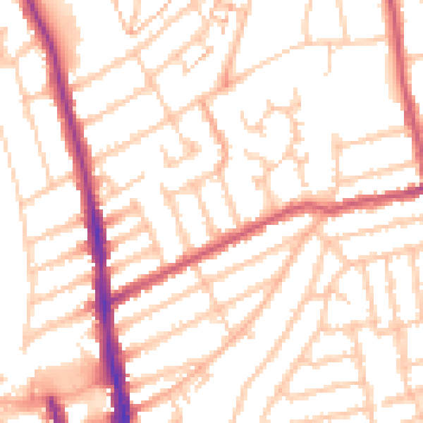
Daytime· 07:00 – 23:00
52.7dB

Night-time· 23:00 – 07:00
41.8dB