The Stables, Broomfield Avenue, Halifax, HX3 0JF
About The Stables
The Stables is an end-of-terrace house in Halifax (HX3 0JF). It has a recorded floor area of 115 m² (around 1238 sq ft), construction records dating it to 1983-1990 and council tax band E. The latest certificate (August 2016) shows a C (score 70). The recommended improvements would push it to B (score 83).
Today's modelled estimate of £434,000 is 37.8% above the 2017 sale price. On a £-per-square-foot basis, the last sale (£254/sq ft) was about 31.8% above the typical sold price in the postcode. On the market in March 2017 and unlisted since — roughly 9 years.
Everything you need to know about The Stables
The true value, the hidden risks and the full sale history, in one report.
Pick your report · every report is £14.99
One time fee only - money back guarantee

The data behind every report


Energy performance
EPC Rating
Get a survey for this property
Level 2 HomeBuyer Report
We've checked 10 risk factors against the available data for this property and believe a Level 2 HomeBuyer Report could be a suitable option for you.
From £695 · Includes VAT
Planning history
The Stables has no planning applications on record.
But the area is active
1 notable application nearby — larger schemes and conversions that could reshape the street. The report maps them all.
Sales history & valuation
The Stables valuation sits well clear of the typical sold price in this postcode.
£434,000
Modelled from EPC, postcode comparables.
£315,000
Recorded with HM Land Registry.
Sales timeline
3 March 2017Most recent
£315,000
Median price across the last 5 sales in HX3 0JF: £525,000 (2025–2024).
Nearby sales in HX3 0JF
20 Broomfield Avenue, Halifax, HX3 0JF
Sold Jul 2025
£610,00032 Broomfield Avenue, Halifax, HX3 0JF
Sold Mar 2025
£525,00022 Broomfield Avenue, Halifax, HX3 0JF
Sold Feb 2025
£785,0003 Broomfield Avenue, Halifax, HX3 0JF
Sold Feb 2025
£344,0001 The Coach House, Broomfield Avenue, Halifax, HX3 0JF
Sold Dec 2024
£307,500
Versus other Broomfield Avenue homes
The Stables outperforms the street on co₂ emissions by a wide margin.
Price per m²
£2,739
Street avg £2,775
Floor Area
115 m²
Street avg 206 m²
Habitable Rooms
5 rooms
Street avg 7 rooms
CO₂ Emissions
4.2 t/year
Street avg 6.0 t/year
Everything you need to know about The Stables
The true value, the hidden risks and the full sale history, in one report.
Pick your report · every report is £14.99
One time fee only - money back guarantee
The data behind every report
Similar properties nearby
1 Acre Mead, Birdcage Lane
HX3 0JQ
1 1a, Grandsmere Place
HX3 0DP
1 Clifton Road
HX3 0BT
1 Brookwater Close
HX3 0QR
1 Delph View, Wakefield Gate
HX3 0NQ
1 Broomfield Avenue
HX3 0JF
1 Copley Drive
HX3 0US
1 Copley Wood View, New Lane, Skircoat Green
HX3 0TE
The neighbourhood at a glance
Reported crime in the wider district is trending notably upward year-on-year.
Crime
3/mo
Rising year-on-year across the wider district.
Nearest stop
0.2 km
Birdcage Lane Skircoat Moor Rd — bus stop.
Closest school
0.7 km
Copley Primary School. 29 schools nearby.
Go deeper on the local area
A Local Area report breaks down crime, transport links, schools and air quality in depth.
Road noise across the postcode
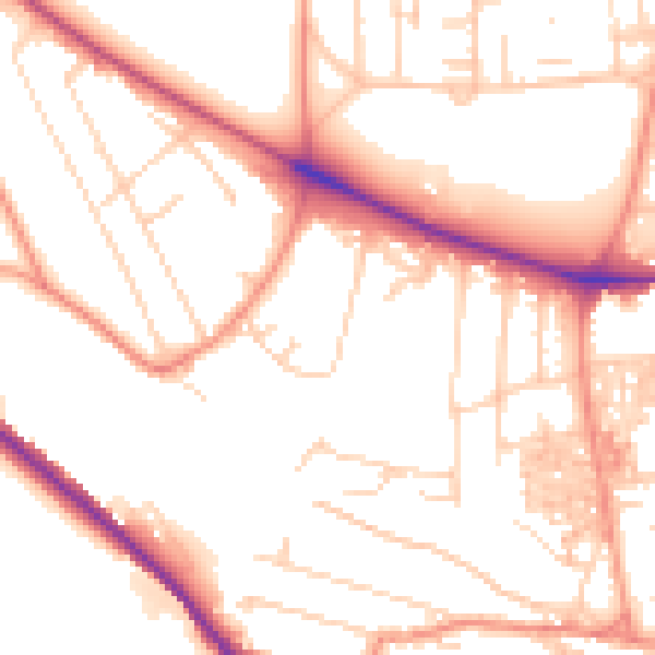
Daytime· 07:00 – 23:00
53.1dB

Night-time· 23:00 – 07:00
42.1dB