Model valuation£417,0008 Busby Close
Local market context
Netherhills is a detached house in Shurdington, Cheltenham, Cheltenham (GL51 4XN). It has a recorded floor area of 202 m² (around 2174 sq ft), construction records dating it to 1950-1966 and council tax band F. The latest certificate (February 2018) returns a high B (score 86), putting the home a stone's throw from an A rating. When first surveyed in August 2011 the rating was D, the property has climbed 2 bands since. Between certificates, wall efficiency went from Good to Very Good, roof efficiency went from Good to Very Good and window efficiency went from Average to Very Good.
At 202 m² the property is well over the postcode median (116 m² across 7 EPCs), placing it in the larger end of the local stock. On energy efficiency it sits in the top 10% of properties in this postcode. Across 1995–2018, sale prices on this property compounded at 9.3% per year. Today's modelled estimate of £1,186,000 is 21.6% above the 2018 sale price. On a £-per-square-foot basis, the last sale (£448/sq ft) was about 54.4% above the typical sold price in the postcode. 8 years since the last transfer (July 2018). 4 planning records sit against the property, 3 approved, 0 refused.
The true value, the hidden risks and the full sale history, in one report.
Pick your report · from £14.99
One time fee only - money back guarantee

The data behind every report


Netherhills ranks among the most efficient homes in the postcode for energy use.
Certificate validity
Valid until 8 February 2028
Changes detected from historical EPC data
Heating controls upgraded for better temperature management
Hot water system upgraded
High performance glazing installed
Wall insulation improved
Loft insulation upgraded to recommended levels
Floor insulation added or improved

Get a survey for this property
We've checked 10 risk factors against the available data for this property and believe a Level 2 HomeBuyer Report could be a suitable option for you.
From £1,245 · Includes VAT
4 applications on record at Netherhills, Farm Lane, Shurdington, Cheltenham, GL51 4XN
Demolition of existing dwelling and erection of two new dwellings with benefit of existing vehicular access.
+ 1 more application in the report
You're seeing the shape of it. The report has the substance.
One time fee only - money back guarantee
Latest sale on Netherhills was the highest on Land Registry record across the postcode.
£1,186,000
Modelled from EPC, postcode comparables and a sale-price growth of 9.3% per year over 23 years.
£975,000
Growth on file: 9.3% per year over 23 years.
4 July 2018Most recent
£975,000
+167.1%over 5 years18 December 2012
£365,000
+180.8%over 17 years30 November 1995
£130,000
Median price across the last 5 sales in GL51 4XN: £490,000 (2026–2020).
Dever, Farm Lane, Shurdington, Cheltenham, GL51 4XN
Sold Jan 2026
Ashburn, Farm Lane, Shurdington, Cheltenham, GL51 4XN
Sold Jan 2023
Glendale, Farm Lane, Shurdington, Cheltenham, GL51 4XN
Sold May 2021
Vooroak, Farm Lane, Shurdington, Cheltenham, GL51 4XN
Sold Mar 2021
2 Myrtledene Cottages, Farm Lane, Shurdington, Cheltenham, GL51 4XN
Sold Jun 2020
On price per m², Netherhills stands well clear of the street.
Price per m²
£4,827
Street avg £3,253
Floor Area
202 m²
Street avg 113 m²
CO₂ Emissions
2.5 t/year
Street avg 4.7 t/year
Years Held
8 years
Street avg 13 years
Property research, connected
Explore sale histories, valuations, energy ratings and local areas. Ask the assistant to connect the details and take your research further.
Start your researchGL51 4XA
GL51 4SX
GL51 4TY
GL51 4XJ
GL51 4GQ
GL51 4TT
GL51 4TL
GL51 4XL
Daytime road noise here sits well below conversation level — a quiet pocket of the postcode.
Crime
284/mo
Falling year-on-year across the wider district.
Nearest stop
0.1 km
Cheese Rollers — bus stop.
Closest school
0.4 km
Shurdington Church of England Primary School. 7 schools nearby.
Go deeper on the local area
A Local Area report breaks down crime, transport links, schools and air quality in depth.
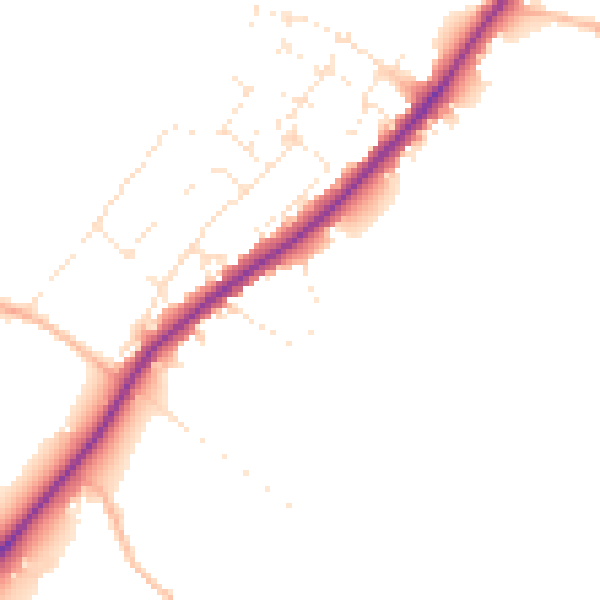
Daytime· 07:00 – 23:00
47.4dB

Night-time· 23:00 – 07:00
40.7dB