Are you a property professional?Get qualified leads from motivated homeowners.
Get started41 Baldwyns Road, Bexley, DA5 2AB
4 sales on record
About 41 Baldwyns Road
A plain-English summary derived from public records, EPC certificates, sold prices and local data.
41 Baldwyns Road is a two-bedroom mid-terrace house in Bexley (DA5 2AB). It has a recorded floor area of 81 m² (around 876 sq ft), construction records dating it to 1930-1949 and council tax band C. The latest certificate (March 2011) shows a C (score 74). The latest certificate is from March 2011, so improvements made since then won't be reflected.
Sale prices here have outpaced Bexley HPI: 6.4% per year against 0% for the wider region. Today's modelled estimate of £393,000 is 16% above the 2016 sale price. On a £-per-square-foot basis, the last sale (£387/sq ft) was about 79% above the typical sold price in the postcode. Last sold in October 2016, so it's been off the market for around 10 years. Across the public record there are 4 sales, relatively high churn for a single property. Its energy rating outperforms most of the postcode (better than 85% of similar EPCs). 2 bedrooms is on the smaller side for this postcode, where 4 is the typical count.
What this property has
Pulled from EPC certificates, claim submissions and our property model. Empty categories are hidden — we only show what's known.
Inside
- Bedrooms2
- Dining roomYes
Outside
- Private gardenYes
- Garage
Energy performance
Every EPC certificate filed against this property — current rating, recorded improvements, and where there's headroom to reach a higher band.
41 Baldwyns Road's EPC is over a decade old — improvements since won't be reflected.
EPC Expired
This certificate is over 10 years old and is no longer valid.Expired 07 Mar 2021
Sales history & valuation
Recorded transactions, our model's current estimate, and a quick read on what neighbouring properties have sold for.
41 Baldwyns Road has more than doubled in price since the earliest registered sale in 2002.
Current estimate
See how we calculated this£393,000
Modelled from EPC, postcode comparables and a sale-price growth of 6.4% per year over 14 years.
Last sold (2016)
£338,750
Growth on file: 6.4% per year over 14 years.
Sales timeline
Versus other Baldwyns Road homes
Four headline reads against 24 similar houses on this street, drawn from the latest EPC and Land Registry data.
41 Baldwyns Road outperforms the street on epc rating by a wide margin.
Price per m²
£4,163
Street avg £3,502
Floor Area
81 m²
Street avg 91 m²
Habitable Rooms
3 rooms
Street avg 5 rooms
Similar properties nearby
A handful of close matches in the same postcode area, ranked by likeness on bedrooms, type and floor area.
The neighbourhood at a glance
A condensed read of the local area. Each tile links through to the full breakdown on the Bexley district page.
Crime
3/mo
Steady year-on-year across the wider district.
Nearest stop
0.1 km
Bexley Park — bus stop.
Road noise across the postcode
Modelled day and night-time noise levels around DA5 2AB from Defra's strategic mapping. The pin marks this postcode's centroid.
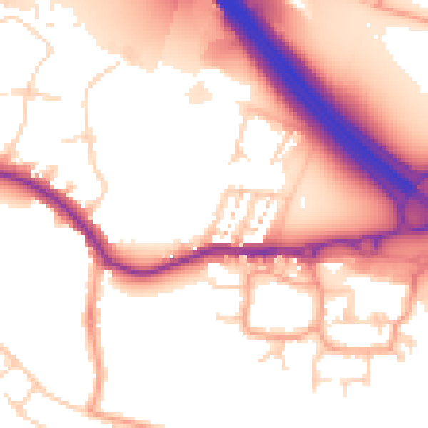
Daytime· 07:00 – 23:00
54.8dB

Everything within walking distance
Schools, transport stops and scenic spots near this property — 62 points of interest in total.
Beautiful places to visit nearby
Curated scenic spots within reach of this postcode, served by Beautifulplaces.ai. Photography and tagging come from their open dataset.
Common questions
The questions buyers, sellers and homeowners most often ask about 41 Baldwyns Road, Bexley, DA5 2AB. Each answer is also embedded as structured data for search engines.