39 Faulkner Street, Hoole, Chester, CH2 3BD
About 39 Faulkner Street
39 Faulkner Street is a two-bedroom mid-terrace house in Hoole, Chester, Chester (CH2 3BD). It has a recorded floor area of 74 m² (around 797 sq ft), construction records dating it to 1900-1929 and council tax band B. The latest certificate (November 2019) shows a D (score 62), on the cusp of jumping into the C band. When first surveyed in March 2010 the rating was E, the property has climbed 1 band since. Between certificates, hot-water efficiency went from Poor to Good, lighting went from Very Poor to Average and main heating went from Average to Good. The recommended improvements would lift it to B (score 84), a 2-band jump.
At 74 m² the property is well over the postcode median (45 m² across 14 EPCs), placing it in the larger end of the local stock. One planning record on file: an extension approved in 2024. Past consents include an extension, meaningful when judging how the property has evolved. Across 2011–2021, sale prices on this property compounded at 5.1% per year. Today's modelled estimate of £188,000 is 39.3% above the 2021 sale price. Sold November 2021 for £135,000. That sale was during the post-pandemic price surge, when transactions cleared materially above pre-2020 trend.
What this property has
Inside
- Bedrooms2
Everything you need to know about 39 Faulkner Street
The true value, the hidden risks and the full sale history, in one report.
Pick your report · every report is £14.99
One time fee only - money back guarantee

The data behind every report


Energy performance
Recommended upgrades on file would lift this property by multiple EPC bands.
EPC Rating
Property Improvements
Changes detected from historical EPC data
Hot water system upgraded
More low energy lighting installed
Get a survey for this property
Level 3 Building Survey
Because the property was built before 1919 and has solid (non-cavity) walls, we believe a Level 3 building survey should be considered.
From £820 · Includes VAT
Planning history
1 application on record at 39 Faulkner Street, Hoole, Chester, CH2 3BD
- Mar 2024ExtensionOtherOutcome in report
Extension: Part single, part two storey · Rear of property
Demolition of existing rear extensions, erection of part single and two storey rear extension
- Documents
- 14 docs on file
- Reference
- 23/02992/FUL
Unlock 39 Faulkner Street, Hoole, Chester, CH2 3BD's full planning history
You're seeing the shape of it. The report has the substance.
- Every decision — granted, refused or withdrawn (1 on record)
- All 1 application on this property in full, plus 3 notable nearby
- The 14 documents, officer reports & conditions
- What the pattern means for extending or converting here
One time fee only - money back guarantee
Sales history & valuation
The latest sale landed in the post-pandemic price surge — useful context when reading the figure.
£188,000
Modelled from EPC, postcode comparables and a sale-price growth of 5.1% per year over 11 years.
£135,000
Growth on file: 5.1% per year over 11 years.
Sales timeline
24 November 2021Most recent
£135,000
+68.8%over 10 years4 May 2011
£80,000
Median price across the last 5 sales in CH2 3BD: £109,000 (2023–2007).
Nearby sales in CH2 3BD
Flat 2, 12 Faulkner Street, Hoole, Chester, CH2 3BD
Sold Feb 2023
£76,00041 Faulkner Street, Hoole, Chester, CH2 3BD
Sold Jan 2019
£135,0007a, Faulkner Street, Hoole, Chester, CH2 3BD
Sold Mar 2010
£68,0009a, Faulkner Street, Hoole, Chester, CH2 3BD
Sold Dec 2007
£225,000Flat 3, 14 Faulkner Street, Hoole, Chester, CH2 3BD
Sold May 2007
£97,000
Versus other Faulkner Street homes
39 Faulkner Street outperforms the street on epc rating by a wide margin.
EPC Rating
62 (D)
Street avg 32 (F)
Floor Area
74 m²
Street avg 68 m²
CO₂ Emissions
3.7 t/year
Street avg 7.7 t/year
Habitable Rooms
4 rooms
Street avg 3 rooms
Everything you need to know about 39 Faulkner Street
The true value, the hidden risks and the full sale history, in one report.
Pick your report · every report is £14.99
One time fee only - money back guarantee
The data behind every report
Similar properties nearby
1 Bishopsgate
CH2 3DD
1 Charlton Court, Hoole Road
CH2 3PB
1 Edge Grove
CH2 3DZ
1 Edna Street
CH2 3BW
1 Brookside Terrace, Hoole
CH2 3PX
1 Eaton Lodge, Hoole Road
CH2 3QY
1 Alder Grove, Hoole
CH2 3ET
1 Clare Avenue, Hoole
CH2 3HT
The neighbourhood at a glance
Rail-style transport is unusually close for this postcode.
Crime
2/mo
Steady year-on-year across the wider district.
Nearest stop
0.1 km
Faulkner Street — bus stop.
Closest school
0.4 km
St Martin's Academy Chester. 19 schools nearby.
Go deeper on the local area
A Local Area report breaks down crime, transport links, schools and air quality in depth.
Road noise across the postcode
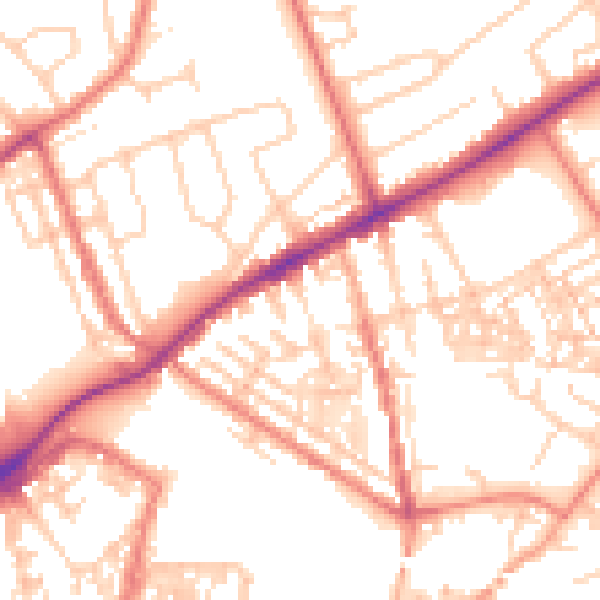
Daytime· 07:00 – 23:00
53.2dB
Night-time· 23:00 – 07:00
42.3dB