601 Filton Avenue, Horfield, Bristol, BS7 0QH
About 601 Filton Avenue
601 Filton Avenue is a one-bedroom mid-terrace house in Horfield, Bristol, Bristol (BS7 0QH). It has a recorded floor area of 126 m² (around 1356 sq ft), construction records dating it to 1930-1949 and council tax band B. The latest certificate (March 2024) shows a C (score 73). When first surveyed in January 2015 the rating was D, the property has climbed 1 band since. Between certificates, wall efficiency went from Very Poor to Poor, roof efficiency went from Very Poor to Good and window efficiency went from Average to Good. The recommended improvements would push it to B (score 85).
At 126 m² the property is well over the postcode median (85 m² across 26 EPCs), placing it in the larger end of the local stock. Across 1999–2015, sale prices on this property compounded at 6.6% per year. Today's modelled estimate of £432,000 sits 91.2% above the 2015 sale of £226,000. On a £-per-square-foot basis, the last sale (£167/sq ft) was about 26.9% above the typical sold price in the postcode. One planning record on file: a loft conversion approved in 2003. Past consents include a loft conversion, meaningful when judging how the property has evolved. Last sold in May 2015, so it's been off the market for around 11 years.
What this property has
Inside
- Bedrooms1
- Bathrooms3
Everything you need to know about 601 Filton Avenue
The true value, the hidden risks and the full sale history, in one report.
Pick your report · every report is £14.99
One time fee only - money back guarantee

The data behind every report


Energy performance
EPC Rating
Property Improvements
Changes detected from historical EPC data
Heating controls upgraded for better temperature management
Window efficiency improved
Wall insulation improved
Loft insulation installed or upgraded to 250mm+
Get a survey for this property
Level 3 Building Survey
Because the property has solid (non-cavity) walls, we believe a Level 3 building survey should be considered.
From £1,020 · Includes VAT
Planning history
1 application on record at 601 Filton Avenue, Horfield, Bristol, BS7 0QH
- Mar 2003Loft ConversionFullOutcome in report
Installation of dormer in rear elevation to facilitate loft conversion to form additional bedroom with ensuite facilities.
- Documents
- 7 docs on file
- Reference
- PT03/0325/F
Unlock 601 Filton Avenue, Horfield, Bristol, BS7 0QH's full planning history
You're seeing the shape of it. The report has the substance.
- Every decision — granted, refused or withdrawn (1 on record)
- All 1 application on this property in full, plus 162 notable nearby
- The 7 documents, officer reports & conditions
- What the pattern means for extending or converting here
One time fee only - money back guarantee
Sales history & valuation
601 Filton Avenue has more than doubled in price since the earliest registered sale in 1999.
£432,000
Modelled from EPC, postcode comparables and a sale-price growth of 6.6% per year over 15 years.
£226,000
Growth on file: 6.6% per year over 15 years.
Sales timeline
17 May 2015Most recent
£226,000
+133.1%over 13 years5 November 2001
£96,950
+15.4%over 1 year10 December 1999
£84,000
Median price across the last 5 sales in BS7 0QH: £205,000 (2022–2015).
Nearby sales in BS7 0QH
557b, Filton Avenue, Horfield, Bristol, BS7 0QH
Sold Jun 2022
£190,000583 Filton Avenue, Horfield, Bristol, BS7 0QH
Sold Feb 2021
£293,000609 Filton Avenue, Horfield, Bristol, BS7 0QH
Sold Feb 2020
£795577 Filton Avenue, Horfield, Bristol, BS7 0QH
Sold Nov 2019
£260,000585 Filton Avenue, Horfield, Bristol, BS7 0QH
Sold Apr 2013
£160,000
Versus other Filton Avenue homes
Habitable Rooms for 601 Filton Avenue runs comfortably ahead of the street norm.
Price per m²
£1,794
Street avg £2,137
Floor Area
126 m²
Street avg 97 m²
Habitable Rooms
7 rooms
Street avg 5 rooms
CO₂ Emissions
3.6 t/year
Street avg 4.1 t/year
Everything you need to know about 601 Filton Avenue
The true value, the hidden risks and the full sale history, in one report.
Pick your report · every report is £14.99
One time fee only - money back guarantee
The data behind every report
Similar properties nearby
1 Boston Road
BS7 0HA
1 Doone Road
BS7 0JQ
1 Broncksea Road
BS7 0SE
1 Alderton Road
BS7 0UY
1 Bythesea Avenue
BS7 0FN
1 Azov Close
BS7 0FL
1 Bartholomews Square, Horfield
BS7 0QA
1 Beechcroft Walk
BS7 0NH
The neighbourhood at a glance
Rail-style transport is unusually close for this postcode.
Crime
6/mo
Rising year-on-year across the wider district.
Nearest stop
0.1 km
The Bulldog — bus stop.
Closest school
0.3 km
Shield Road Primary School. 21 schools nearby.
Go deeper on the local area
A Local Area report breaks down crime, transport links, schools and air quality in depth.
Road noise across the postcode
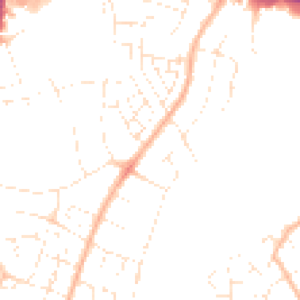
Daytime· 07:00 – 23:00
46.6dB

Night-time· 23:00 – 07:00
36.9dB