46 Highbury Road, Horfield, Bristol, BS7 0BZ
About 46 Highbury Road
46 Highbury Road is a three-bedroom semi-detached house in Horfield, Bristol, Bristol (BS7 0BZ). It has a recorded floor area of 111 m² (around 1195 sq ft), construction records dating it to 1930-1949 and council tax band C. The latest certificate (June 2024) shows a C (score 70). When first surveyed in January 2013 the rating was D, the property has climbed 1 band since. Between certificates, lighting went from Good to Very Good; while wall efficiency dropped from Poor to Very Poor. The recommended improvements would push it to B (score 88). Period features are noted in the property record. Our model identifies extension potential, subject to local planning policy.
Its energy rating outperforms most of the postcode (better than 87% of similar EPCs). Across 1995–2024, sale prices on this property compounded at 8.2% per year. On a £-per-square-foot basis, the last sale (£465/sq ft) was about 137.6% above the typical sold price in the postcode. Sold August 2024 for £556,000. One historical planning record sits against the property in 2018.
What this property has
Inside
- Bedrooms3
- Bathrooms2
- Open-plan layoutYes
- Dining roomYes
- Utility roomYes
- CloakroomYes
- StudyYes
Outside
- Private gardenSouth-facing
- ParkingOff street
Building
- Period featuresYes
- Extension potentialPossible
Everything you need to know about 46 Highbury Road
The true value, the hidden risks and the full sale history, in one report.
Pick your report · every report is £14.99
One time fee only - money back guarantee

The data behind every report


Energy performance
EPC Rating
Property Improvements
Changes detected from historical EPC data
More low energy lighting installed
Get a survey for this property
Level 3 Building Survey
Because the property has solid (non-cavity) walls, we believe a Level 3 building survey should be considered.
From £1,085 · Includes VAT
Planning history
1 application on record at 46 Highbury Road, Horfield, Bristol, BS7 0BZ
- Jul 2018ExtensionOutlineOutcome in report
Extension: Single storey
Application for a Certificate of Proposed Development - Erection of single storey side extension, following demolition of existing rear extension.
- Council
- Horfield And Lockleaze
- Documents
- 9 docs on file
- Reference
- 18/02810/CP
Unlock 46 Highbury Road, Horfield, Bristol, BS7 0BZ's full planning history
You're seeing the shape of it. The report has the substance.
- Every decision — granted, refused or withdrawn (1 on record)
- All 1 application on this property in full, plus 162 notable nearby
- The 9 documents, officer reports & conditions
- What the pattern means for extending or converting here
One time fee only - money back guarantee
Sales history & valuation
Latest sale on 46 Highbury Road was the highest on Land Registry record across the postcode.
£569,000
Modelled from EPC, postcode comparables and a sale-price growth of 8.2% per year over 29 years.
£556,000
Growth on file: 8.2% per year over 29 years.
Sales timeline
29 August 2024Most recent
£556,000
+51.1%over 6 years27 March 2018
£368,000
+55.3%over 10 years12 April 2007
£237,000
+315.8%over 11 years24 November 1995
£57,000
Median price across the last 5 sales in BS7 0BZ: £495,000 (2025–2021).
Nearby sales in BS7 0BZ
28 Highbury Road, Horfield, Bristol, BS7 0BZ
Sold Jul 2025
£522,61052 Highbury Road, Horfield, Bristol, BS7 0BZ
Sold Jun 2022
£495,00056 Highbury Road, Horfield, Bristol, BS7 0BZ
Sold Feb 2022
£535,00030 Highbury Road, Horfield, Bristol, BS7 0BZ
Sold May 2021
£393,11962 Highbury Road, Horfield, Bristol, BS7 0BZ
Sold Mar 2021
£490,000
Versus other Highbury Road homes
EPC Rating for 46 Highbury Road runs comfortably ahead of the street norm.
Price per m²
£5,009
Street avg £2,876
Floor Area
111 m²
Street avg 114 m²
Habitable Rooms
6 rooms
Street avg 6 rooms
CO₂ Emissions
3.6 t/year
Street avg 5.6 t/year
Everything you need to know about 46 Highbury Road
The true value, the hidden risks and the full sale history, in one report.
Pick your report · every report is £14.99
One time fee only - money back guarantee
The data behind every report
Similar properties nearby
1 Bayswater Road
BS7 0BN
1 Beechcroft Walk
BS7 0NH
1 Cropthorne Road South
BS7 0PS
1 Blakeney Road
BS7 0DL
1 Conrad Court, Shakespeare Avenue
BS7 0PN
1 Buxton Walk
BS7 0LG
1 Dorchester Road
BS7 0LA
1 Bythesea Avenue
BS7 0FN
The neighbourhood at a glance
Reported crime in the wider district is trending notably upward year-on-year.
Crime
6/mo
Rising year-on-year across the wider district.
Nearest stop
0.2 km
Wessex Avenue — bus stop.
Closest school
0.6 km
Filton Avenue Primary School. 37 schools nearby.
Go deeper on the local area
A Local Area report breaks down crime, transport links, schools and air quality in depth.
Road noise across the postcode
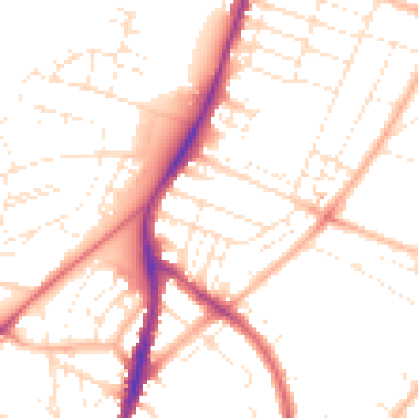
Daytime· 07:00 – 23:00
50.6dB

Night-time· 23:00 – 07:00
40.6dB