571 Gloucester Road, Horfield, Bristol, BS7 0BW
About 571 Gloucester Road
571 Gloucester Road is a three-bedroom semi-detached house in Horfield, Bristol, Bristol (BS7 0BW). It has a recorded floor area of 114 m² (around 1227 sq ft), construction records dating it to 1900-1929 and council tax band C. The latest certificate (June 2022) shows a C (score 79), near the top of the C band. When first surveyed in December 2018 the rating was E, the property has climbed 2 bands since. Between certificates, wall efficiency went from Very Poor to Poor, hot-water efficiency went from Average to Good and lighting went from Very Poor to Very Good. The recommended improvements would push it to B (score 86).
Today's modelled estimate of £510,000 sits 51.2% above the 2019 sale of £337,250. On a £-per-square-foot basis, the last sale (£275/sq ft) was about 62.7% above the typical sold price in the postcode. At 114 m² it sits well below the postcode median (163 m² across 17 EPCs), making it one of the more compact homes locally. Its energy rating outperforms most of the postcode (better than 82% of similar EPCs). 2 planning records sit against the property, 1 approved, 1 refused. Past consents include an extension, meaningful when judging how the property has evolved. Sold June 2019 for £337,250.
What this property has
Inside
- Bedrooms3
- Bathrooms1
Everything you need to know about 571 Gloucester Road
The true value, the hidden risks and the full sale history, in one report.
Pick your report · every report is £14.99
One time fee only - money back guarantee

The data behind every report


Energy performance
EPC Rating
Property Improvements
Changes detected from historical EPC data
Heating controls upgraded for better temperature management
Hot water efficiency improved
Windows upgraded, improving insulation
Wall insulation improved
Floor insulation added or improved
More low energy lighting installed
Get a survey for this property
Level 3 Building Survey
Because the property was built before 1919, has been extended more than once, and has solid (non-cavity) walls, we believe a Level 3 building survey should be considered.
From £1,085 · Includes VAT
Planning history
A an annexe application was refused at 571 Gloucester Road in 2022.
2 applications on record at 571 Gloucester Road, Horfield, Bristol, BS7 0BW
- Apr 2022AnnexFullOutcome in report
Conversion and extension of existing garage to form 1 bed bungalow with associated access. (Self Build).
Extension- Documents
- 16 docs on file
- Reference
- 22/00293/F
- More recent applications — locked
- ExtensionOct 2025Decision
Unlock 571 Gloucester Road, Horfield, Bristol, BS7 0BW's full planning history
You're seeing the shape of it. The report has the substance.
- Every decision — granted, refused or withdrawn (2 on record)
- All 2 applications on this property in full, plus 162 notable nearby
- The 22 documents, officer reports & conditions
- What the pattern means for extending or converting here
One time fee only - money back guarantee
Sales history & valuation
571 Gloucester Road valuation sits well clear of the typical sold price in this postcode.
£510,000
Modelled from EPC, postcode comparables.
£337,250
Recorded with HM Land Registry.
Sales timeline
27 June 2019Most recent
£337,250
Median price across the last 5 sales in BS7 0BW: £570,000 (2024–2020).
Nearby sales in BS7 0BW
601 Gloucester Road, Horfield, Bristol, BS7 0BW
Sold Nov 2024
£695,000581 Gloucester Road, Horfield, Bristol, BS7 0BW
Sold Apr 2024
£595,000587 Gloucester Road, Horfield, Bristol, BS7 0BW
Sold Jun 2022
£570,000597 Gloucester Road, Horfield, Bristol, BS7 0BW
Sold Dec 2020
£502,500First Floor Flat, 569 Gloucester Road, Horfield, Bristol, BS7 0BW
Sold Oct 2020
£285,000
Versus other Gloucester Road homes
On epc rating, 571 Gloucester Road stands well clear of the street.
Price per m²
£2,958
Street avg £2,200
Floor Area
114 m²
Street avg 176 m²
Habitable Rooms
4 rooms
Street avg 8 rooms
CO₂ Emissions
2.6 t/year
Street avg 7.3 t/year
Everything you need to know about 571 Gloucester Road
The true value, the hidden risks and the full sale history, in one report.
Pick your report · every report is £14.99
One time fee only - money back guarantee
The data behind every report
Similar properties nearby
1 Bayswater Road
BS7 0BN
1 Beechcroft Walk
BS7 0NH
1 Cropthorne Road South
BS7 0PS
1 Blakeney Road
BS7 0DL
1 Conrad Court, Shakespeare Avenue
BS7 0PN
1 Buxton Walk
BS7 0LG
1 Dorchester Road
BS7 0LA
1 Bythesea Avenue
BS7 0FN
The neighbourhood at a glance
Reported crime in the wider district is trending notably upward year-on-year.
Crime
6/mo
Rising year-on-year across the wider district.
Nearest stop
0.2 km
Muller Road Top — bus stop.
Closest school
0.7 km
Filton Avenue Primary School. 37 schools nearby.
Go deeper on the local area
A Local Area report breaks down crime, transport links, schools and air quality in depth.
Road noise across the postcode
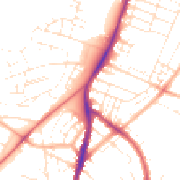
Daytime· 07:00 – 23:00
50.8dB

Night-time· 23:00 – 07:00
40.9dB