23 Clyde Grove, Filton, Bristol, BS34 7RL
About 23 Clyde Grove
23 Clyde Grove is a three-bedroom semi-detached house in Filton, Bristol, Bristol (BS34 7RL). It has a recorded floor area of 91 m² (around 980 sq ft), construction records dating it to 1930-1949 and council tax band D. The latest certificate (May 2023) shows a D (score 55), a step below the typical UK home. The recommended improvements would lift it to B (score 85), a 2-band jump. The home occupies a cul-de-sac position.
Today's modelled estimate of £493,000 is 13.1% above the 2023 sale price. On a £-per-square-foot basis, the last sale (£445/sq ft) was about 78.3% above the typical sold price in the postcode. Sold September 2023 for £436,050.
What this property has
Inside
- Bedrooms3
- Bathrooms1
Outside
- Private gardenRear
- GarageSingle
- Cul-de-sacYes
Building
- RefurbishedYes
Everything you need to know about 23 Clyde Grove
The true value, the hidden risks and the full sale history, in one report.
Pick your report · every report is £14.99
One time fee only - money back guarantee

The data behind every report


Energy performance
Recommended upgrades on file would lift this property by multiple EPC bands.
EPC Rating
Get a survey for this property
Level 3 Building Survey
Because the property has solid (non-cavity) walls, we believe a Level 3 building survey should be considered.
From £1,020 · Includes VAT
Planning history
23 Clyde Grove has no planning applications on record.
But the area is active
130 notable applications nearby — larger schemes and conversions that could reshape the street. The report maps them all.
Sales history & valuation
23 Clyde Grove valuation sits well clear of the typical sold price in this postcode.
£493,000
Modelled from EPC, postcode comparables.
£436,050
Recorded with HM Land Registry.
Sales timeline
27 September 2023Most recent
£436,050
Median price across the last 5 sales in BS34 7RL: £445,000 (2025–2022).
Nearby sales in BS34 7RL
17 Clyde Grove, Filton, Bristol, BS34 7RL
Sold Jun 2025
£445,00029 Clyde Grove, Filton, Bristol, BS34 7RL
Sold Mar 2024
£417,50027 Clyde Grove, Filton, Bristol, BS34 7RL
Sold Mar 2024
£522,50014 Clyde Grove, Filton, Bristol, BS34 7RL
Sold Feb 2022
£350,00022 Clyde Grove, Filton, Bristol, BS34 7RL
Sold Jan 2022
£450,000
Versus other Clyde Grove homes
Price per m² for 23 Clyde Grove runs comfortably ahead of the street norm.
Price per m²
£4,792
Street avg £3,552
Floor Area
91 m²
Street avg 108 m²
Habitable Rooms
5 rooms
Street avg 6 rooms
CO₂ Emissions
5.0 t/year
Street avg 5.4 t/year
Everything you need to know about 23 Clyde Grove
The true value, the hidden risks and the full sale history, in one report.
Pick your report · every report is £14.99
One time fee only - money back guarantee
The data behind every report
Similar properties nearby
1 Charlton Avenue
BS34 7QX
1 Glebelands Road, Filton
BS34 7AD
1 Concorde House, Bevan Court, Filton
BS34 7QN
1 Blenheim Drive, Filton
BS34 7AX
1 Canberra Grove, Filton
BS34 7DH
1 Clyde Grove, Filton
BS34 7RL
1 Elm Park, Filton
BS34 7PR
1 Dunkeld Avenue, Filton
BS34 7RH
The neighbourhood at a glance
Daytime road noise here sits well below conversation level — a quiet pocket of the postcode.
Crime
6/mo
Steady year-on-year across the wider district.
Nearest stop
0.2 km
Charborough Road — bus stop.
Closest school
0.2 km
Charborough Road Primary School. 28 schools nearby.
Go deeper on the local area
A Local Area report breaks down crime, transport links, schools and air quality in depth.
Road noise across the postcode
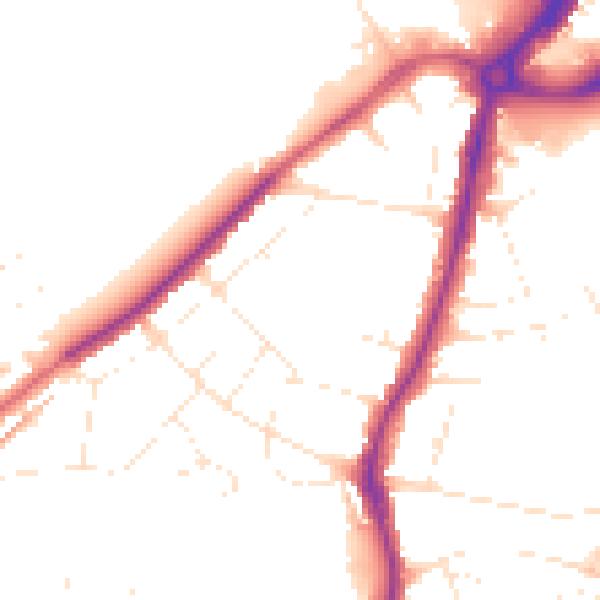
Daytime· 07:00 – 23:00
49.0dB

Night-time· 23:00 – 07:00
40.8dB