35 Arlingham Way, Patchway, Bristol, BS34 5NH
About 35 Arlingham Way
35 Arlingham Way is a two-bedroom end-of-terrace house in Patchway, Bristol, Bristol (BS34 5NH). It has a recorded floor area of 63 m² (around 680 sq ft), construction records dating it to 1950-1966 and council tax band B. The latest certificate (July 2010) shows a D (score 65), on the cusp of jumping into the C band. The latest certificate is from July 2010, so improvements made since then won't be reflected.
Untraded for 16 years, with the last transfer in October 2010. Across the public record there are 4 sales, relatively high churn for a single property. Across 2001–2010, sale prices on this property compounded at 6.9% per year. Today's modelled estimate of £237,000 sits 93.5% above the 2010 sale of £122,500. On a £-per-square-foot basis, the last sale (£180/sq ft) was about 25.8% above the typical sold price in the postcode. At 63 m² it's 17.9% smaller than the typical home in the postcode (77 m² median across 23 EPCs).
What this property has
Inside
- Bedrooms2
Everything you need to know about 35 Arlingham Way
The true value, the hidden risks and the full sale history, in one report.
Pick your report · every report is £14.99
One time fee only - money back guarantee

The data behind every report


Energy performance
35 Arlingham Way's EPC is over a decade old — improvements since won't be reflected.
EPC Expired
This certificate is over 10 years old and is no longer valid.Expired 11 Jul 2020
EPC Rating
Get a survey for this property
Level 2 HomeBuyer Report
We've checked 10 risk factors against the available data for this property and believe a Level 2 HomeBuyer Report could be a suitable option for you.
From £545 · Includes VAT
Planning history
35 Arlingham Way has no planning applications on record.
But the area is active
11 notable applications nearby — larger schemes and conversions that could reshape the street. The report maps them all.
Sales history & valuation
35 Arlingham Way's estimated value is more than triple its earliest registered sale price (2001).
£237,000
Modelled from EPC, postcode comparables and a sale-price growth of 6.9% per year over 9 years.
£122,500
Growth on file: 6.9% per year over 9 years.
Sales timeline
25 October 2010Most recent
£122,500
+8.4%over 5 years30 June 2005
£113,000
+17.7%over 1 year2 February 2004
£96,000
+43.3%over 2 years29 October 2001
£67,000
Median price across the last 5 sales in BS34 5NH: £235,000 (2022–2018).
Nearby sales in BS34 5NH
49 Arlingham Way, Patchway, Bristol, BS34 5NH
Sold Dec 2022
£268,00069 Arlingham Way, Patchway, Bristol, BS34 5NH
Sold Nov 2021
£250,00047 Arlingham Way, Patchway, Bristol, BS34 5NH
Sold Jan 2021
£235,00071 Arlingham Way, Patchway, Bristol, BS34 5NH
Sold Oct 2018
£222,00013 Arlingham Way, Patchway, Bristol, BS34 5NH
Sold Sept 2018
£233,000
Versus other Arlingham Way homes
On habitable rooms, 35 Arlingham Way runs well behind the street norm.
Price per m²
£1,938
Street avg £2,267
Floor Area
63 m²
Street avg 79 m²
Habitable Rooms
3 rooms
Street avg 5 rooms
CO₂ Emissions
3.3 t/year
Street avg 3.3 t/year
Everything you need to know about 35 Arlingham Way
The true value, the hidden risks and the full sale history, in one report.
Pick your report · every report is £14.99
One time fee only - money back guarantee
The data behind every report
Similar properties nearby
1 Arlingham Way, Patchway
BS34 5NH
1 Brick Hill Way, Patchway
BS34 5UY
1 Bay Tree Close, Patchway
BS34 5EU
1 Ashley House, Elmore Road, Patchway
BS34 5NU
1 Birch Close, Patchway
BS34 5SB
1 Donns Close, Patchway
BS34 5JW
1 Eagle Drive, Patchway
BS34 5RJ
1 Clermont Close, Patchway
BS34 5QJ
The neighbourhood at a glance
Crime
6/mo
Steady year-on-year across the wider district.
Nearest stop
0.1 km
Durban Road — bus stop.
Closest school
0.3 km
Coniston Primary School. 16 schools nearby.
Go deeper on the local area
A Local Area report breaks down crime, transport links, schools and air quality in depth.
Road noise across the postcode
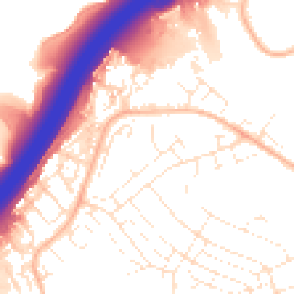
Daytime· 07:00 – 23:00
55.0dB

Night-time· 23:00 – 07:00
45.4dB