28 Ringsfield Lane, Patchway, Bristol, BS34 5AQ
About 28 Ringsfield Lane
28 Ringsfield Lane is a two-bedroom end-of-terrace house in Patchway, Bristol, Bristol (BS34 5AQ). It has a recorded floor area of 72 m² (around 775 sq ft), construction records dating it to 1996-2002 and council tax band C. The latest certificate (October 2021) shows a C (score 73). The rating has held steady at C across 2 certificates since June 2011. Between certificates, window efficiency dropped from Very Good to Very Poor. The recommended improvements would push it to B (score 89).
Today's modelled estimate of £328,000 sits 66.5% above the 2011 sale of £196,995. At 72 m² it's 20% larger than the typical home in the postcode (60 m² median across 14 EPCs). On the market in October 2011 and unlisted since — roughly 15 years.
What this property has
Inside
- Bedrooms2
- Bathrooms1
- EnsuiteYes
Outside
- GarageYes
Building
- RefurbishedYes
Everything you need to know about 28 Ringsfield Lane
The true value, the hidden risks and the full sale history, in one report.
Pick your report · every report is £14.99
One time fee only - money back guarantee

The data behind every report


Energy performance
EPC Rating
Property Improvements
Changes detected from historical EPC data
Heating controls changed
More low energy lighting installed
Get a survey for this property
Level 2 HomeBuyer Report
We've checked 10 risk factors against the available data for this property and believe a Level 2 HomeBuyer Report could be a suitable option for you.
From £595 · Includes VAT
Planning history
28 Ringsfield Lane has no planning applications on record.
But the area is active
11 notable applications nearby — larger schemes and conversions that could reshape the street. The report maps them all.
Sales history & valuation
28 Ringsfield Lane valuation sits well clear of the typical sold price in this postcode.
£328,000
Modelled from EPC, postcode comparables.
£196,995
Recorded with HM Land Registry.
Sales timeline
27 October 2011Most recent
£196,995
Median price across the last 5 sales in BS34 5AQ: £238,000 (2024–2018).
Nearby sales in BS34 5AQ
30 Ringsfield Lane, Patchway, Bristol, BS34 5AQ
Sold Nov 2024
£240,00022 Ringsfield Lane, Patchway, Bristol, BS34 5AQ
Sold May 2024
£305,0004 Ringsfield Lane, Patchway, Bristol, BS34 5AQ
Sold Oct 2022
£208,00016 Ringsfield Lane, Patchway, Bristol, BS34 5AQ
Sold Mar 2022
£198,00020 Ringsfield Lane, Patchway, Bristol, BS34 5AQ
Sold Sept 2018
£238,000
Versus other Ringsfield Lane homes
28 Ringsfield Lane is notably below the street on epc rating.
Price per m²
£2,736
Street avg £3,261
Floor Area
72 m²
Street avg 72 m²
CO₂ Emissions
2.3 t/year
Street avg 1.7 t/year
Years Held
15 years
Street avg 10 years
Everything you need to know about 28 Ringsfield Lane
The true value, the hidden risks and the full sale history, in one report.
Pick your report · every report is £14.99
One time fee only - money back guarantee
The data behind every report
Similar properties nearby
1 Bay Tree Close, Patchway
BS34 5EU
1 Brick Hill Way, Patchway
BS34 5UY
1 Arlingham Way, Patchway
BS34 5NH
1 Eagle Drive, Patchway
BS34 5RJ
1 Donns Close, Patchway
BS34 5JW
1 Clermont Close, Patchway
BS34 5QJ
1 Ashley House, Elmore Road, Patchway
BS34 5NU
1 Birch Close, Patchway
BS34 5SB
The neighbourhood at a glance
Crime
6/mo
Steady year-on-year across the wider district.
Nearest stop
0.2 km
High Leaze Road — bus stop.
Closest school
0.1 km
Charlton Wood Primary Academy. 24 schools nearby.
Go deeper on the local area
A Local Area report breaks down crime, transport links, schools and air quality in depth.
Road noise across the postcode
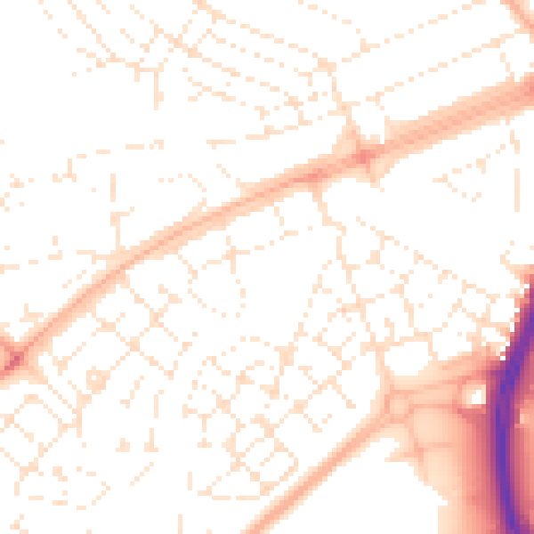
Daytime· 07:00 – 23:00
51.8dB

Night-time· 23:00 – 07:00
40.3dB