30 Ringsfield Lane, Patchway, Bristol, BS34 5AQ
About 30 Ringsfield Lane
30 Ringsfield Lane is a two-bedroom detached house in Patchway, Bristol, Bristol (BS34 5AQ). It has a recorded floor area of 57 m² (around 614 sq ft), construction records dating it to 2007-2011 and council tax band B. At 57 m² this is the 2nd smallest of 15 units on EPC record in the building, where floor areas span 46–72 m². The building's EPC ratings span C to B, with this unit at the bottom. The latest certificate (April 2024) shows a C (score 76), near the top of the C band. The rating has held steady at C across 2 certificates since June 2011. Between certificates, window efficiency dropped from Very Good to Good.
On a £-per-square-foot basis, the last sale (£391/sq ft) was about 56% above the typical sold price in the postcode. Sold November 2024 for £240,000.
What this property has
Inside
- Bedrooms2
- Bathrooms1
- Open-plan layoutYes
Outside
- Private gardenYes
- GarageYes
Everything you need to know about 30 Ringsfield Lane
The true value, the hidden risks and the full sale history, in one report.
Pick your report · every report is £14.99
One time fee only - money back guarantee

The data behind every report


Energy performance
EPC Rating
Property Improvements
Changes detected from historical EPC data
Heating controls changed
More low energy lighting installed
Get a survey for this property
Level 2 HomeBuyer Report
We've checked 10 risk factors against the available data for this property and believe a Level 2 HomeBuyer Report could be a suitable option for you.
From £545 · Includes VAT
Planning history
30 Ringsfield Lane has no planning applications on record.
But the area is active
11 notable applications nearby — larger schemes and conversions that could reshape the street. The report maps them all.
Sales history & valuation
30 Ringsfield Lane valuation sits well clear of the typical sold price in this postcode.
£252,000
Modelled from EPC, postcode comparables.
£240,000
Recorded with HM Land Registry.
Sales timeline
22 November 2024Most recent
£240,000
Median price across the last 5 sales in BS34 5AQ: £208,000 (2024–2017).
Nearby sales in BS34 5AQ
22 Ringsfield Lane, Patchway, Bristol, BS34 5AQ
Sold May 2024
£305,0004 Ringsfield Lane, Patchway, Bristol, BS34 5AQ
Sold Oct 2022
£208,00016 Ringsfield Lane, Patchway, Bristol, BS34 5AQ
Sold Mar 2022
£198,00020 Ringsfield Lane, Patchway, Bristol, BS34 5AQ
Sold Sept 2018
£238,0006 Ringsfield Lane, Patchway, Bristol, BS34 5AQ
Sold Dec 2017
£183,500
Versus other Ringsfield Lane homes
30 Ringsfield Lane outperforms the street on price per m² by a wide margin.
Price per m²
£4,211
Street avg £3,007
Floor Area
57 m²
Street avg 58 m²
Habitable Rooms
3 rooms
Street avg 3 rooms
CO₂ Emissions
1.6 t/year
Street avg 1.2 t/year
Everything you need to know about 30 Ringsfield Lane
The true value, the hidden risks and the full sale history, in one report.
Pick your report · every report is £14.99
One time fee only - money back guarantee
The data behind every report
Similar properties nearby
1 Brick Hill Way, Patchway
BS34 5UY
1 Arlingham Way, Patchway
BS34 5NH
1 Bay Tree Close, Patchway
BS34 5EU
1 Ashley House, Elmore Road, Patchway
BS34 5NU
1 Birch Close, Patchway
BS34 5SB
1 Donns Close, Patchway
BS34 5JW
1 Eagle Drive, Patchway
BS34 5RJ
1 Clermont Close, Patchway
BS34 5QJ
The neighbourhood at a glance
Crime
6/mo
Steady year-on-year across the wider district.
Nearest stop
0.2 km
High Leaze Road — bus stop.
Closest school
0.1 km
Charlton Wood Primary Academy. 24 schools nearby.
Go deeper on the local area
A Local Area report breaks down crime, transport links, schools and air quality in depth.
Road noise across the postcode
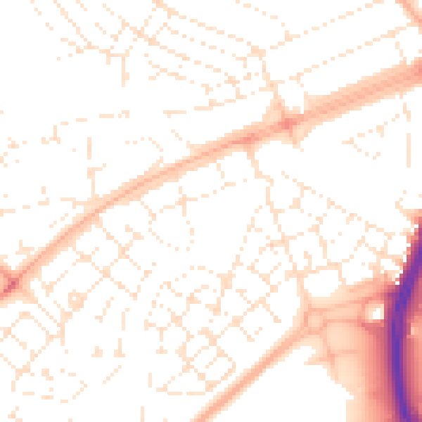
Daytime· 07:00 – 23:00
51.8dB

Night-time· 23:00 – 07:00
40.3dB