4 Friar Road, Brighton, BN1 6NG
Sales history & valuation
No sales recorded with HM Land Registry
That can mean the property has never traded since the registry began publishing in 1995, was a new build that hasn't been registered yet, or is held in the same hands long-term.
Median price across the last 5 sales in BN1 6NG: £1,180,000 (2026–2022).
About 4 Friar Road
4 Friar Road is a property in Brighton (BN1 6NG). It has council tax band F.
Energy performance
No EPC on record
This property doesn't have an Energy Performance Certificate yet. An EPC is required to sell or let — and unlocks our automated valuation.
Planning history
No planning applications are recorded against 4 Friar Road, Brighton, BN1 6NG. The full report also covers planning activity across the surrounding area.
The neighbourhood at a glance
Daytime road noise here sits well below conversation level — a quiet pocket of the postcode.
Crime
1110/mo
Falling year-on-year across the wider district.
Nearest stop
0.1 km
Friar Road East End — bus stop.
Closest school
0.1 km
Varndean School. 30 schools nearby.
Nearest schools
- Varndean SchoolSecondary74m
- Balfour Primary SchoolPrimary360m
- Varndean College16 plus449m
- Dorothy Stringer SchoolSecondary495m
Nearest stops
- Friar Road East EndBus stop115m
- Friar RoadBus stop150m
- Varndean High SchoolBus stop285m
- Surrenden Road East EndBus stop306m
Most reported crime locally
- Violence & Sexual Offences4,189 reports27%
- Shoplifting2,866 reports18%
- Anti-social Behaviour2,547 reports16%
- Public Order1,432 reports9%
Road noise across the postcode
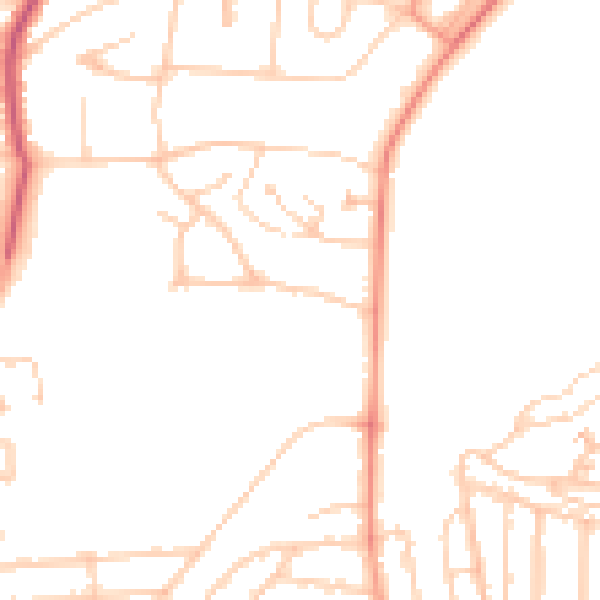
Daytime· 07:00 – 23:00
46.9dB

Night-time· 23:00 – 07:00
37.7dB

Get a survey for this property
Level 2 HomeBuyer Report
We've checked 10 risk factors against the available data for this property and believe a Level 2 HomeBuyer Report could be a suitable option for you.
Similar properties nearby
1 Acacia Court, Herbert Road
BN1 6PB
1 Ashford Road
BN1 6LL
1 Balfour Road
BN1 6NA
1 Bates Road
BN1 6PF
1 Bavant Road
BN1 6RD
1 Beaconsfield Parade, Beaconsfield Road
BN1 6DN
1 Beaconsfield Villas
BN1 6HA
1 Beechwood, Curwen Place
BN1 6UJ
How to read this page
- How the estimate is made
- We don't publish an estimate for 4 Friar Road because there is no EPC to tell the model the home's size and specification. The full report sets its records against recent comparable sales in BN1 6NG.
- Where sold prices come from
- Sold prices are HM Land Registry Price Paid Data, which covers residential sales in England and Wales since 1995. No sale is recorded for 4 Friar Road, which usually means it hasn't changed hands since 1995 or the sale was not for value. Sales normally appear two to three months after completion, so the most recent ones take time to show up anywhere.
- Reading the EPC
- There is no Energy Performance Certificate on the public register for 4 Friar Road. A valid EPC is needed to sell or let a home in England and Wales, and lasts 10 years.
- Planning records
- Planning applications are collected from local authority registers through PlanIt. None is matched to 4 Friar Road. Councils sometimes file applications under a different address format, and applications on neighbouring land aren't listed here; the report covers both.
- Area figures
- Crime is police-recorded street-level data over the last 14 months, which places each incident at an approximate point. The 30 schools and 30 stops listed are measured in a straight line from BN1 6NG, not by walking route. Road noise is Defra's strategic noise modelling, averaged across the postcode.
- Council tax band
- 4 Friar Road is in council tax band F. Bands are set by the Valuation Office Agency from historic values (1 April 1991 in England, 1 April 2003 in Wales), not today's price; the amount you pay depends on the council's rate for the band.
Common questions
Know this home? Think our valuation is wrong?
Leave a note for other visitors about work done or anything the records miss, and say what you think it's worth. It takes about two minutes.